A Mag5.3 struck 53 minutes ago, 4km WNW of Arkalochori, Greece.
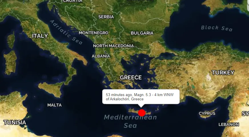
53 minutes ago
Magnitude: 5.3 | Depth: 10km
DateTime: 2021-09-27 23:48:09
Region: 4 km WNW of Arkalochóri, Greece
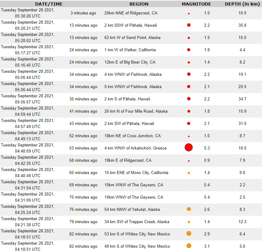
Other recent earthquakes this past hour According to GlobalIncidentMap
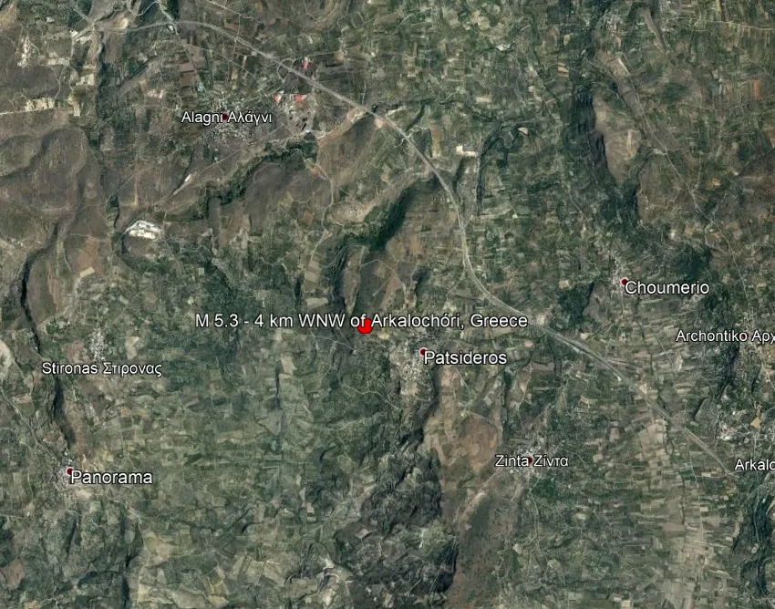
I can take a closer look at where these struck exactly using Google Earth.
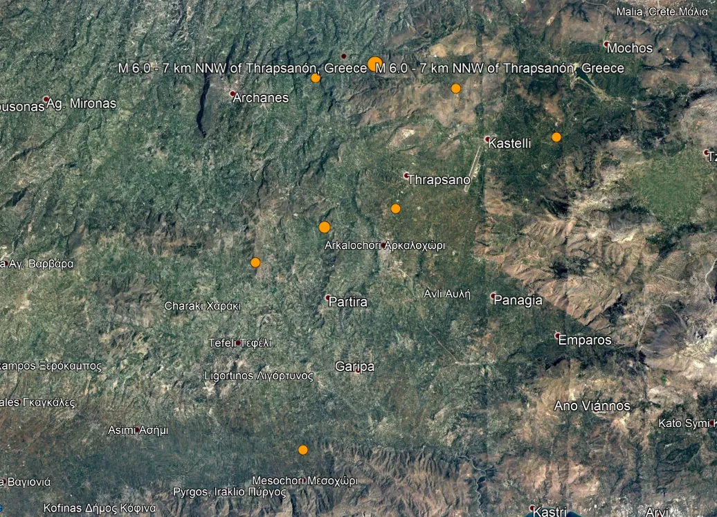
Seven earthquakes here,
4.2, 4.4, 4.6, 4.7, 4.7, 4.8, 5.3
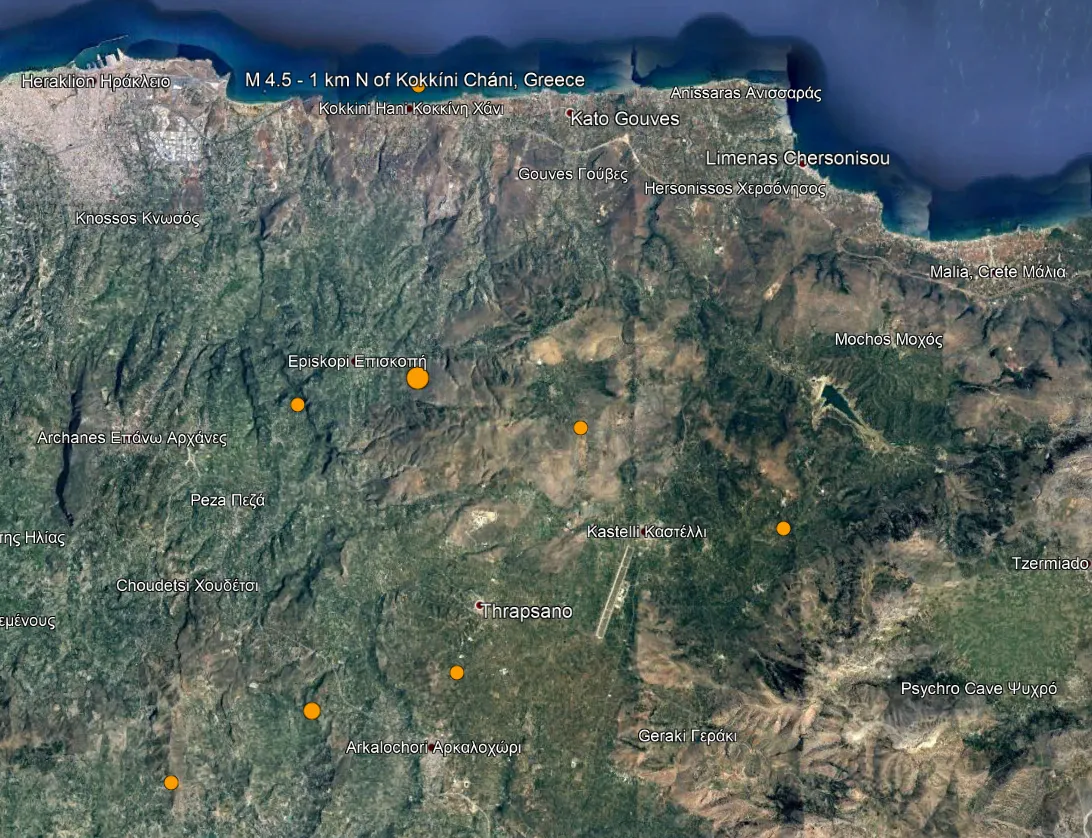
8 if you include
the one along the coast near Kokkini Hani, Greece.
All the eyes are on La Palma Volcano in the Canary Islands which has been erupting for the past week. USGS does not show the quakes for some reason, but VolcanoDiscovery does.
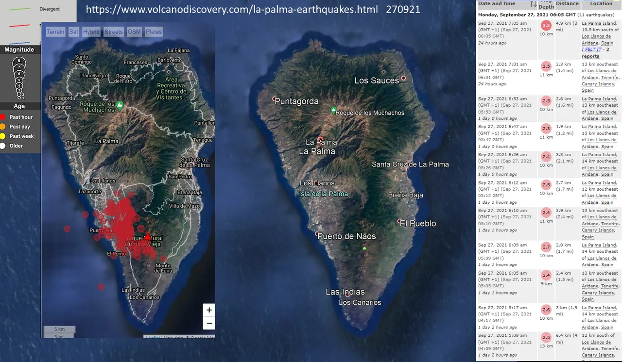
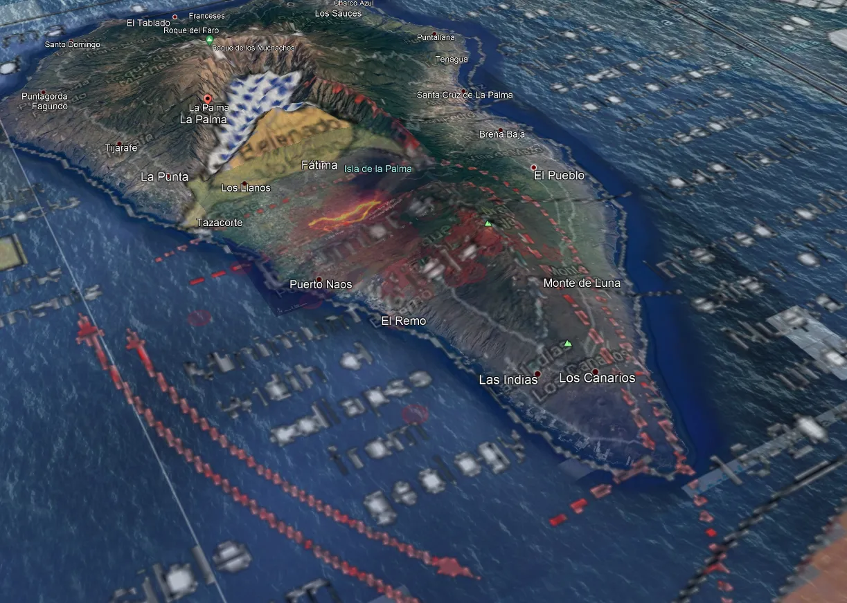
I added it as a layer in GE so now we can see which areas are shaking.
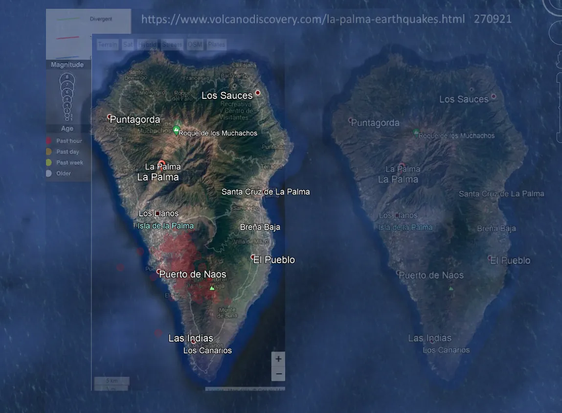
I would say that this is not a good sign and that we should continue to monitor the situation.
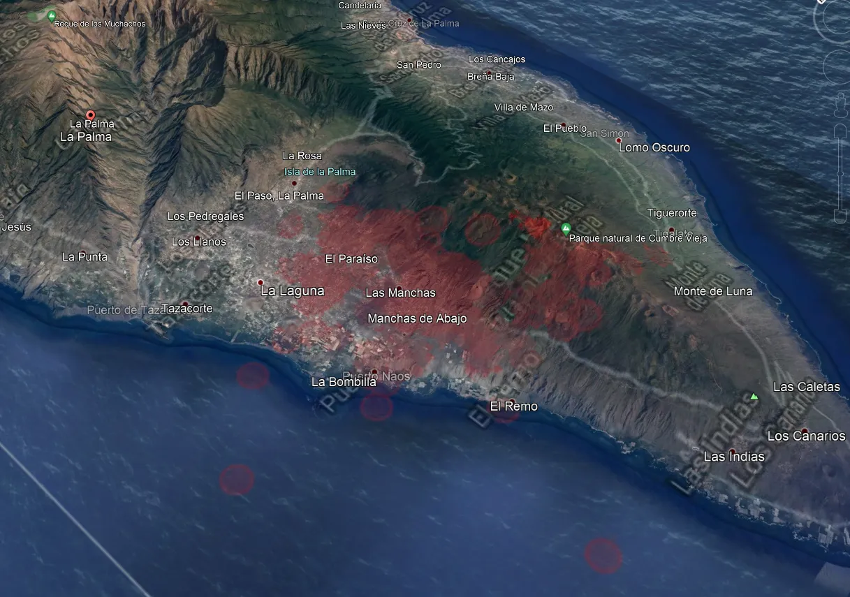
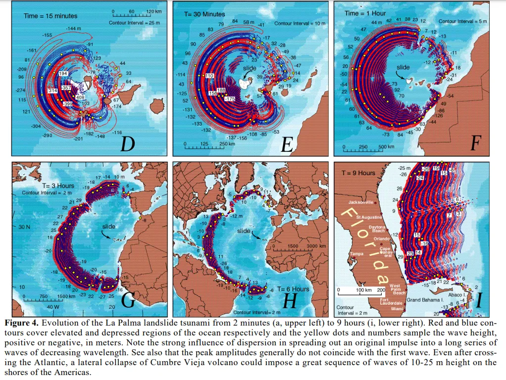
If this part of the island collapses into the sea it could create a tsunami as the energy moves across the ocean towards several countries. This simulation has been written about in multiple papers you can find via the Wikipedia page, I was looking at them the other week. I heard about this years ago, but the volcano was dormant. Now it is active, and as you can see, the island is shaking.
Fact Checkers have already begun to 'debunk' this by publishing misleading articles.
"While the theory being shared exists, social media users are presenting it as if it is a likely scenario or represents an expert consensus of some kind." says USAtoday.
AP reported the eruption of La Palma on September 16th 2021
"Authorities have detected more than 4,200 temblors in what scientists are calling an “earthquake swarm” around La Palma island since last Saturday. An earthquake swarm is a cluster of quakes in one area during a short period and can indicate an approaching eruption."
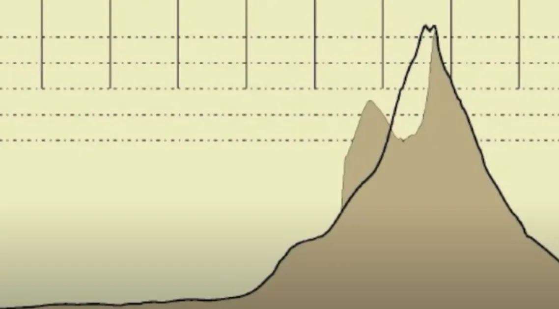
These are the recent Earthquakes shown on VolcanoDiscovery overlaid on top.
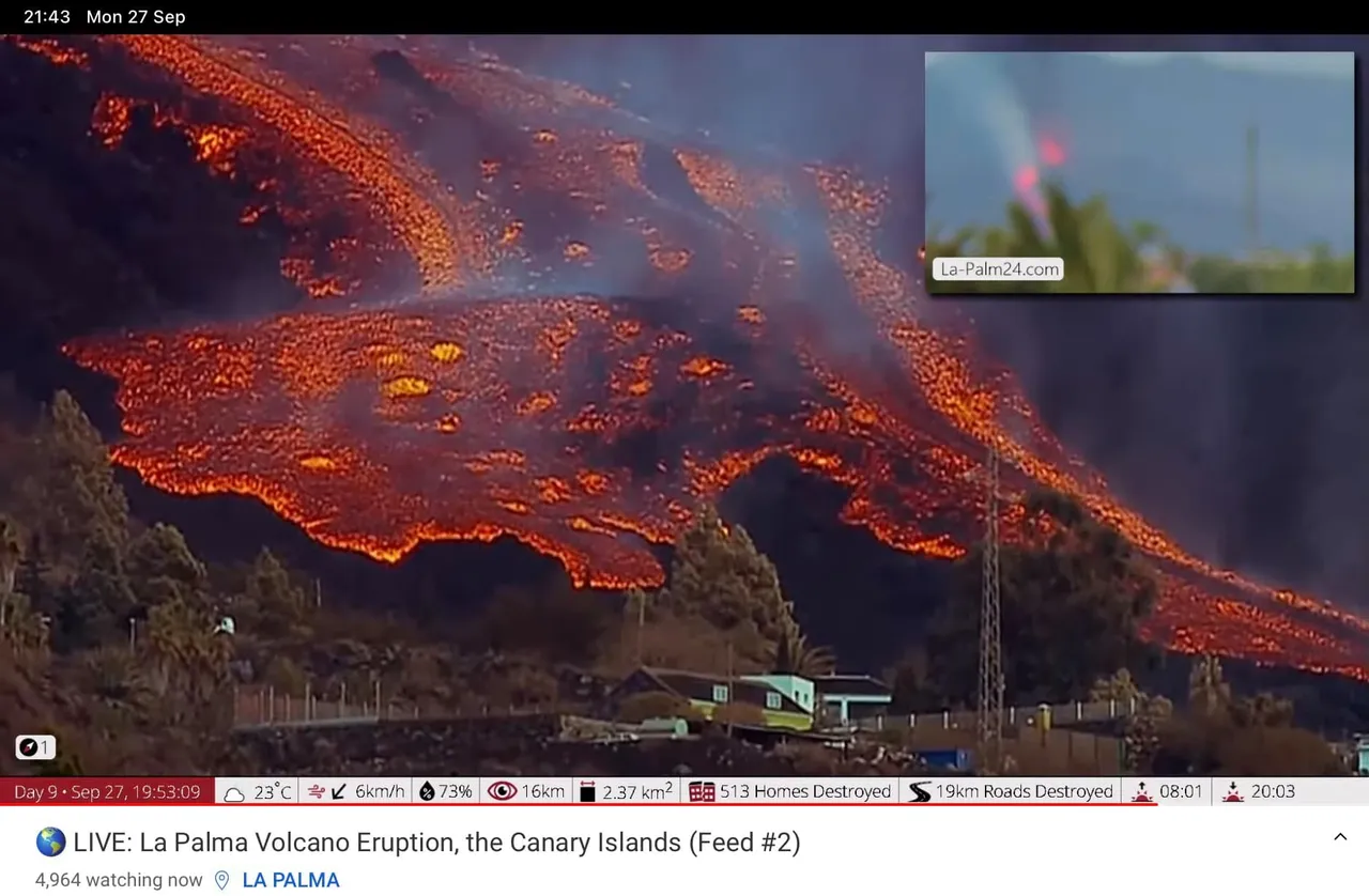
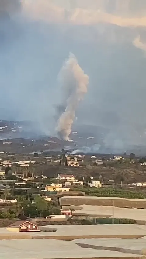
However this is Lava, a friend shared these pictures with me yesterday.
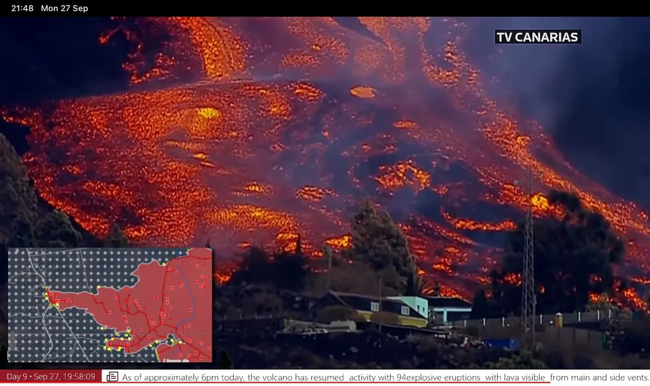
I think it is safe to say this is not a fake news story, don't read that garbage.
https://twitter.com/alejandrosantos/status/1442735077461479425
- alejandrosantos
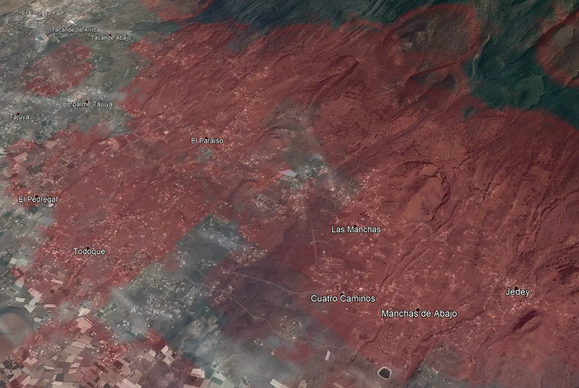
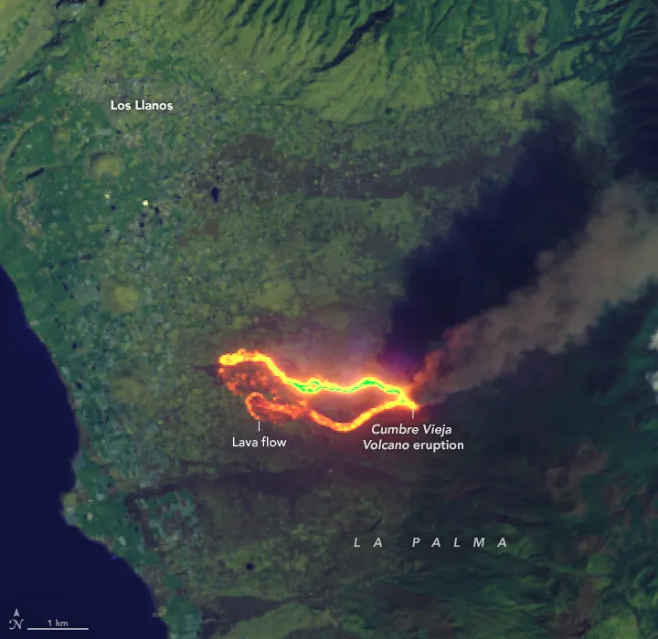
Lava Burns a Path Through La Palma
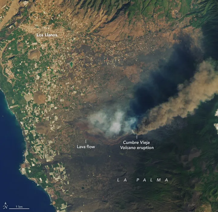
https://earthobservatory.nasa.gov/images/148880/lava-burns-a-path-through-la-palma
"The lava flow has advanced more than 14 hectares in the past 36 hours and continues to destroy everything in its path. Our team has been mapping the flow, both actual and modeled, in order to estimate its inexorable advance to the sea and the potential damage to property based on a number of data sources as described below."
https://carto.com/blog/canary-islands-volcano-mapping-lava-flow-damage/
"After Cumbre Vieja split open and began erupting on September 19, 2021, a slow-moving wall of basaltic lava began bulldozing its way through populated parts of one of the Canary Islands. Lava flows have destroyed nearly 400 homes, covered dozens of kilometers of roads, and consumed farmland on the island of La Palma as they creep down the western flank of the volcanic island toward the ocean."
https://earthobservatory.nasa.gov/images/148880/lava-burns-a-path-through-la-palma
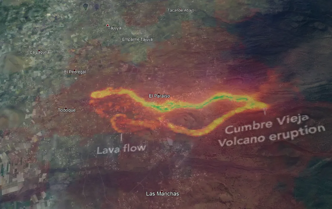
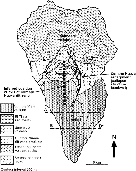
So now I can see where the Fissures are and have overlaid this image on Google Earth.
According to Wikipedia, referencing a 2001 paper that is not linked, "There is no indication that the crack has penetrated the edifice of the volcano, and, due to the absence of Minas Galerias (water tunnels) within the Cumbre Vieja, there is no possibility of examining the internal structure of the flank." [ Carracedo, J. C; Badiola, E. R; Guillou, H; de la Nuez, J; and Pérez Torrado, F. J; 2001. Geology and Volcanology of La Palma and El Hierro, Western Canaries. Estudios Geol. 57, (5–6) 175–273]
https://hal.archives-ouvertes.fr/hal-03323419/document <-- 12MB PDF
A brief summary is found at https://www.semanticscholar.org/paper/Geology-and-volcanology-of-La-Palma-and-El-Hierro%2C-Carracedo-Badiola/9058f2297d38139c3b5e45cfea6bbccdc1c16fd2
Published 2001.
Ok maybe I am just being skeptical here but that was 20 years ago. What else is there?
Bonelli Rubio, J. M., 1950. Contribucion al estudio de la erupcion del Nambroque o San Juan. Madrid: Inst. Geografico y Catastral, 25 pp.
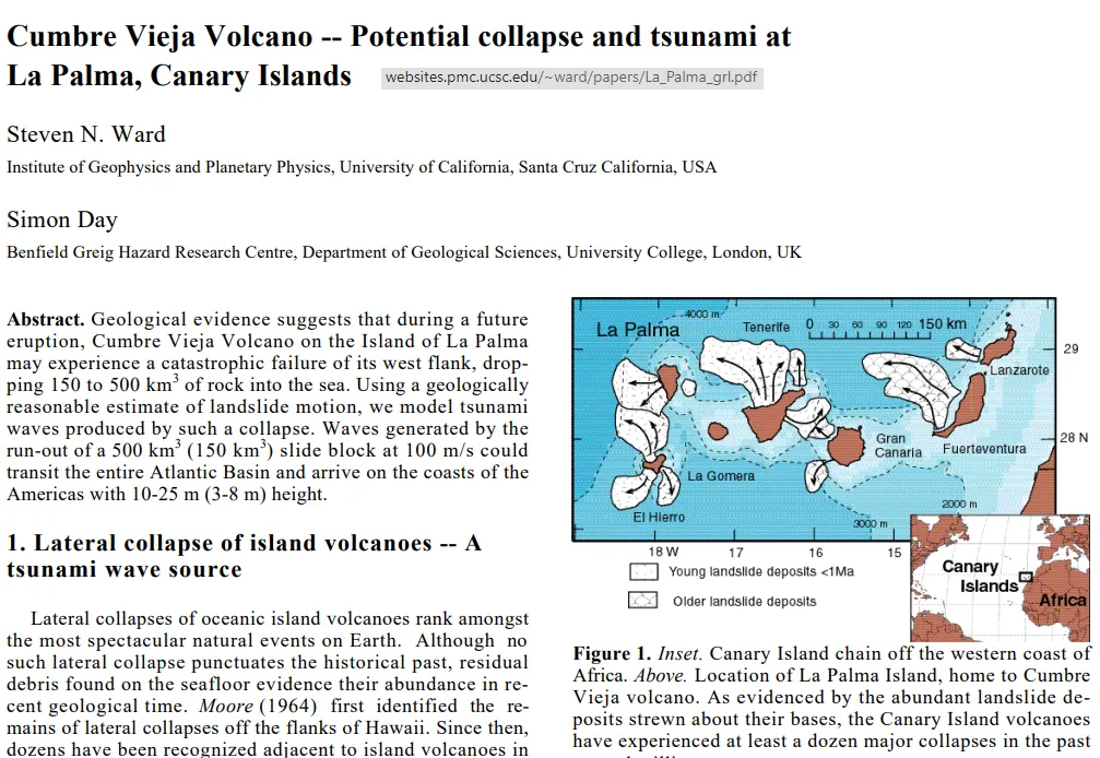
https://websites.pmc.ucsc.edu/~ward/papers/La_Palma_grl.pdf
One more layer
Recent structural evolution of the Cumbre Vieja volcano, La Palma, Canary Islands: volcanic rift zone reconfiguration as a precursor to volcano flank instability?
https://www.sciencedirect.com/science/article/abs/pii/S0377027399001018
Copernicus has some mapping tools
https://emergency.copernicus.eu/mapping/list-of-components/EMSR546
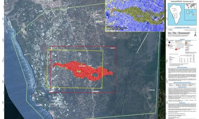
https://emergency.copernicus.eu/mapping/ems-product-component/EMSR546_AOI01_GRA_MONIT09_r1_RTP01/1
A second crack has opened up,
"The new crack is located about 900 meters from the main one and to the north. In this case it would be the ninth mouth of which there is evidence" (translated)
"This eruption, the eighth that La Palma has experienced in historical times, since the 15th century, erupts through two fissures aligned from north to south and about 200 meters apart , with various emission points, as detailed by the scientific committee that follows the emergency. Tacande is a town with 704 inhabitants . 112 has not been able to specify how many of them are going to be evicted from their homes, but insists that the evacuation follows precautionary criteria." (translated)
These quakes are from the last 48 hours
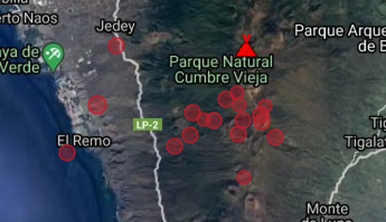
https://www.volcanodiscovery.com/la-palma-earthquakes-past48hrs.html
Stay alert, Stay safe. I will keep watching the quakes.