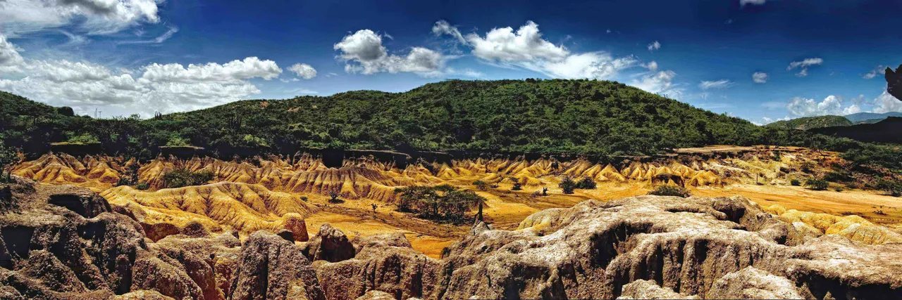
Hello steemers. Today I will talk about a subject that we studied in my fourth semester of architecture. It is about giving a revaluation to spaces or places. Particularly we carry out the practical approach in a place of the Lara state in Venezuela, called
Images: author's property.
Source of the image.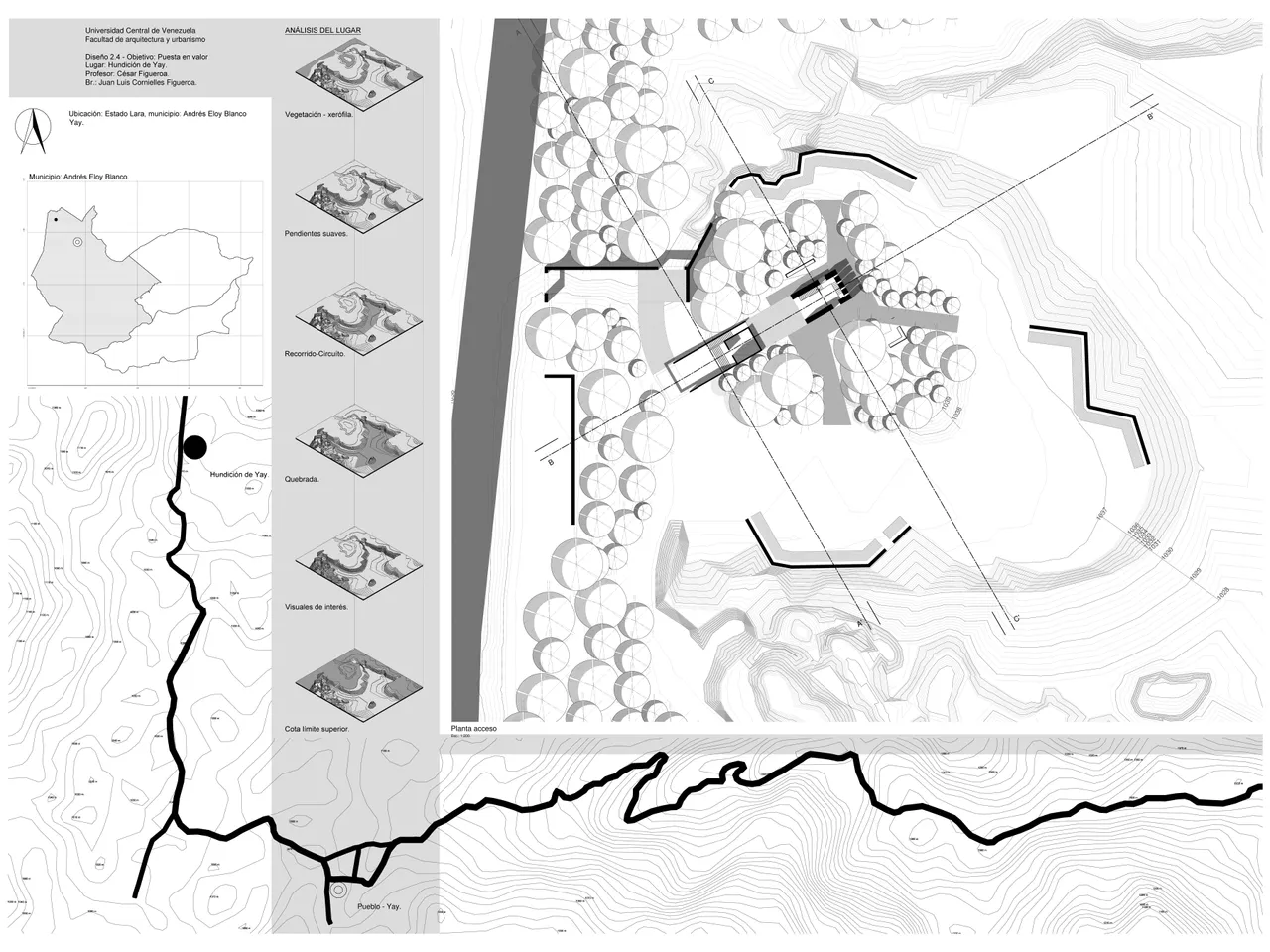
Images: author's property.
Images: author's property.
Images: author's property.
Source of the image.
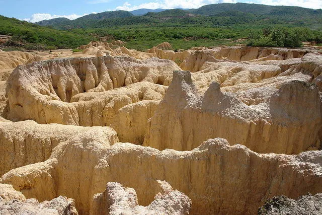
"Hundición de Yay"
An important fact is that, in this place there is a myth that all travelers who go must know.
There are many aspects to take into consideration when evaluating the strategies with which to give a revaluation. When seeing the photos, probably all we agree in the main decision... To take advantage of the scenographic value, because it is beautiful.
Source of the image.

Basically
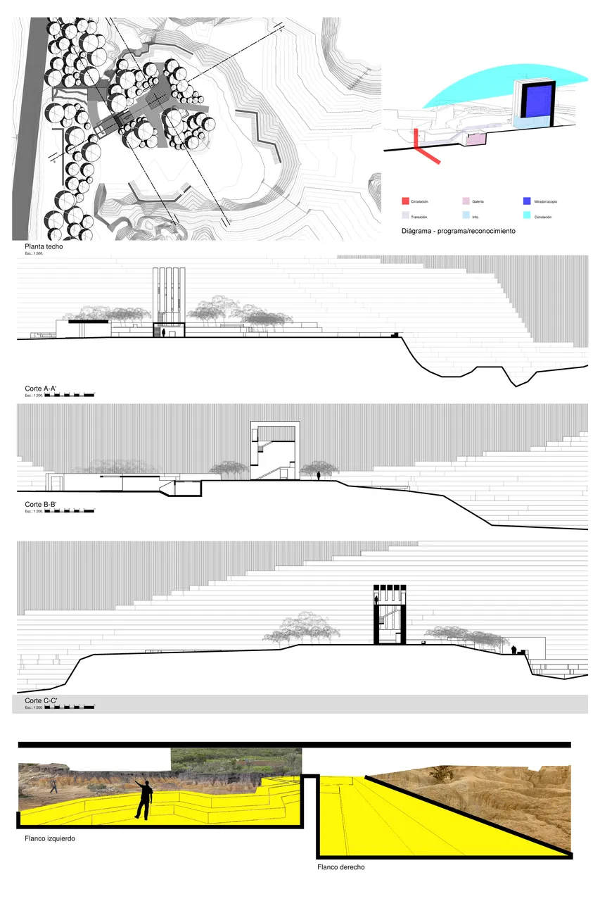
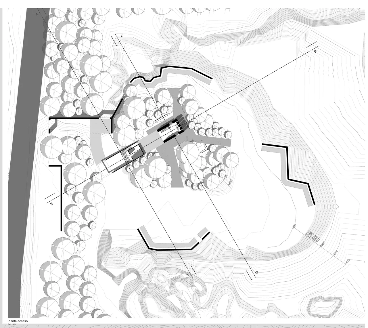
I can summarize the design in a lookout tower in the center of the terrain, where furniture was placed on the different sides of it to give prominence to the scenic values of the landscape.
We
did different tasks to determine the contour lines to this rugged topography and to have an approximation to reality.
SHEET_01: 48" x 36":
- Site
- Road
- Topography
- Schemes
- Floor plan
SHEET_02: 36" x 24":
- Roof plan
- Diagram
- Section cuts
- Photomontage (2)
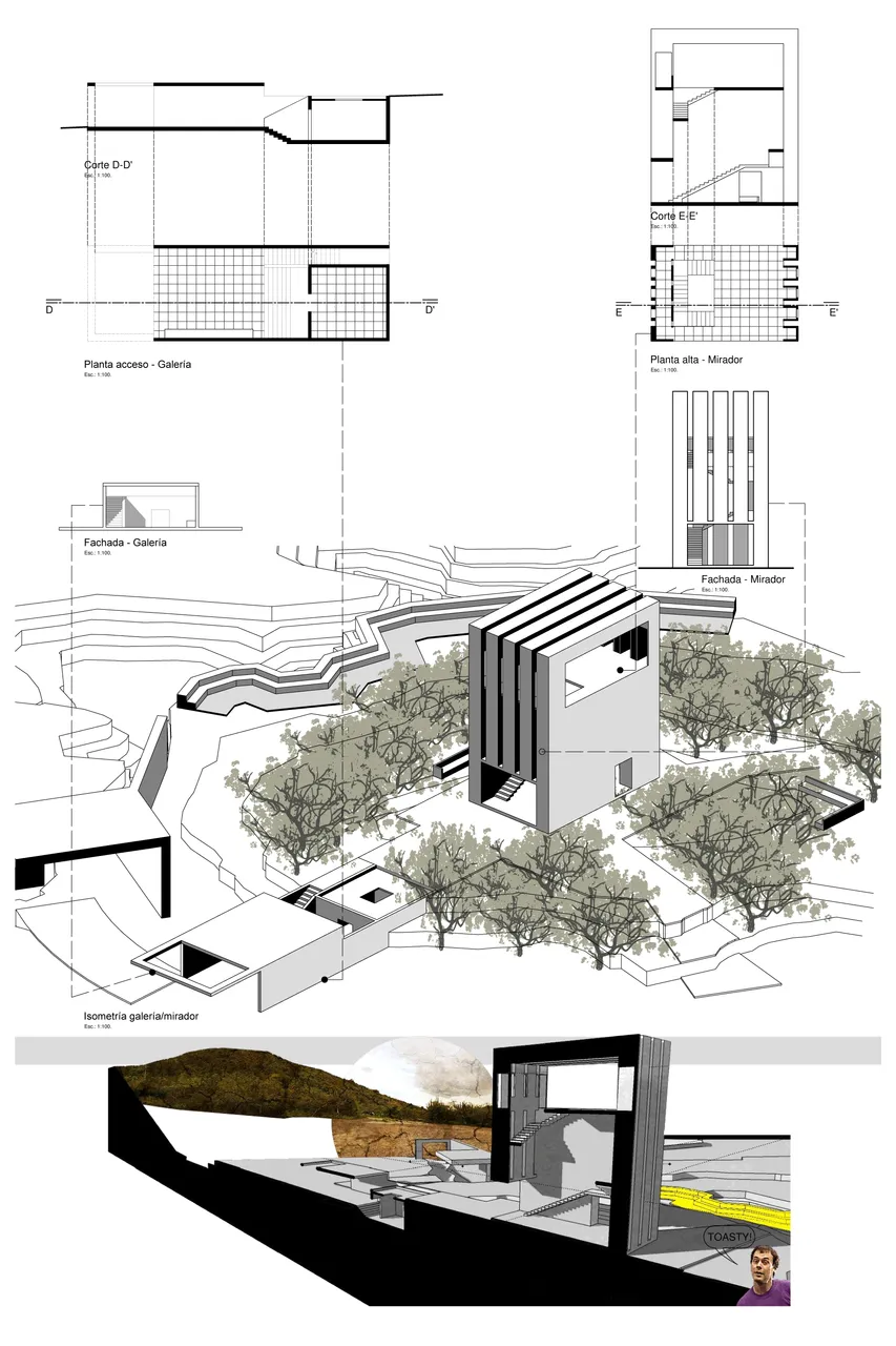
SHEET_03: 36" x 24":
- Blueprints
- Isometric view
- Collage
Source of the image.