This time, I was a bit more daring. I went further than before and discovered a "rest stop" with bathrooms, drinking fountains and covered picnic tables. One of many such stops along the trail, which I today learned spans forty god damned miles.
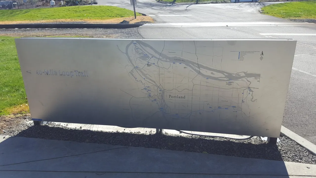
That's not a typo. See for yourself. The sign was made in 2012 and apparently much of the trail was not yet finished then, as sections I was able to bike on are marked as dotted lines, indicating they were unfinished at the time. This explains why it felt like the trail goes on forever!
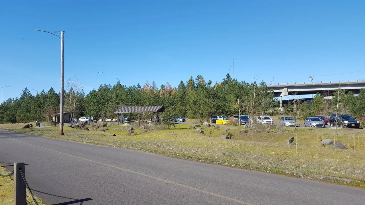
Here's one of those rest stops. Not everybody lives so close to the trail they can just bike to one of the trail heads like me (heh heh heh) so there are plentiful spots to bring your bike by car, on the sort of rack I really ought to buy for my Volt one of these days when SBD is doing better.
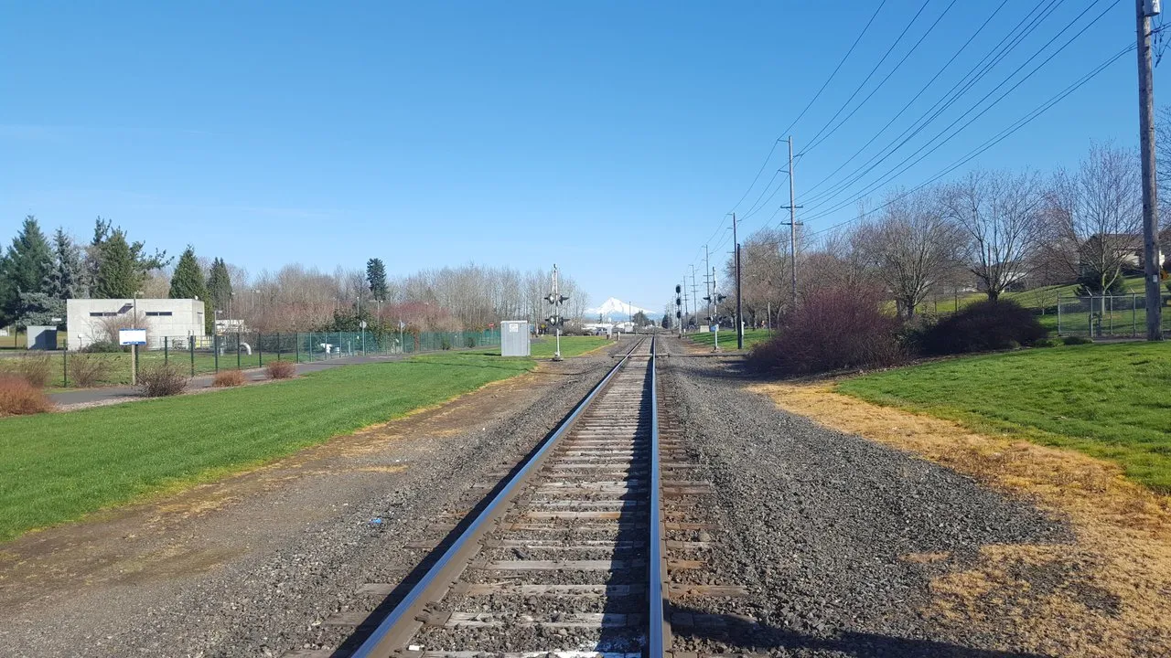
Yes, I'm standing on the railroad tracks. Because I have poor self preservation instinct, but also to get a clear shot of Mount Hood in the distance. Stunning, isn't it? One of many beautiful sighs to be found in the Pacific Northwest.
I came upon this intriguing hiking trail, but entry is forbidden to bicycles. I have nothing to chain my bike up with as I never leave it out of my sight, the pedals are just for show and it can't be started without the key. It's heavy as fuck so I am not concerned about it being stolen from under my nose.
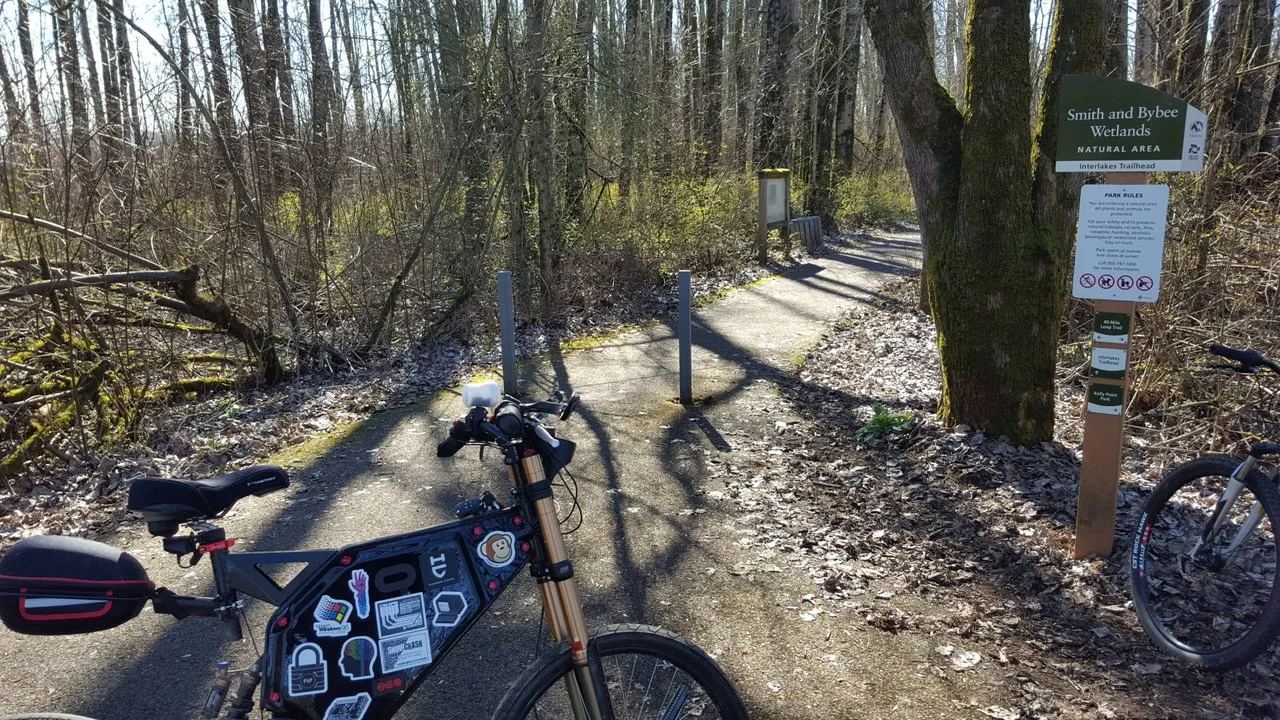
The wetlands I approached from a different side in the prior article. I flew my drone over it this time, but as my only internet connection is currently my phone in hotspot mode, I can't upload it. Let me just take a moment here to tell you what a shitload of fuck DJI drones are.
I unpacked the drone, connected my phone to the controller and could not fly it because it wanted to first be calibrated (the compass is always uncalibrated somehow). It also wanted several software updates. By the time this was done, the battery was down to 50%.
I actually couldn't finish all the updates on that battery because it won't continue if the battery charge level is below 50%. So I popped in the other battery just to finish that process. Then, after the drone was in the air, a popup window appeared obscuring my view of what the drone was seeing.
It said because I was near an airport I had to agree to a terms of service saying I am responsible for anything that happens on this flight. I had to "unlock" to proceed, but didn't know what that meant. When I clicked the URL for the terms of service and scrolled all the way to the bottom, there was no "I agree" button.
My drone was stuck in the air at this point, I could not instruct it to land until I resolved this problem and it was burning through battery. Finally I discovered the "I agree" option was a faint dark grey on black check box on the popup window that I couldn't see due to the bright sunlight.
However even after checking it, it kept returning as I flew. I eventually just ignored it, only for another problem to soon arise. The camera pivoted to look straight down at the ground and would not respond to any attempt to make it look up towards the horizon.
I was down to 28% battery by this point and had no idea where the drone was because I couldn't tell from the top down view where it was in the sky relative to me. Add to that the incessant popup window blocking my view every ten seconds and I began to worry it was going to run out of battery and drop like a brick pretty soon when the battery ran out.
Luckily just by listening for the propeller sound I was able to steer it close enough that I could sight it above me and bring it down close to the ground for a safe landing, with about 5% battery remaining. What a frustrating heap of bullshit.
I had a $99 drone before with vastly less features, and I liked it that way. I got more actual flying done with it even though the batteries only supported it in the air for 5 to 7 minutes. Not having to spend half an hour updating firmware and safe flight area definitions, not having to recalibrate the compass every time I used it meant I could quickly get it up in the air and be having fun with it in a hurry.
I know this rant is out of place in an article about my eBike ride but holy balls, it pissed me off. The more "advanced" drones get the more useless and frustrating they become, all those advancements just amount to more and more barriers in the way of actually flying the damned thing.
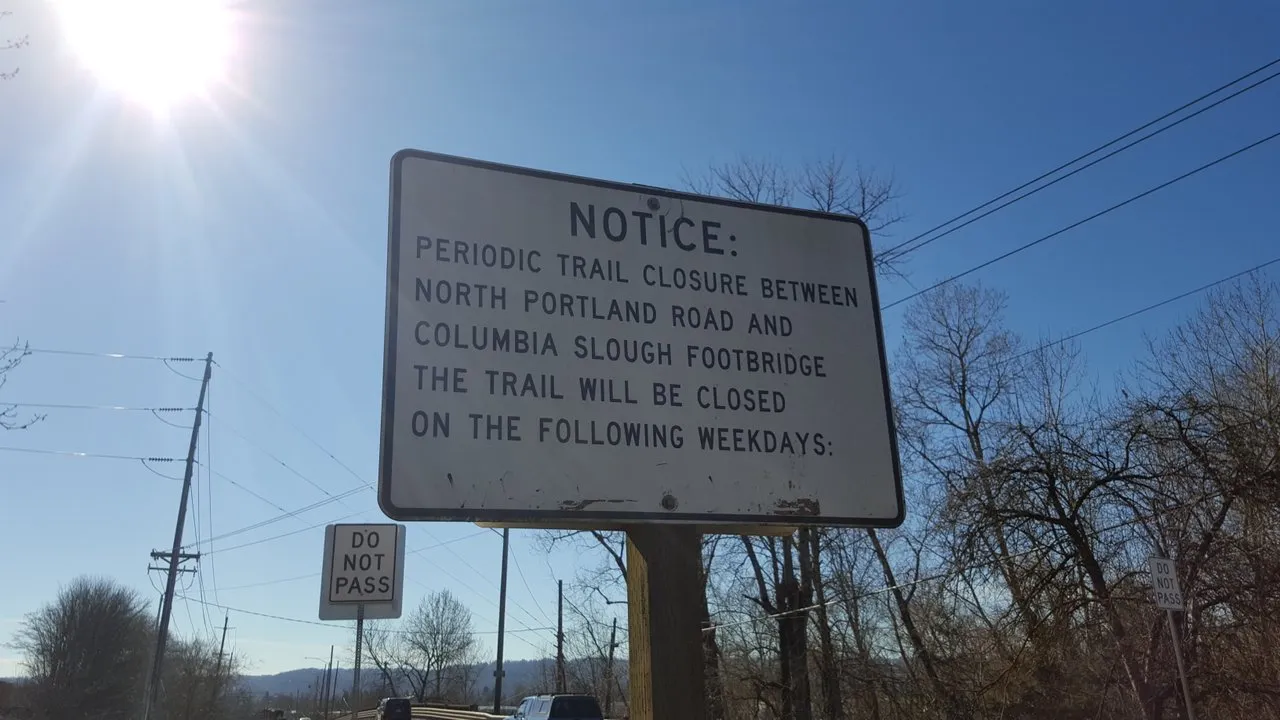
Anyways, moving on. Can anybody tell me what the point of this sign is? Do they send somebody to come write the days they want with sharpie underneath every so often or what? This reminds me of the portion on my tax return which asked me to indicate whether I'm deceased.
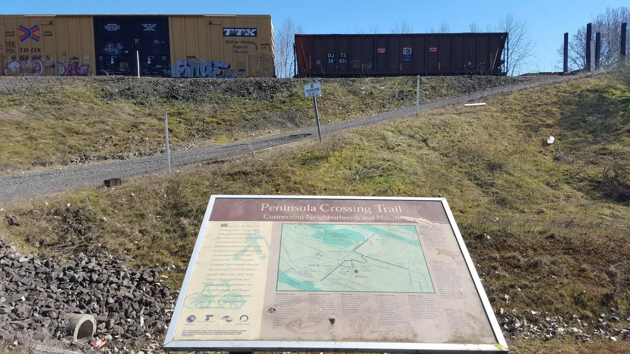
Another handy dandy info kiosk which I photographed as a train was going by. Kind of cool to be close enough to so much industrial infrastructure that I get to see stuff like that on a regular basis. Yet I don't live close enough to suffer from the noise.
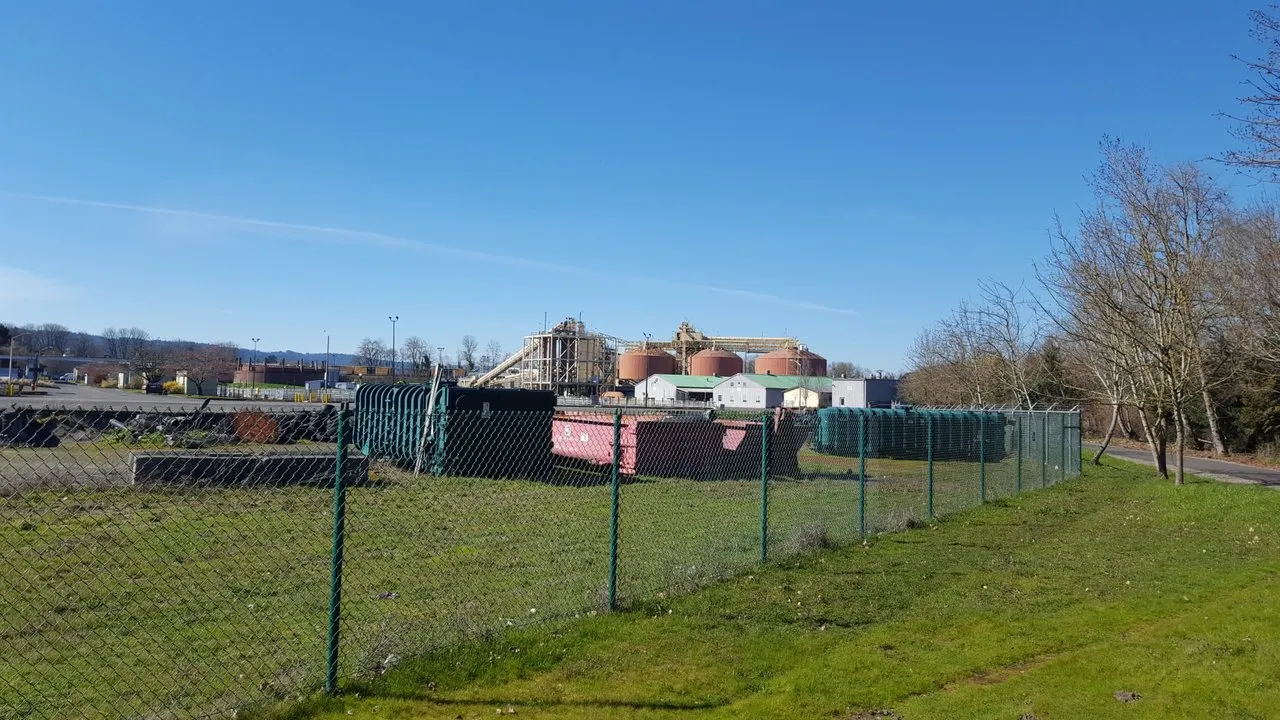
More industrial infrastructure. Somebody's playing irl Factorio out here. It's funny because this was taken from one of the more lush, landscaped parts of the trail. Then bam, silos and cargo containers.
That's kind of symbolic of Portland, which as the name implies is a port city and a hub of commerce, so there's all sorts of industrial structures around. But mixed with lush natural beauty. Reminds me of the Wooded Kingdom from Mario Odyssey. :3
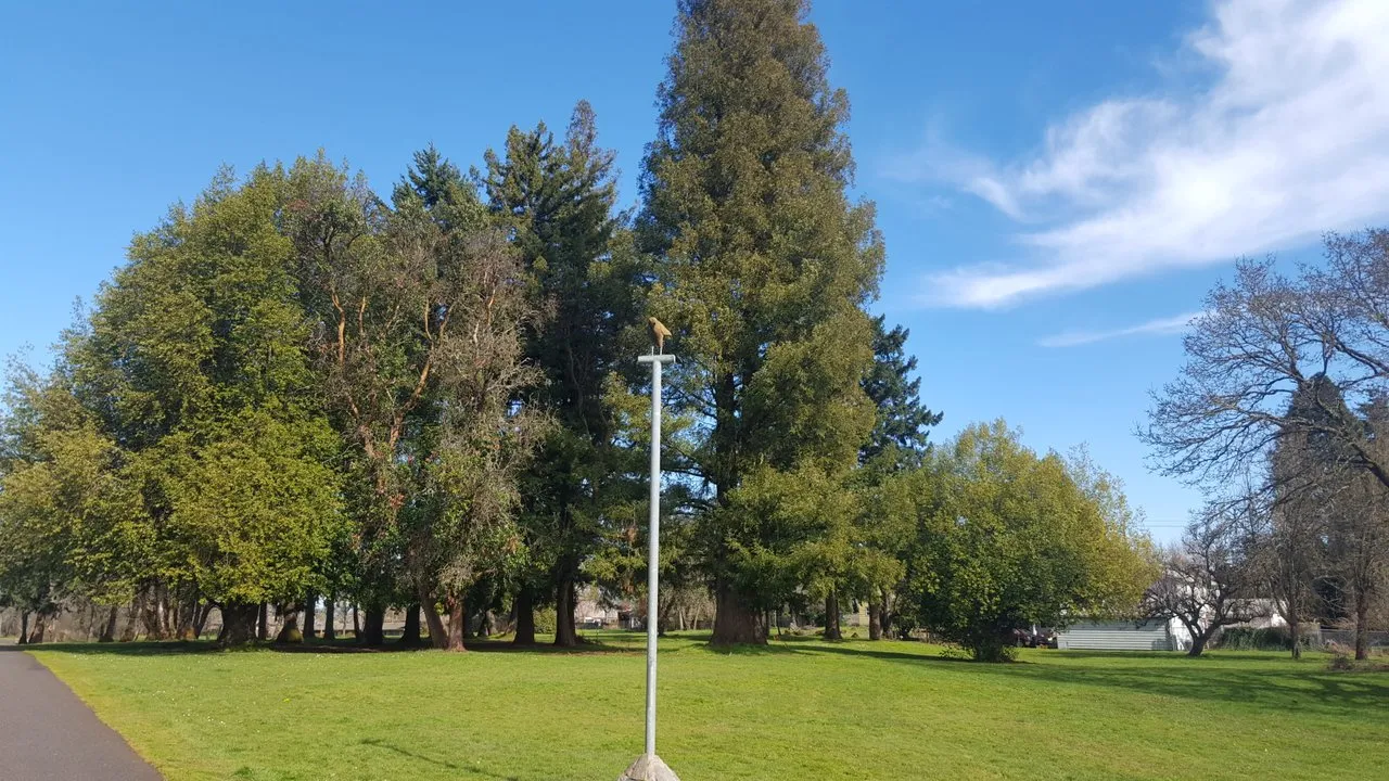
On the way back I thought I saw a bird of prey perched on this pole, only to discover as I drew near that it's actually a statue. I didn't spot the plaque under it until emailing myself the photo later. I'll have to go back at some point and find out why some eagle got his own memorial.
Anyway that's all for this time. On paper, I have ample battery to take on the entire 40 mile loop. Supposedly up to 75 miles, but I only like to "count on" 50. I'll muster the courage one of these days to make the entire circuit, just wait.
Stay Cozy!