While jogging on the beach in Thailand, I noticed something that may be of interest to those following the arguments being tossed around the blogosphere between the flat-earthers and globe-heads.
Frequently, there's hardly any surf on the beaches of the Gulf of Thailand and when the tide is low one can walk out on a stretch of beach that is almost exactly at sea level. I first noticed that parts of Ko Lin (the Thai word for island is ko) were not visible when I went down to the flat stretch of beach. I needed to borrow a good camera with a telescopic lens to be able to zoom in on Ko Lin, which is approximately 21 Km away from where I was standing (a camera phone just wouldn't do).
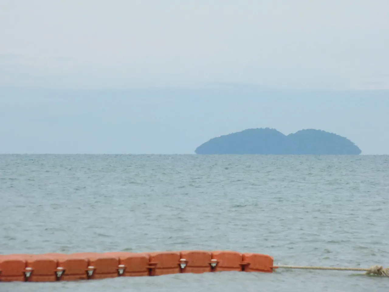
But when I backed away and up to about 6 meters, I could begin to see those island features again.
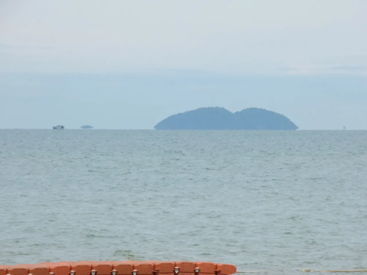
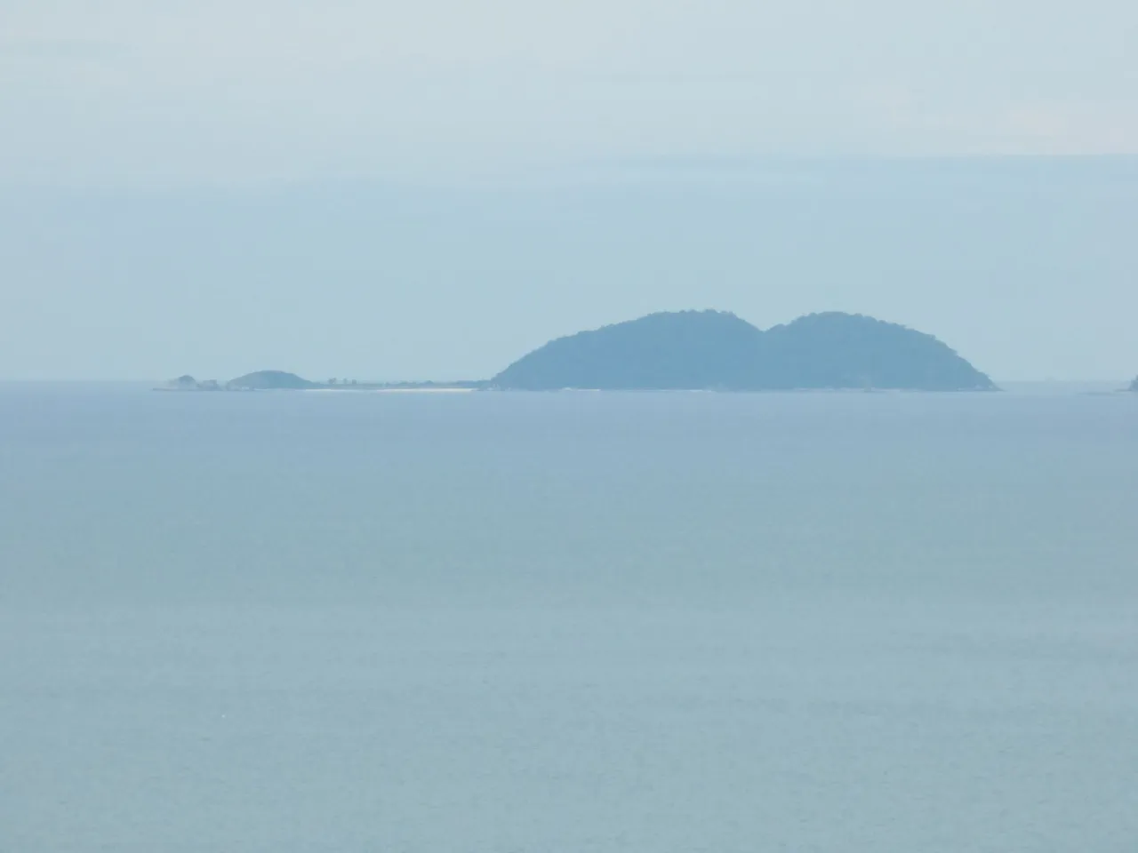
That little blip on the left (not the boat) is part of a lower part of Ko Lin. And there's even a stretch of beach between that blip and the rest of the island, which cannot be seen unless I move to even higher ground. The next photo is shot from the 27th floor of an apartment building about 100 yards further back behind the beach.
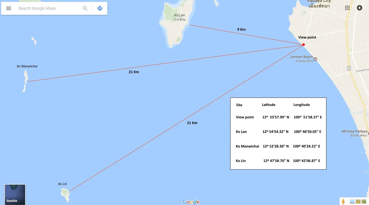
More details regarding this observation is available in the following video. It also contains observations on a neighboring island, Ko Manwichai, which shows similar effects. A geographical map is used to show the location along with latitude and longitude coordinates and ends with a discourse on the calculations of the earth's curvature using the Pythagorean theorem.

Map:
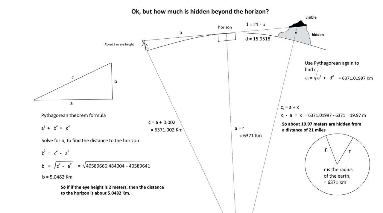
Pythagorean Theorem:
Links:
National Hurricane Center - Geographical distance calculator using latitude and longitude