Hello again!
In my previous post I mentioned the ongoing projects I´m working on and this time I´ll focus on one of the various local maps I made.
Ibiza is a small island but it´s full of twisted roads going up and down all our little hills. Many old farmhouses are on old dirt tracks that might wind up and around for a few kilometers . To find somebody´s house or location people nowadays send phone locations and when we are lucky we can reach the place but half the time as you are driving up these paths you lose internet and then it gets you lost.
When I was a child and many of my family´s friends were artists, we always had hand drawn plans with visual references of how to get there. Like for example, "turn left after the big carob bean tree" " go left at the blue and white stone" " next turning after the well" etc...
Anyway, after going to see a friend who was renting a new house and my other friend went though the hassle of getting lost because of lack of internet on her phone or the battery going flat, they said jokingly that they preferred the old fashioned way.
I suddenly thought is would be a lovely thing to do. Create unique illustrations for peoples homes in remote places in the island.
I did two as a gift to try it out on my friends.
They are a lot of work but I really enjoyed doing them.
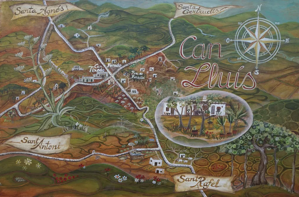
This is the first one I did of Can Lluis.
This one is acrylic on wood and measures 27x41cm.
In it I have rubbed out the last part of the track with photoshop to keep the privacy of the people´s homes.
I hope you enjoy this idea.
Best wishes from my little rock.
Romanie