Coconut Trees for the Whole Coastline!
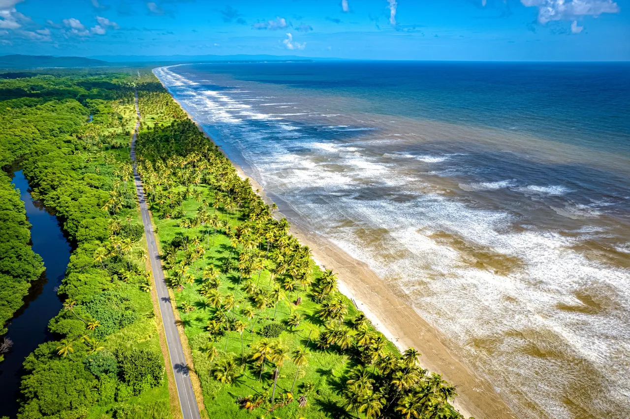
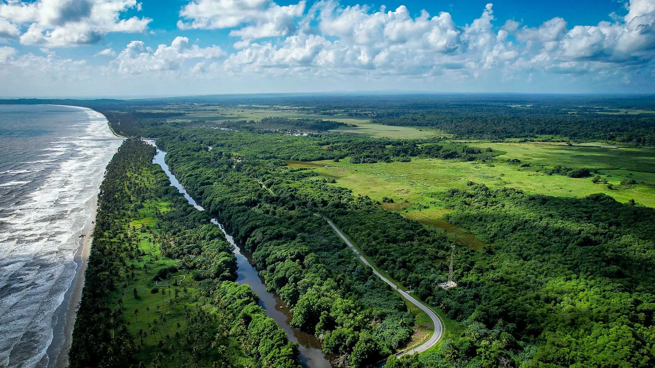
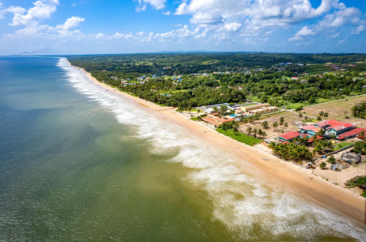
An Aerial north facing View of the Manzanilla/ Mayaro Stretch
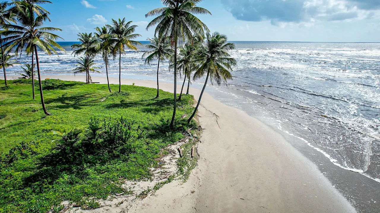
The eastern coastline of the island of Trinidad is mostly just large stretches (along the coast) of beach and coconut trees as you can see in the photo above where the shore goes in a linear curved fashion for as far as the eyes can see! This is known as the Manzanilla/ Mayaro Stretch and a long but mostly straight solitary road takes you along the stretch of the coast from the top all the way down to the bottom of the island! Now, we have already covered the top and bottom of the eastern coastline very well in HIVE blogs but now we are going to explore the middle area of this side of the island with its abundance of amazing beaches and the Nariva Swamp.
Manzanilla and the Nariva Swamp
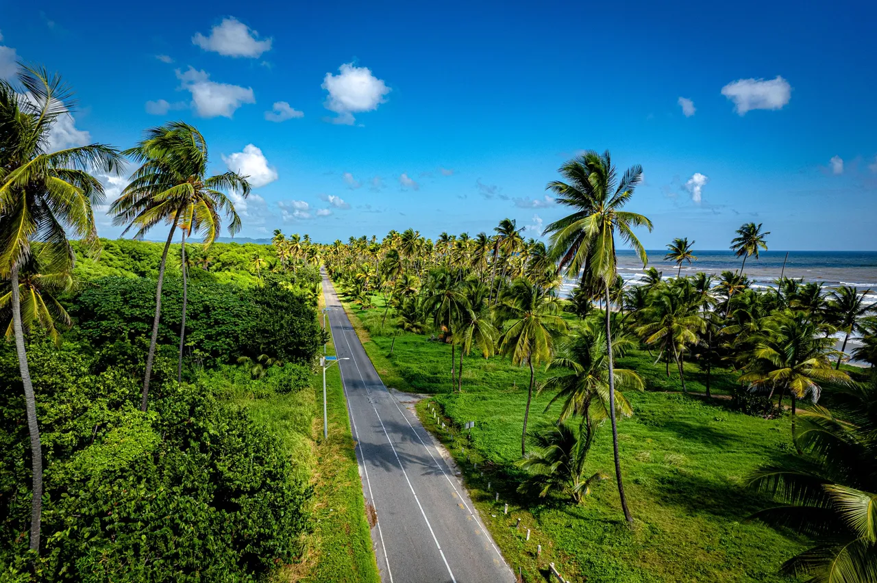
We start off at the northern half called Manzanilla. Here, the road passes amidst the coconut trees and just near ocean. It is such a long drive through if you are heading to Mayaro (which we are later on) but if you are bathing in Manzanilla, you have the liberty of stopping off and parking anywhere along the road to take a dip anywhere along the stretch of road! There are inlets in the coconut trees scattered along the way as well to park where the best and most beautiful areas are! There are also beach houses that are rare in this area scattered here and there throughout in the coconut tree line that you see in the photos.
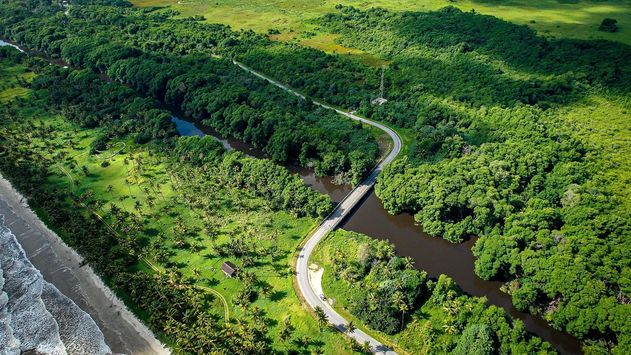
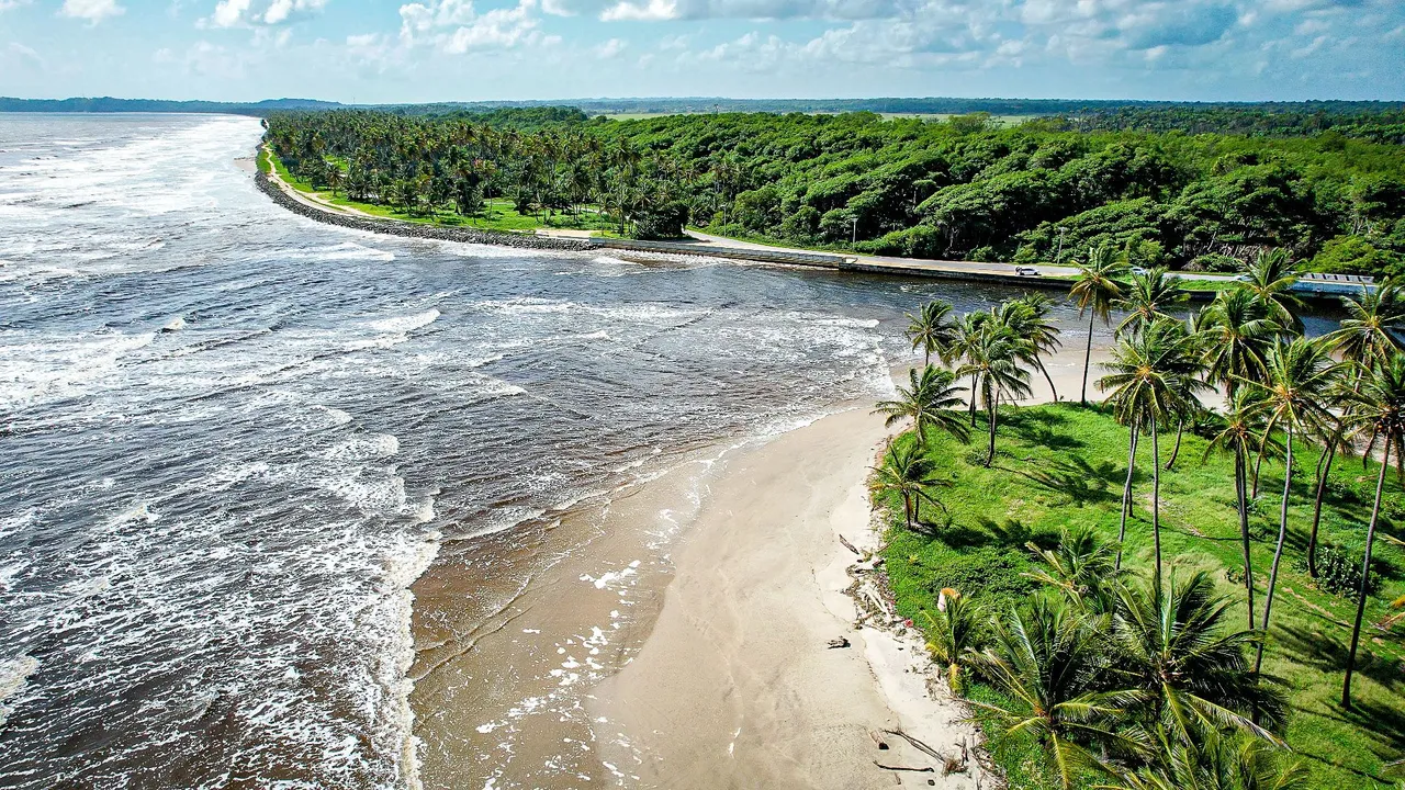
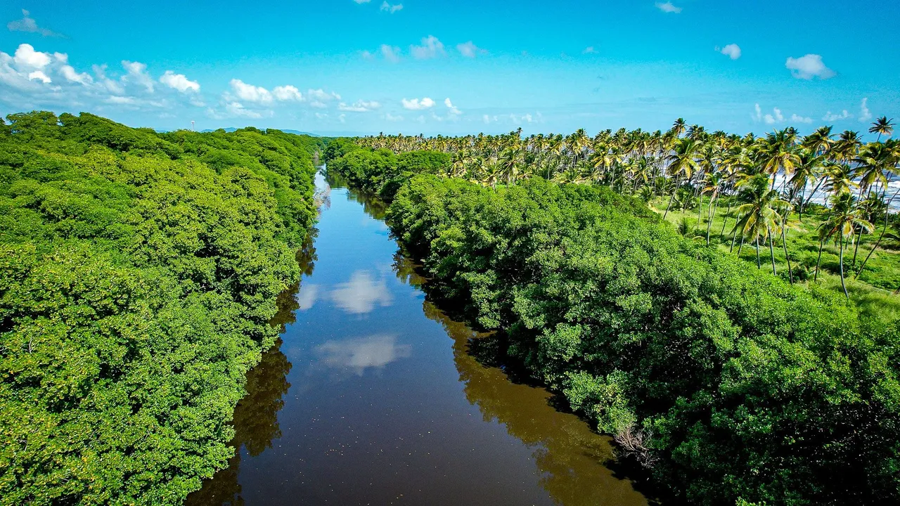
The solitary road at a point, as you are traveling southwards and entering Mayaro which is lower down on the same coast eastern coastline as Manzanilla crosses over the Nariva river which is part of the larger Nariva Swamp. Coming from the north as everyone would be driving from, the river is always on the right side but it eventually leads diagonlally towards the ocean so the road has to cross the river at some point via a bridge! We will get to the river mouth at ocean soon as it is quite beautiful.
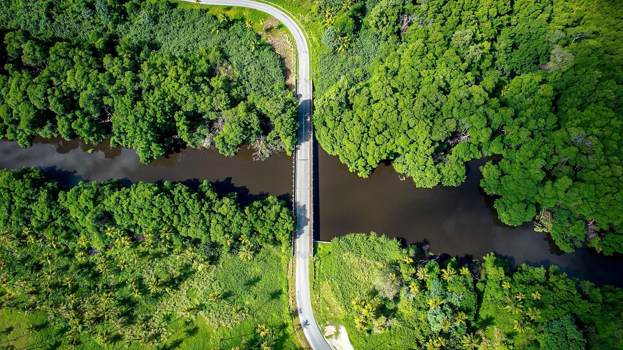
This is a closer top down view of the bridge where the road has to cross over the river. So all along, the mangrove trees and river were on the right and now after the bridge it is switched to the left side until we get to the river mouth. After this point you cannot see the beach for a while as the mangroves are in the way now.
Here is a better view of the road after the bridge. You can clearly see the Nariva river on the left side now and how to leads out to the ocean in the top left. Basically the lovely coconut tree and ocean view that you get for the whole drive in the beginning is cut off for a while until the road reaches back up to the river mouth and the ocean as well, as you see above.
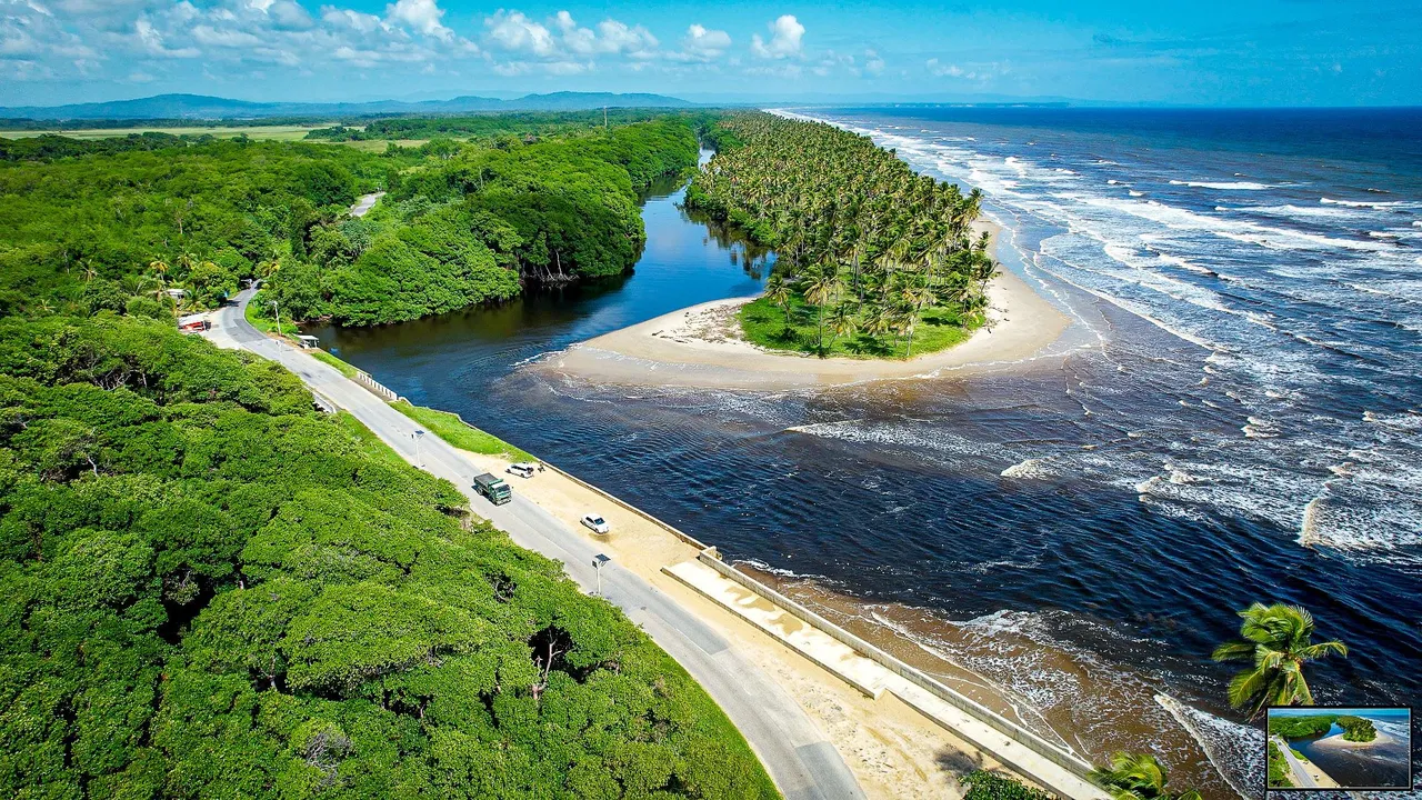
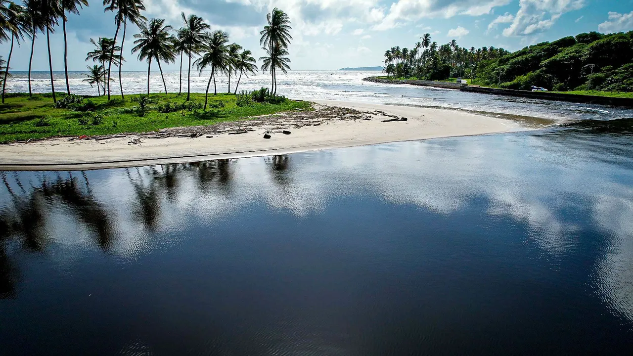
We drove for around 5 minutes with just mangrove trees in sight until we arrived at the point of convergence of the river mouth, the ocean and the road. The slice land that is split by the sweet river water from the main land seemed to look like its own island! It was nice to have coconut trees on the slice of land and strictly mangrove trees on the other side, this was so beautiful!
I decided to send up the drone to explore the Nariva Swamp as not many people are able to see these natural beauties without a boat or kayak. In this area, not many people do such water activities as it is quite dangerous and filled with caymans and anacondas, I kid you not! The above shot shows the view of the river mouth from on the side of the slice of land where not many people get to go onto as they usually just drive past on the way to Mayaro. Some stop and take photos but that's it.
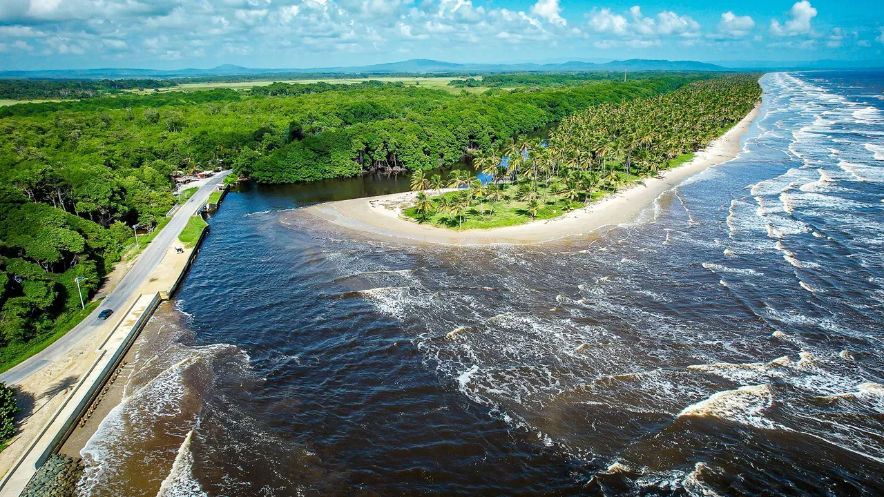
This is another view of the ocean side from the edge of the slice of land at the river mouth.
Facing back towards the road, I decided to take a quick shot again before delving into the river itself to see what we could discover! I hoped so much to see a huge anaconda or maybe a cayman!
As I flew into the river itself I noticed I was indeed flying with a flock of birds that seemed to be white egrets from my viewfinder. THey were quite unfazed by the large noisy drone which was quite unorthodox as birds always seemed to scatter and run away by even the sound of the propellers!
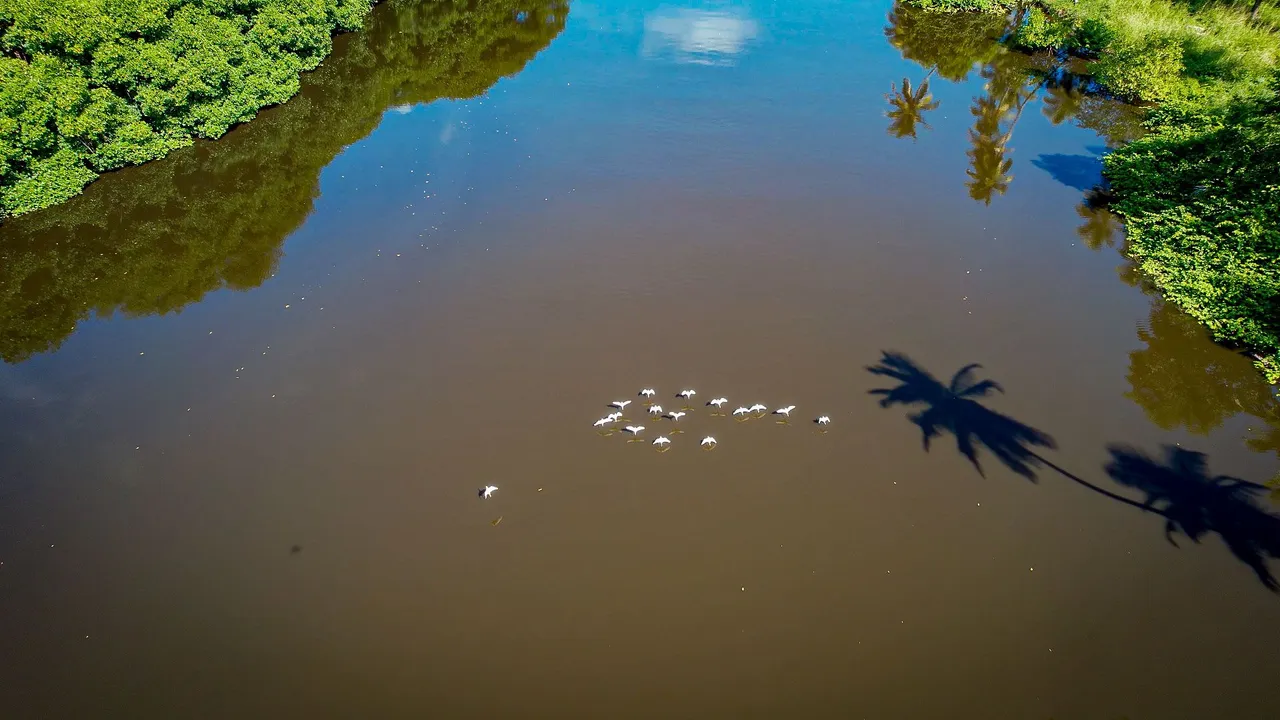
It was quite a breathtaking moment being bale to fly with them, what a time to be alive! I could just send up my flying machine miles away and feel what it is like to be guided by a flock of native species of the Nariva Swamp!
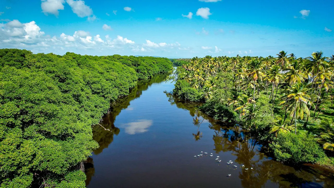
The river itself was a work of art. It was fringed on both sides by healthy thick hedges of mangrove trees. In the middle was calm river swamp waters and on the other side were an array of breathtaking coconut palms that were just as numerous as the mangroves and they all came together to produce a unique symbiosis I had never seem before!
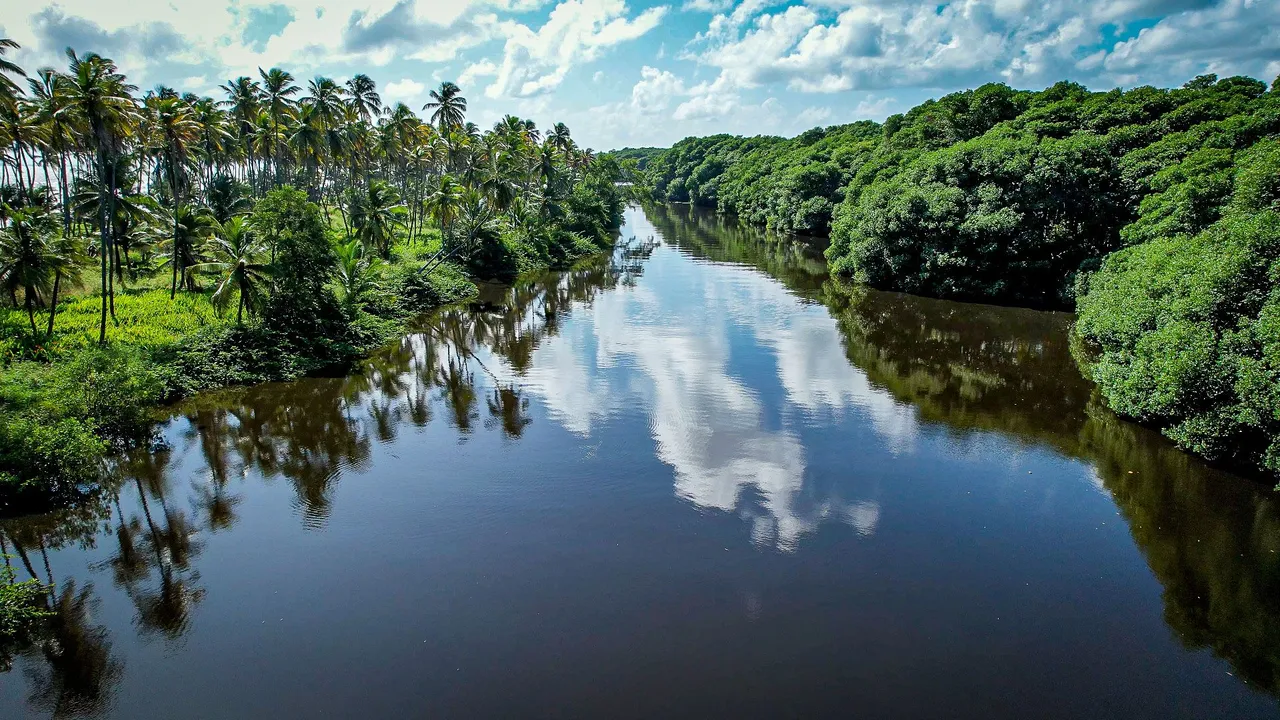
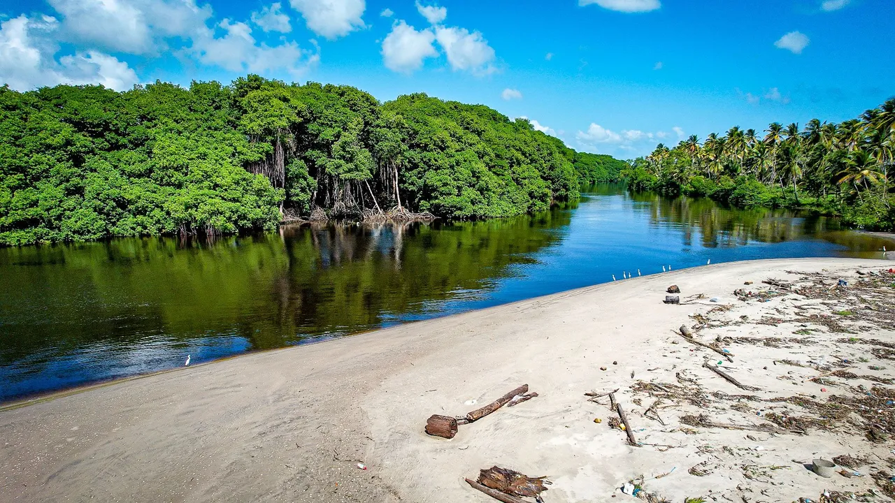
Here is a view form inside the river facing back towards the entrance. Look how thickly the mangrove tree's leaves hug the surface of the water! It almost looked like they were growing on solid land!
This was the last shot I took when I finally flew back out of the river and to the mouth again before landing and jumping back into the car to head lower down on the coastline to Mayaro.
Mayaro and Finally Getting to Take a Dip!
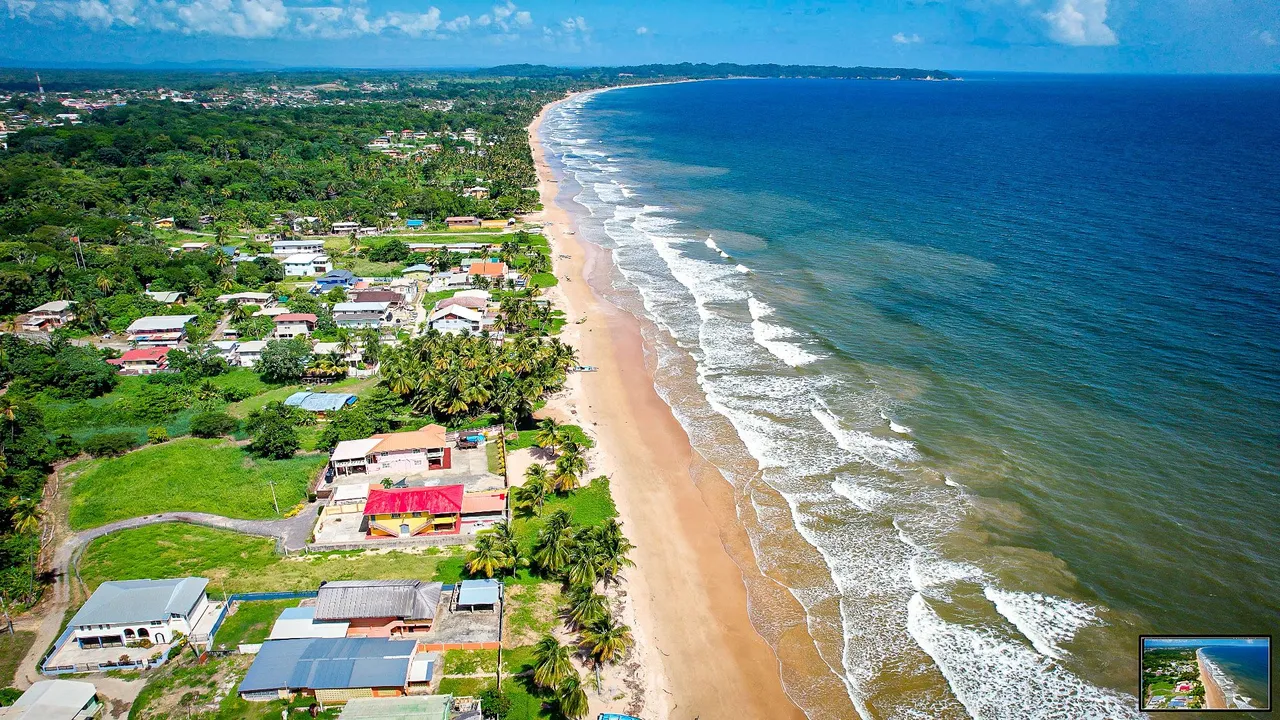
After another half and hour drive, we finally got to Mayaro. Manzanilla was just coconuts and mangroves for miles and in contrast, Mayaro's coastline is covered with beach houses and towns! The shoreline, as you can see from the above photo is more curved as well. We usually stay in beach houses for public holidays, its a Trinidadian tradition!

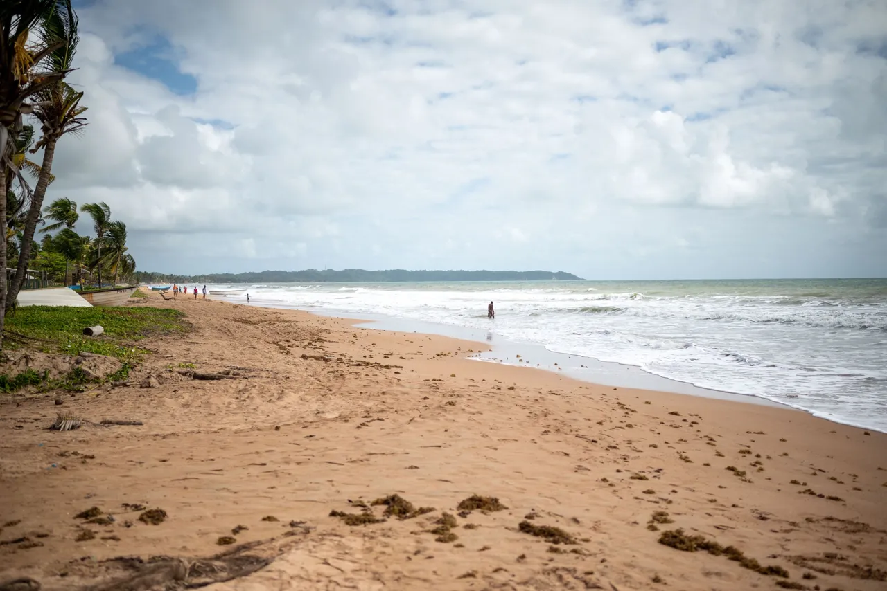
Heres another north facing view of the curved coastline was well as a look at the noticeable cleaner waters than those of Manzanilla.
This is the south facing view of the coastline is breathtaking as it shows the shoreline that goes all the way down for as far as the drone's pixels could register. At the point on the top left of the image where there is smoke is the end of the island of Trinidad itself, the smoke being from an oil refinery.
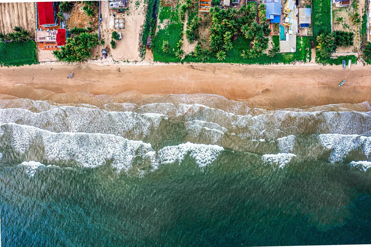
We parked up on one of the roads leading up to the shore line and passed through one of the alley ways between one of the beach housed to access our favorite area of beach to visit in Mayaro. You can see from the above photo how the buildings are built and why we had to pass through them!
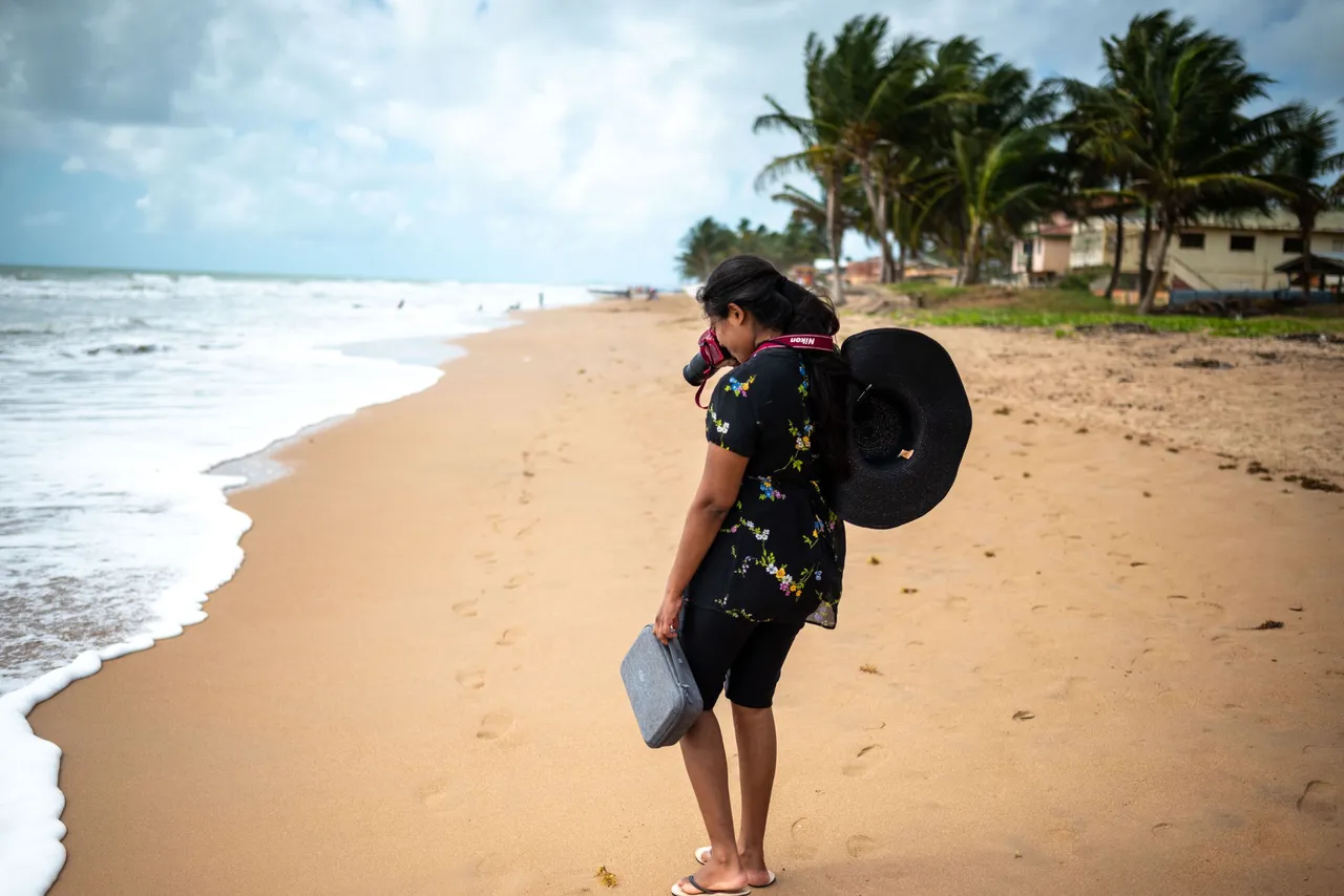
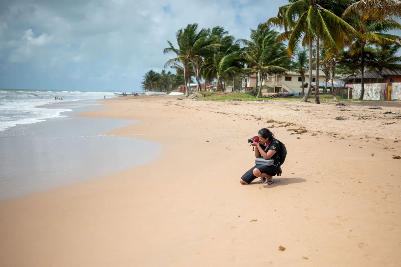
My wife and I decided to walk around first before taking a bath to take photos of the beach and document whatever we could see, especially of the people visiting much like us! She had her Nikon D3400 and I was used my Nikon Z5. It is such fun indulging in hobbies with your spouse!
The sands were so much cleaner and the water looked so much more enticing than Manzanilla. We could not wait to take a dip even though the weather was seeming to have changed a bit.
There were people here already with their families who were either visitors like us or patrons of the rental beach houses. Families often rent the houses out just for the day or the weekend.
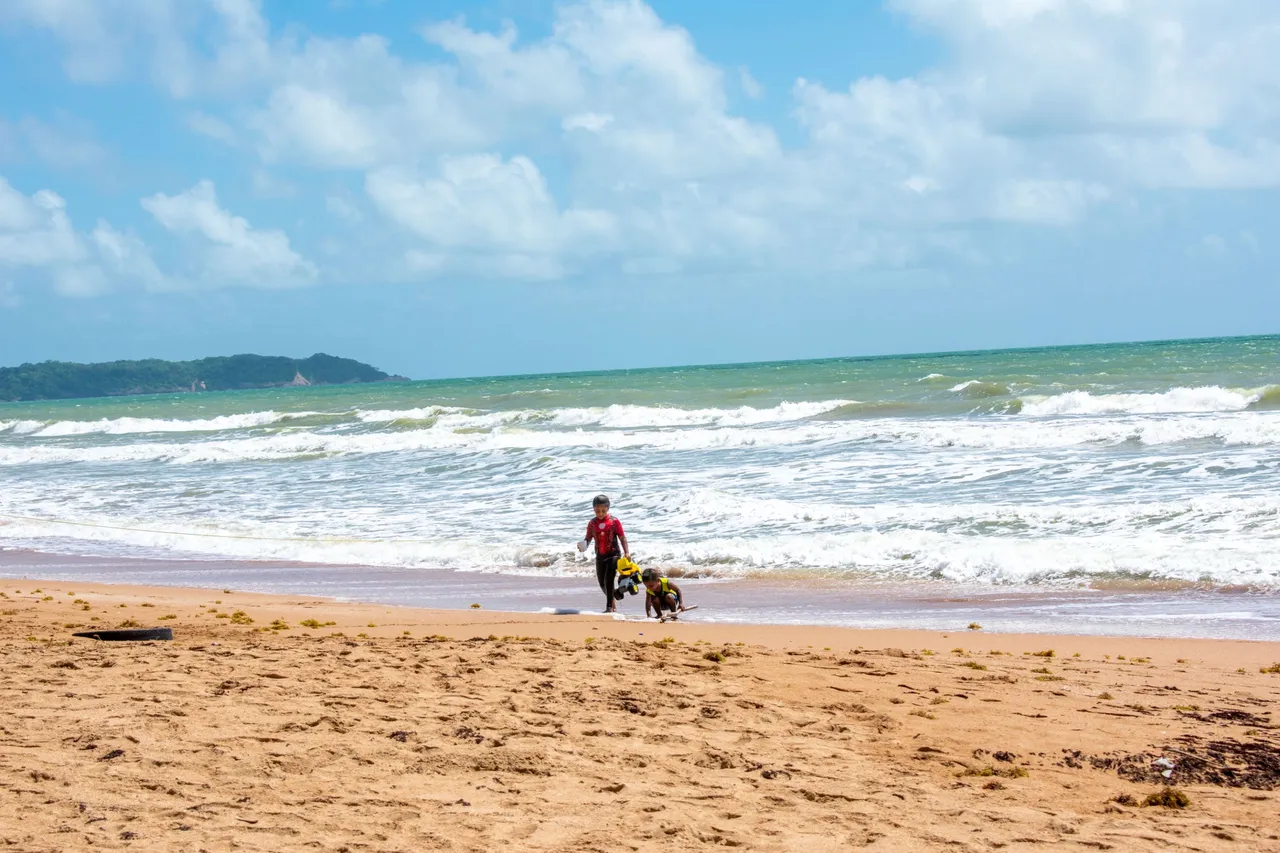
Children were out and about playing the sands with their beach toys, something I was so excited about in my younger days but now that I am older, I would much rather take photos, funny how life changes.
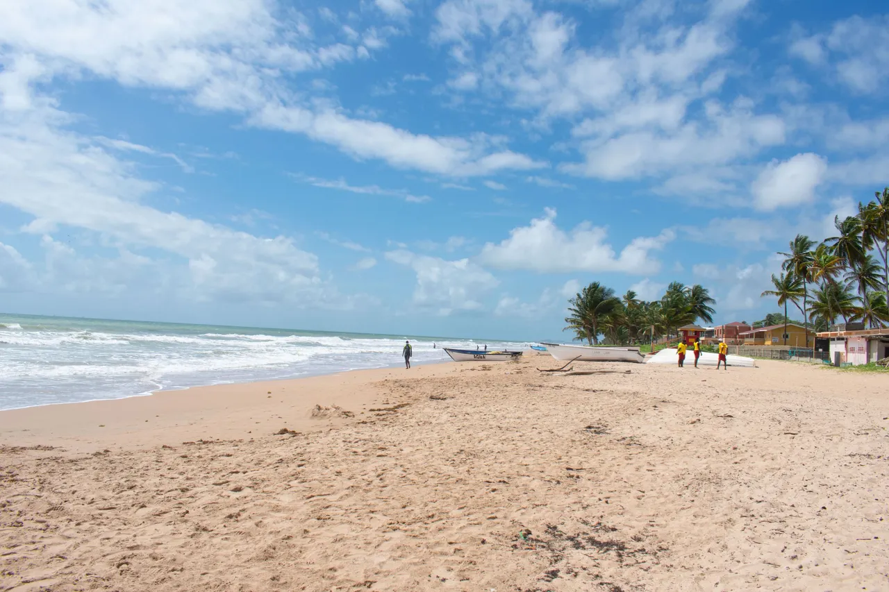
In the tip right of the image above, you can see life guards in yellow having a meeting of sorts. I felt a but safer having them around as they usually are so hard to come by on this shoreline as it is so HUGE and that and people are always stopping to bathe at any location they want and they usually are stretched so thin!
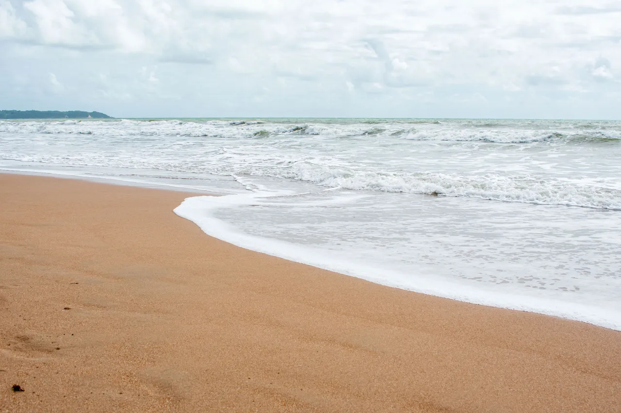
I could not get enough of the color of the sand! IT was so beautiful and the waters that complemented them were mesmerizing as they crashed upon the shore.
They were not as beautiful as the turquoise blue waters of Tobago or Curaçao as you may have seen in my previous blog posts but they were beautiful in very much their own way.
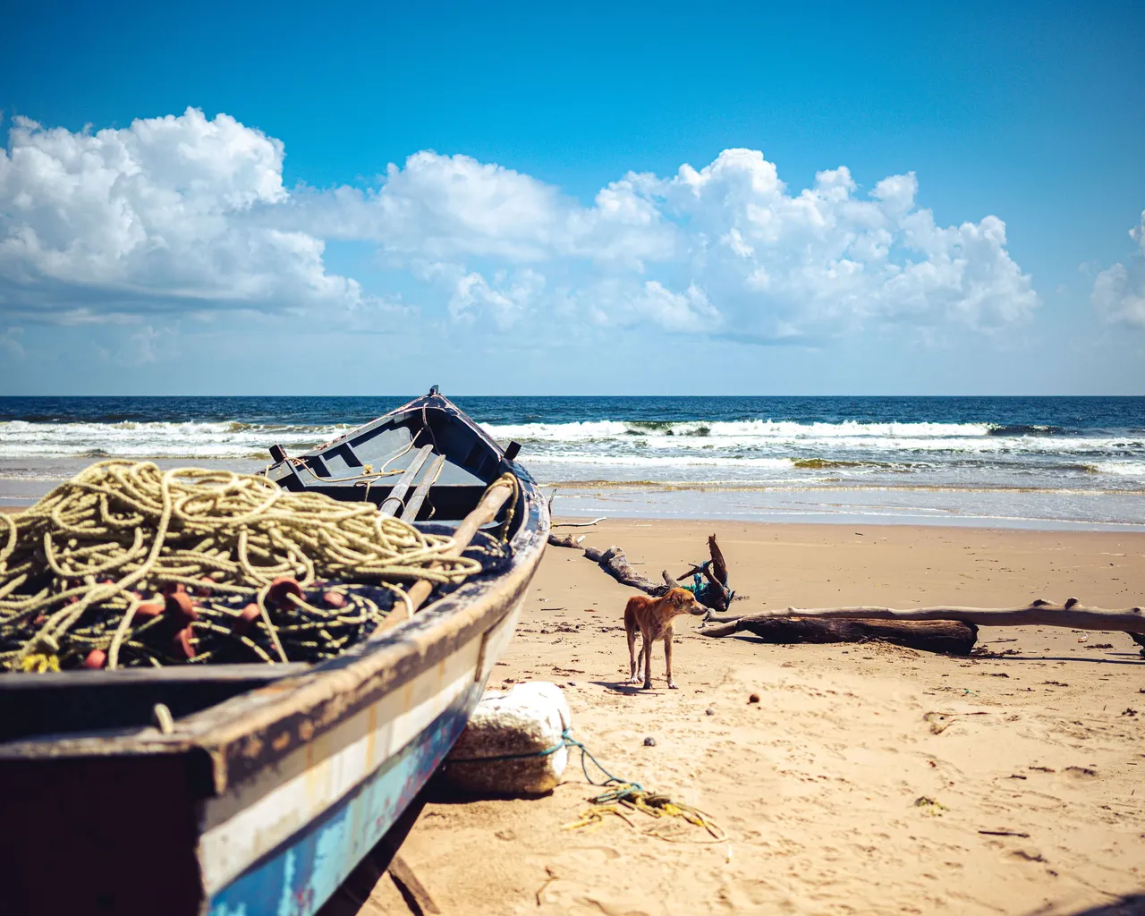
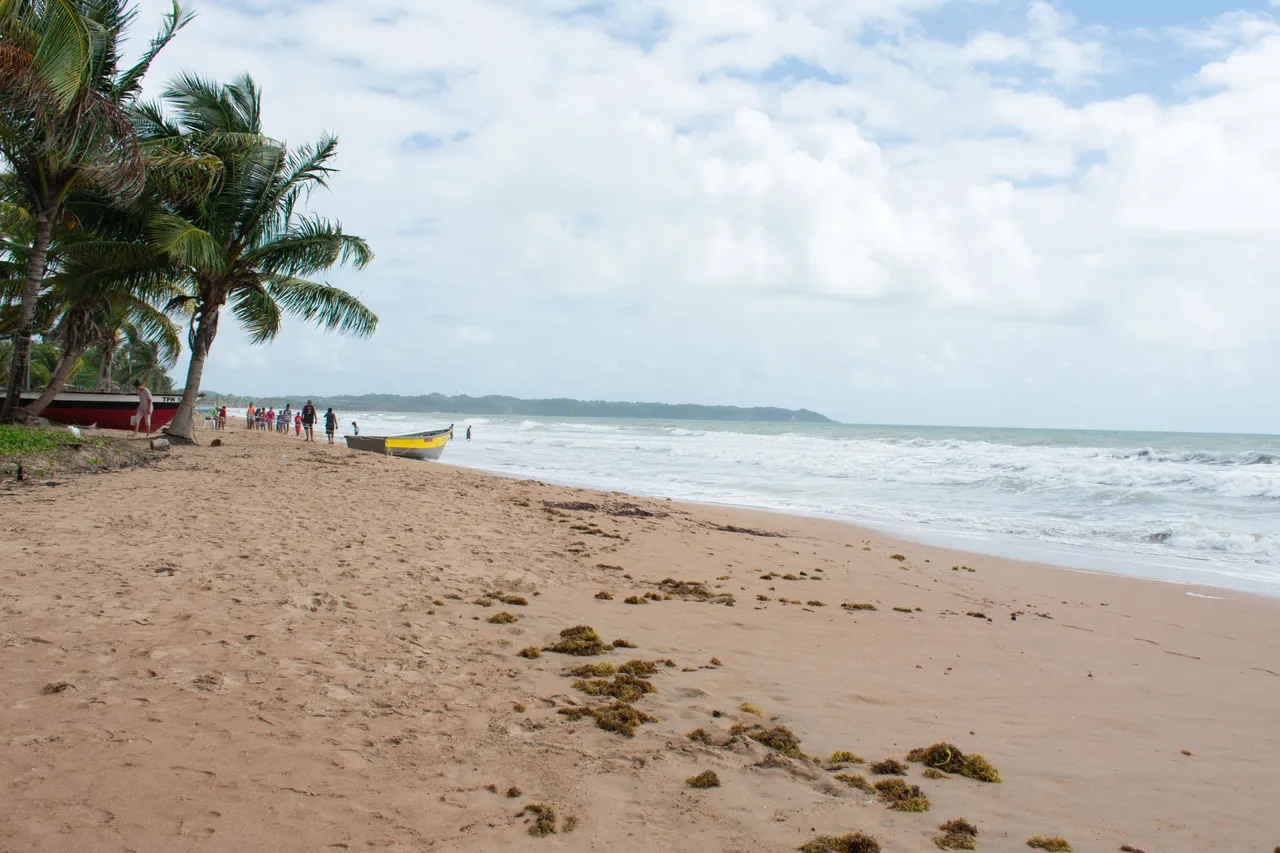
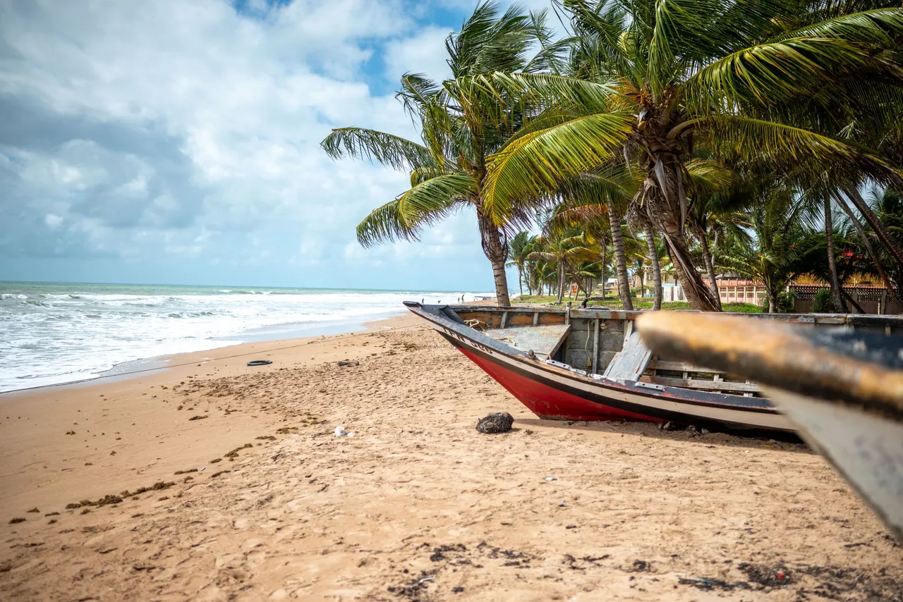
There were fishing boats or, as we call them locally, pirogues scattered about the beach, some with fishing equipment left in them for the for when the fishermen return to ply their trade. This is not considered an eye sore in Trinidad or Tobago and it part of the culture to see them. It would be as if something integral is missing if there were none!
After having our fill of photography, we put down our gear in a safe place and jumped into the cool refreshing Mayaro waters. This was a much deserved ending to our exploration and documentation of the eastern coastline all the way from breathtaking Manzanilla with its coconut palm decorated coastlines and Nariva River, to Mayaro with its ideal vacation beach fronts. Thanks a lot for coming along with us, Cheers!