A Small Fort With A Big View
A panoramic view of Charlotteville in the backgroud, Fort Campbelton in the foreground and Man O' War Bay
Today we head over to farthest eastern end of the little island of Tobago in search of Fort Campbelton! It was quite the story trying to find the actual location of the fort even though we had google maps and waze! We eventually found the fort and all the trouble was worth it in the end!
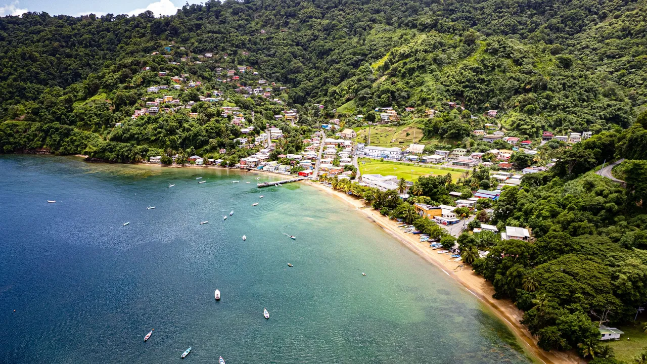
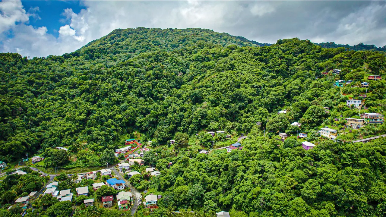
A closer view of the western side of Charlotteville
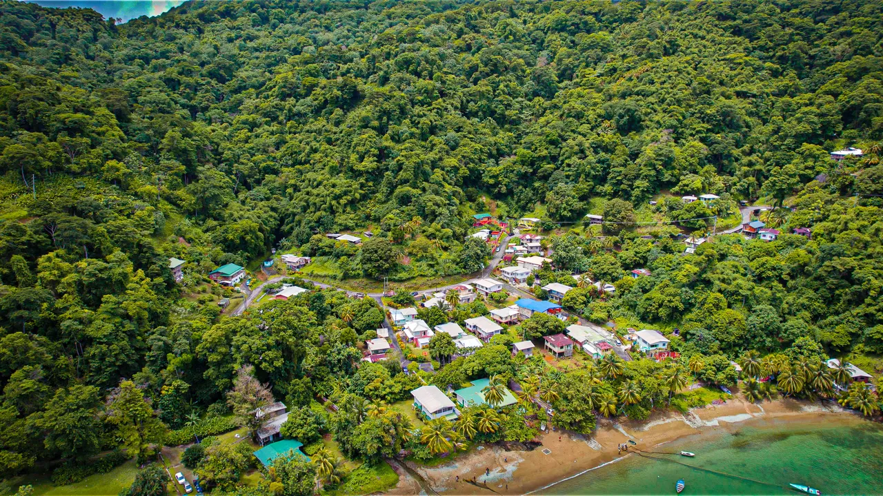
We drive for around 2 hours through winding mountainous roads before arriving at the town of Charlotteville, so much so, that the brakes of the car were smelling really high! Our intention was to head directly to the fort but we decided to check out the little town first and Man O War Bay by which it was built.
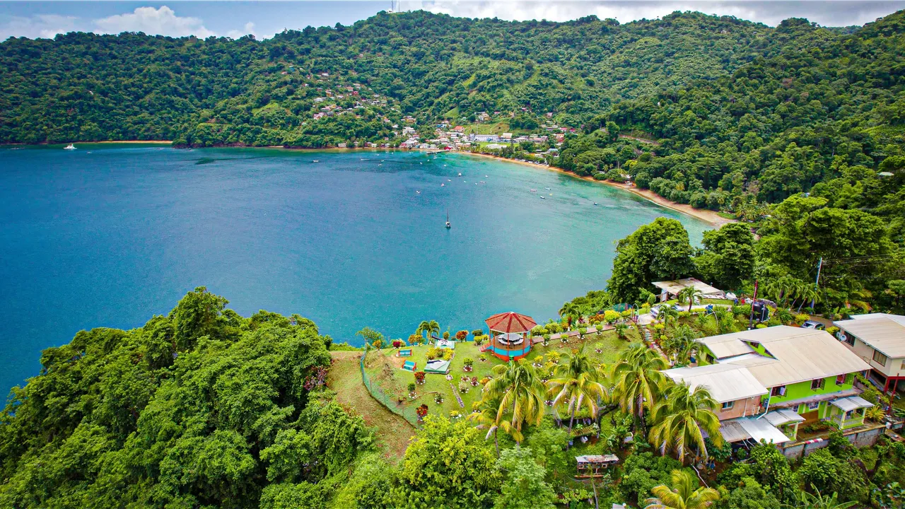
Man O War bay was large with mesmerizing turquoise blue waters and healthy reefs that you could see through the surface of the pristine ocean. There was this large jetty and the town was quiet and very charming mainly being situated in the valley as well as upon the mountainside.
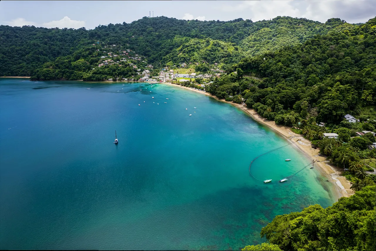
The mountains that surrounded the town panoramically are what we basically drive over! You can see from the wider angle shot above how pristine the waters were and how well you could see through them to the corals below!
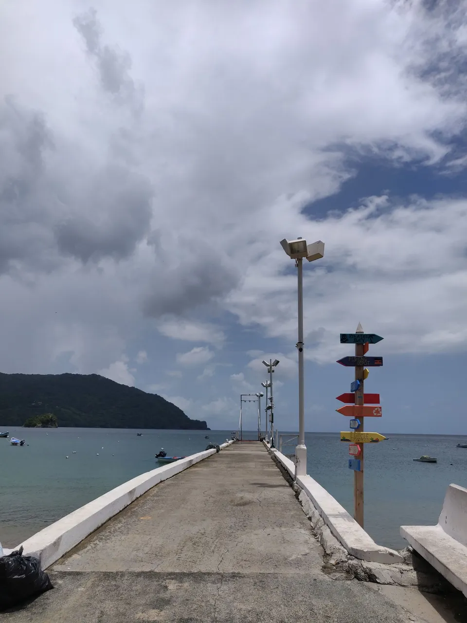
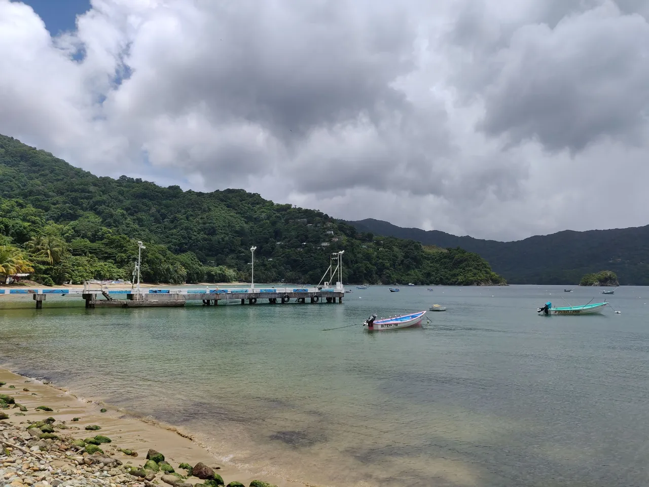
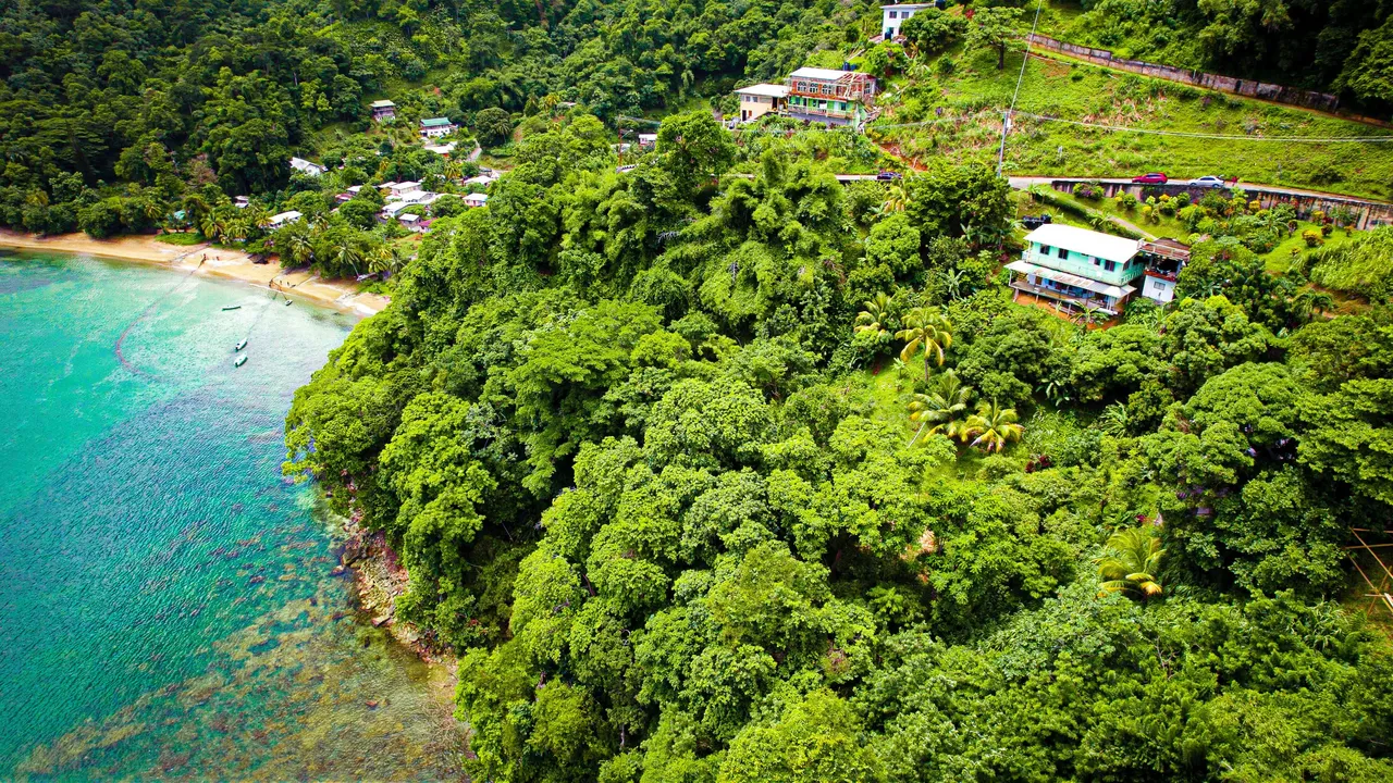
We quickly checked out the jetty and Man O War Bay in the town of Charlotteville. Little did we know that in the photo above, there on the top of that hill in the distance on the right side, was the fort which you can see! We did not know what trouble we were in for to find the location yet though!
We typed in the destination of Fort Campbelton on Google Maps and saw that it took us out of the the main area of Charlotteville and and up one of the hills on the outskirts. The road was steep and the car struggled with all of us in it but we kept going as we never really give up.
We got to almost the top of the said hill when the maps told us we arrived and to our surprise it seemed that the POI on the map was wrong! Normally, for forts in Tobago, there are signs from all the way out of the town in which it is situated so tourists can get to it easily and know that they are on the right way but here there were none. There were no roads, gates, entry ways or any thing of the sort that indicated that there was a fort in the area, just residential houses, and peoples front yards! Were we in the right location? The right road? The right part of the whole island even?
We were just about to leave when an old lady who seemed to be in the healthiest shape of her life was singing happily while walking briskly up a hill the car was just struggling to go up. She was more than elated to help us with out plight as are all Tobagonian locals. It turns out that we were in the right area after all, just that the entrance to the fort was basically right through someone's front yard! It kind of felt illegal, trespassing or something.
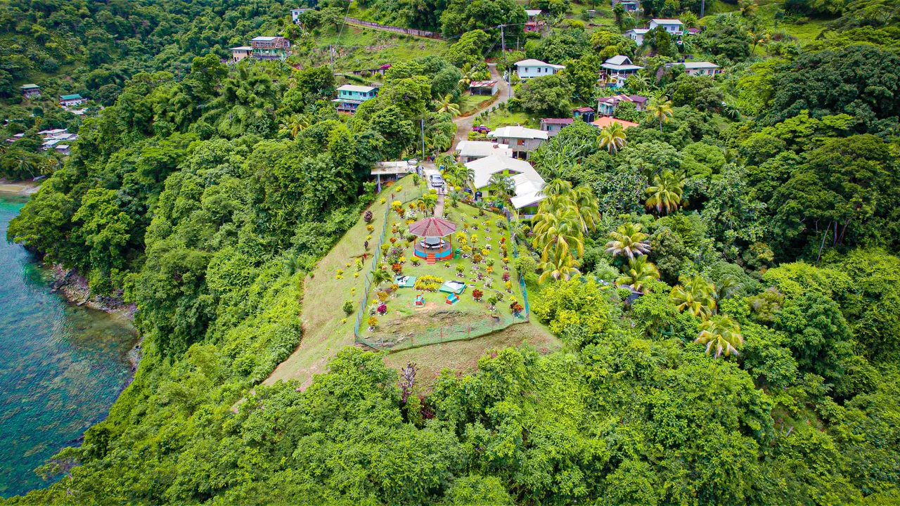
So from the main hill road we walked into someone's yard then found ourselves on a paved trail of sorts where there were more houses along that up until we got to the edge of cliff or the top of the hill we were upon that descended steeply into the sea. You can even see in the photo above how there are residential houses right there with people's cars parked right in front of the gate of the fort. How peculiar!
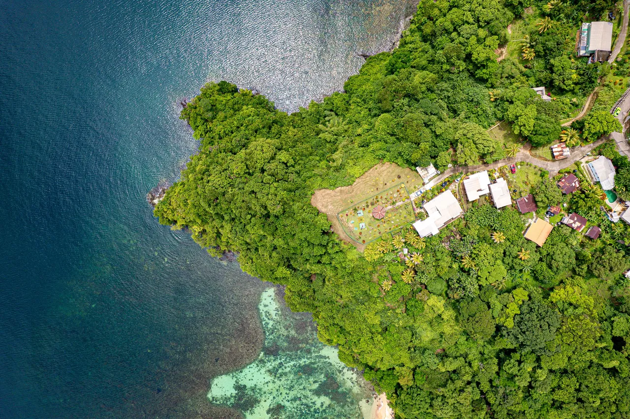
The fort itself was really small as it was situated upon as much area of the hill it could be built upon. There was a large gazebo in the middle that provided seating and shade as a well as concrete benches on the left and right sides to provide 360 degree panoramic views of the beautiful vistas and bays that Charlotteville had to offer. On the right hand side of the photo above, you can see a patch of vibrant blue corals and pristine clear waters so much so that you could see beneath them. This known as Lover's Beach which is right below the cliff upon which fort Campbelton is built!
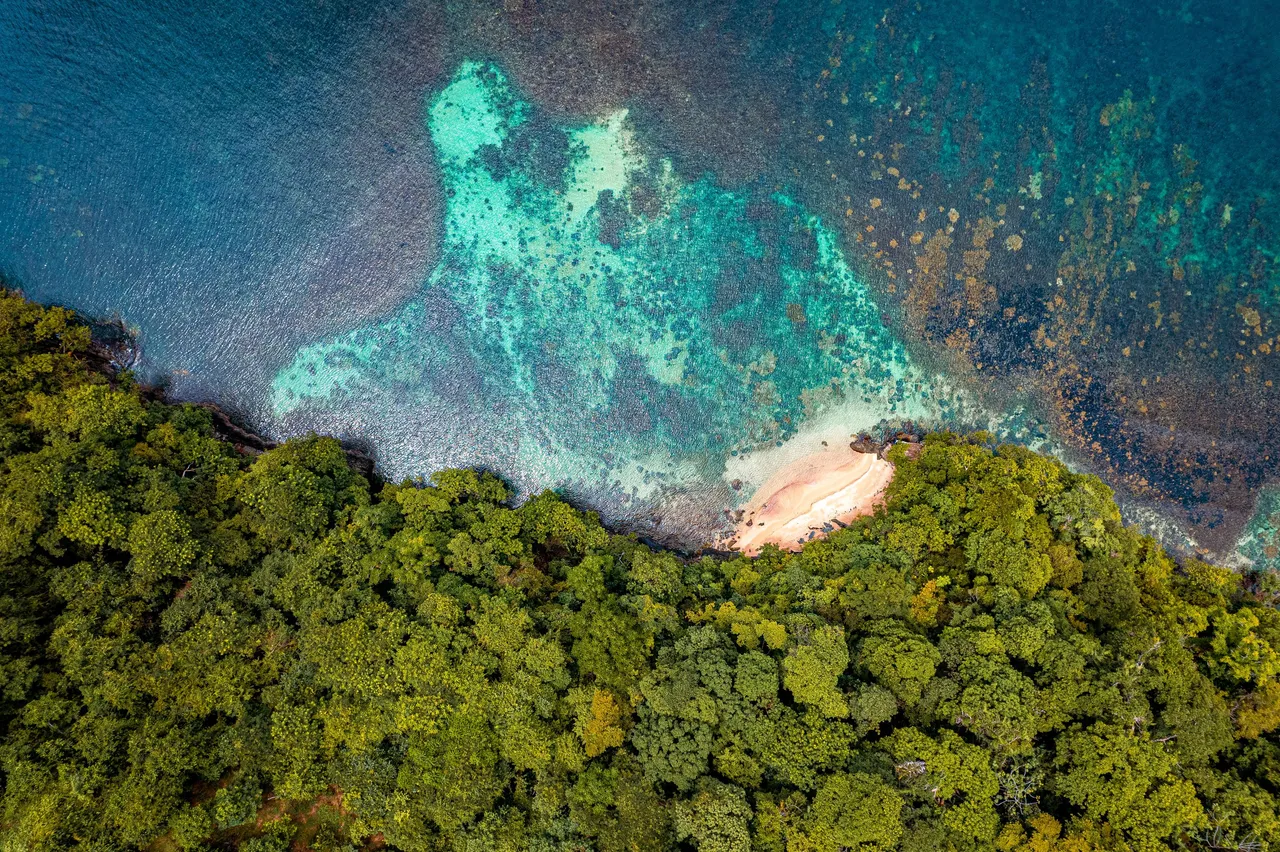
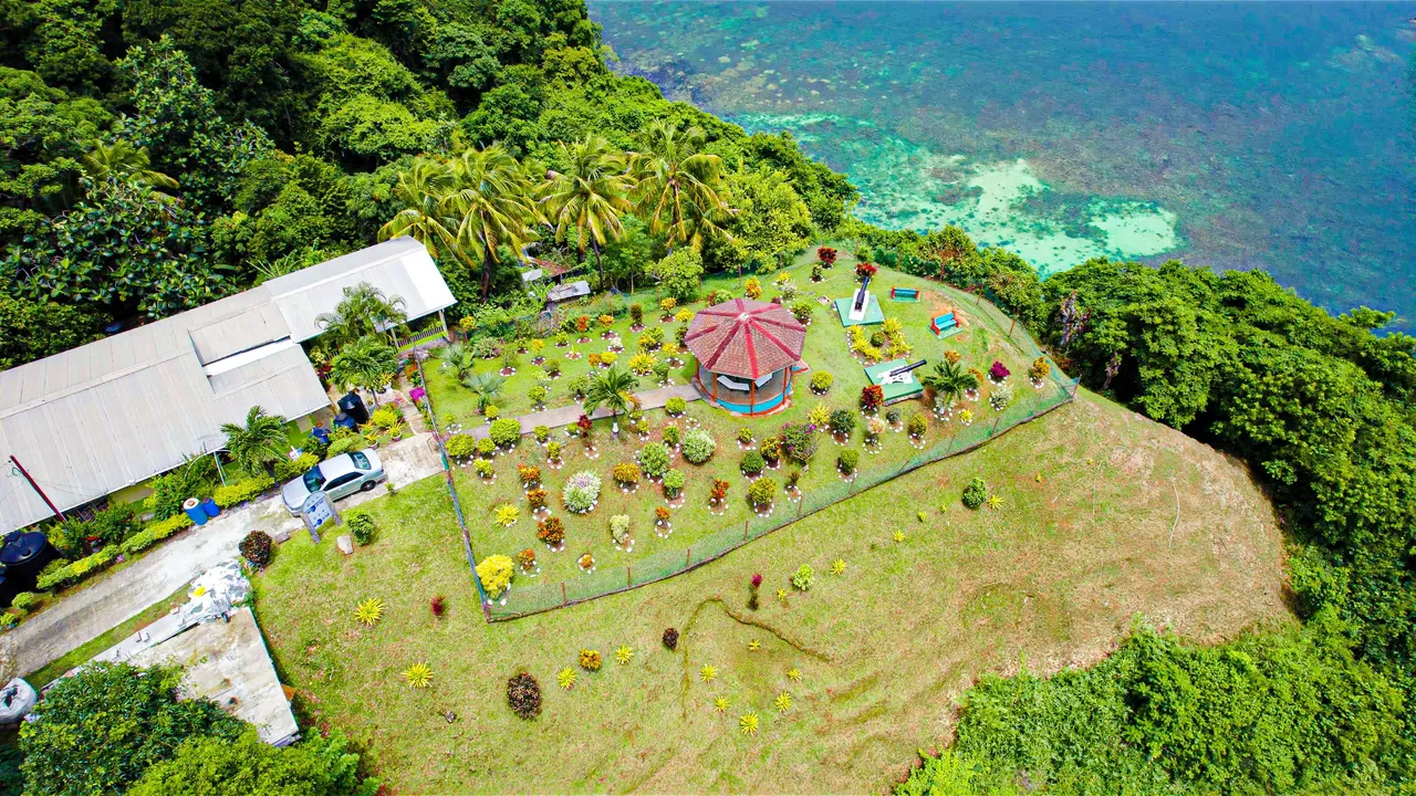
Here is another view focussing on Lover's Beach itself and the coral reef that accompanies it. As you can see, it is a small patch of beach sand and pristine clear waters that is only accessible via boat from the jetty we showed you earlier. There are boatmen who carry couples or whoever wishes to go, leave them and come back for them at their specified times for privacy. It is quite the experience!
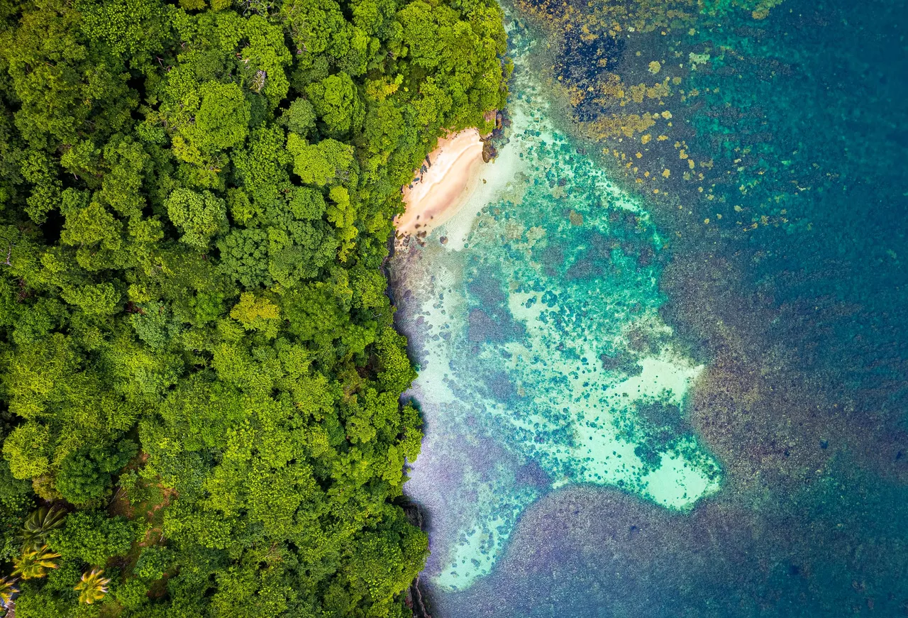
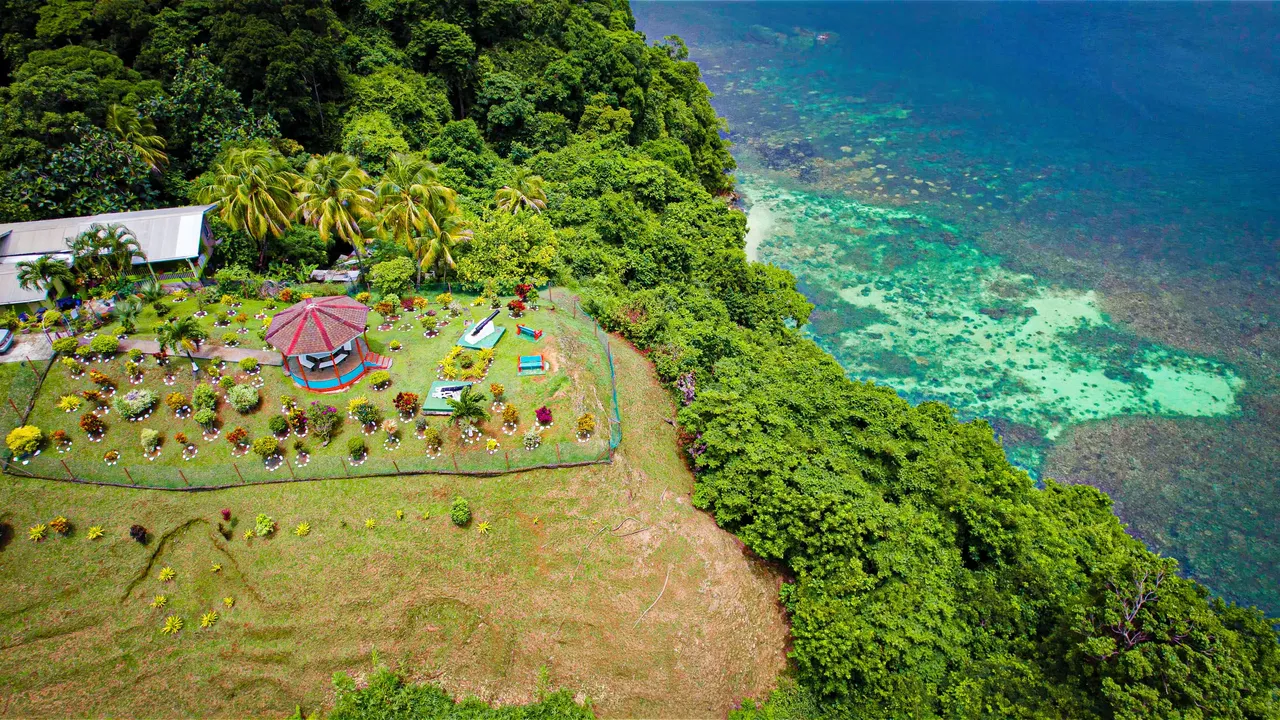
This was my favorite shot taken of the whole trip that day to the fort as It shows clearly the reef and in such detail what was below the surface of the waters almost as if there were non at all! This was taken using long exposure and ND filters.
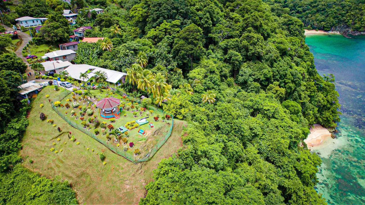
Here is another view of the fort with the beach on the right side, and a better view in order to understand the pathway taken to get to the fort from the main road!
The fort was not at all large like all the others but it certainly had what was, in my opinion, the best view! You could see the whole of Charlotteville, all of Man O War Bay as well as Pirate's Bay on the left side of the above photo.
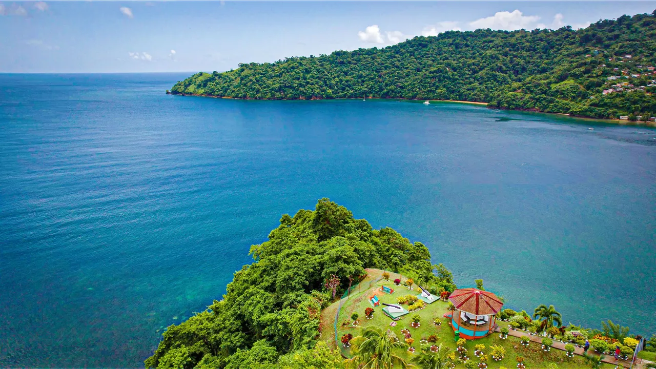
Just like Lover's Beach, Pirates Bay has to be accessed by boat. You can see it in the image above in the top right and even though it is hard to get to, it is quite populated most of the time as you would have seen in a previous blog.
I can quite clearly say that the views you get at fort Campbelton are like that of no other on the island. It is very rare to get such a panoramic view of so many popular locations on the island in one place! It was such a hassle to get to the fort but all the finds and views we had along the way as well as those we got when we finally did get to it were all very worth it. Thanks so much for coming along, cheers!