Julley Everyone,
Just a single word I would call to this place away from hustle and bustle and even after the hot summers in the Himalayas and now starting of the monsoon season was still this place covered under a thick blanket of snow as people say this is the only corner at this altitude that has snow throughout the year and even in the mountains nearby to as the whole region there for two local people so I also always wanted to visit such places that I could only visit during a certain time period as usually the place used to get covered under thick blanket of snow and I'm going to share my whole journey with you guys through this post.
Beyond The Rahalla Glecier.
This was the place and beyond that I wanted to visit I always had a keen interest visiting this place and exploring the land is unknown as I have been wondering around seeing that how I could approach the mountain and how I could make my way till the top so was this particular day my friends when I finally made it a success it was around 9:27 AM or something when I started my journey from Kullu Himachal Pradesh and it was quite a lot tiring journey just in order to reach the Rohtang Pass it took more than six hours when I was at this place.
A Glimpse of the GPS Maps
A few days back in an year or so I was just going through the Google Earth and I was just thinking about that how I could reach the mountaintop's or something or I could explore the place is unknown so I found out that there was this portion that I have put in yellow circle what is the place that I could approach right from the Rohtang Pass and firstly I thought from the portion where it says Rohtang Pass I could just climb the mountain up but then I thought about it was a steep mountain and I saw that the first curve towards the Khoksar Village of Lahul I could approach the top of the mountain or somewhere between I would say and finally reach at the space reach at the spot where I could view the higher ranges of the Leila dark and even the local Spiti higher mountains.
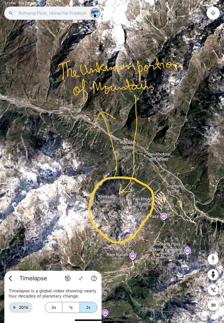
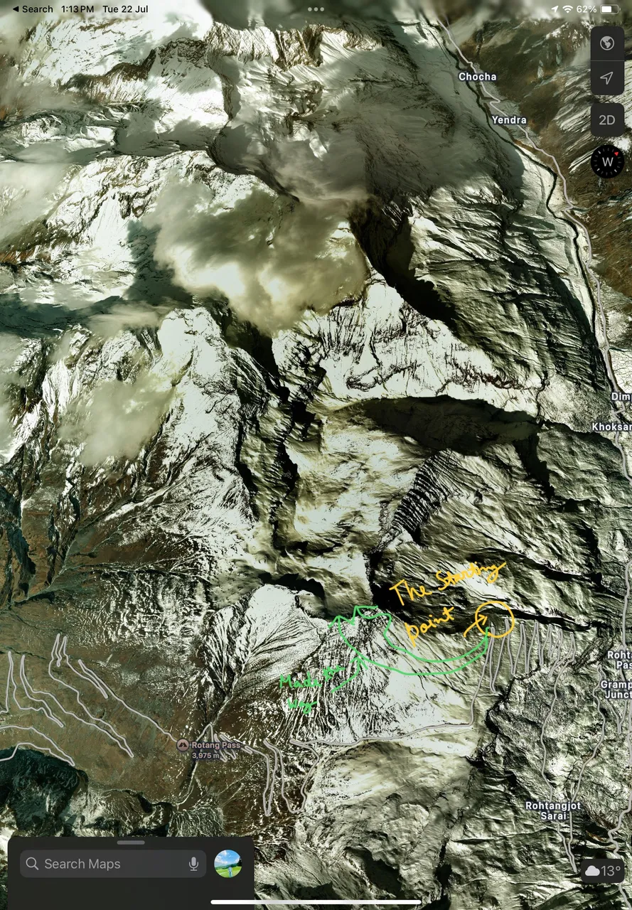
In order to see the clear map or topographical location I need to turn the timelapse on on Google Earth as wherever I could see the place could show up that it was covered under thick blanket of snow and that was true to that only there used to be certain portions of the timing on year when the place used to melt the snow but not in the glacier nearby so I thought it to be a day when I could explore this beautiful wonderland and share my journey with you guys through this post.
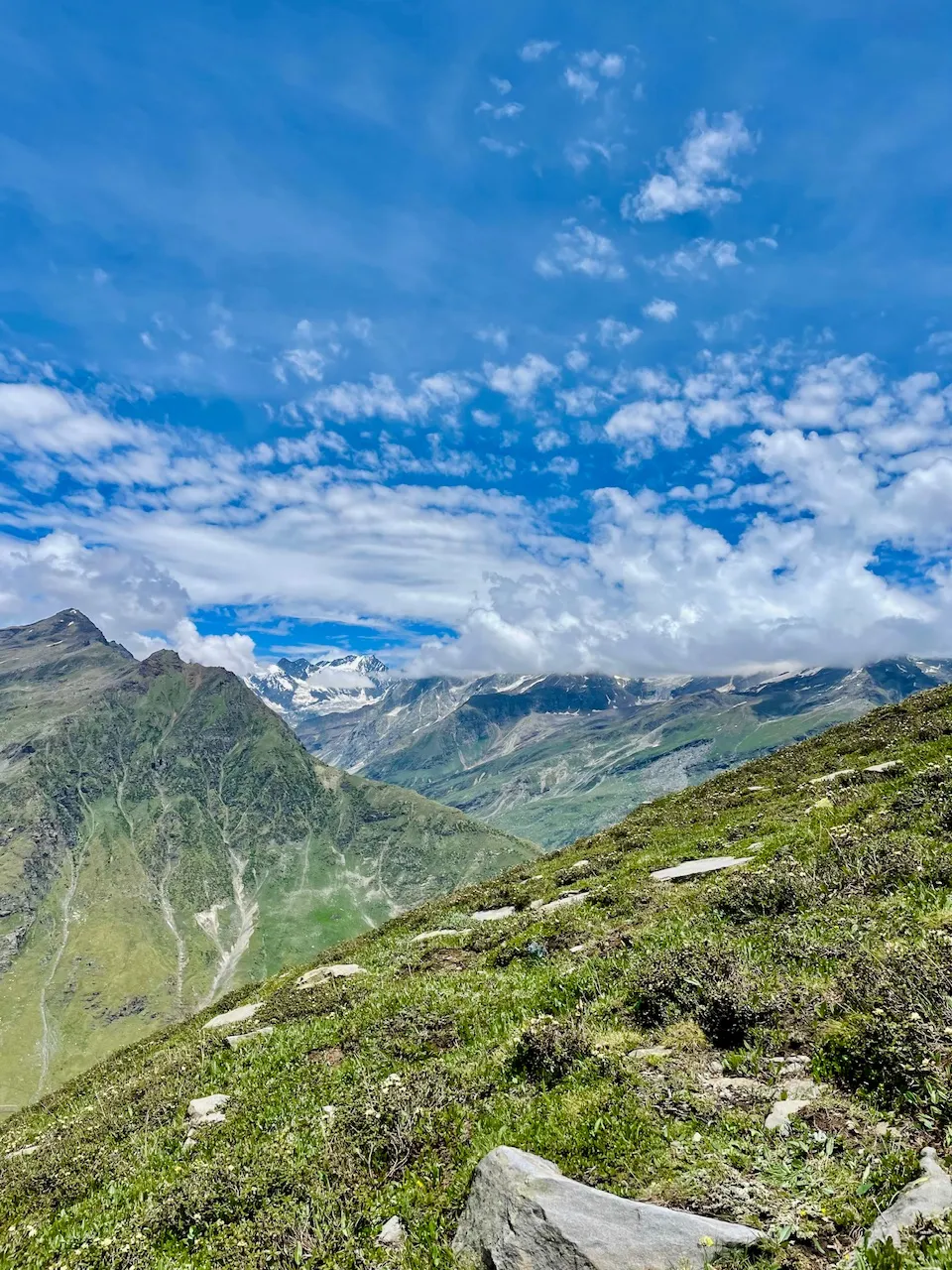
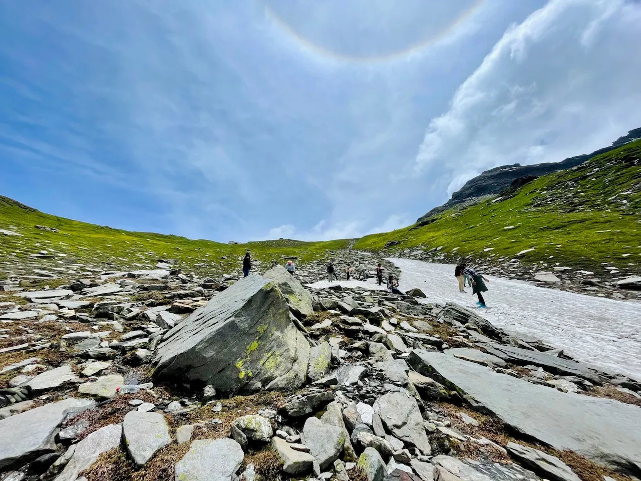
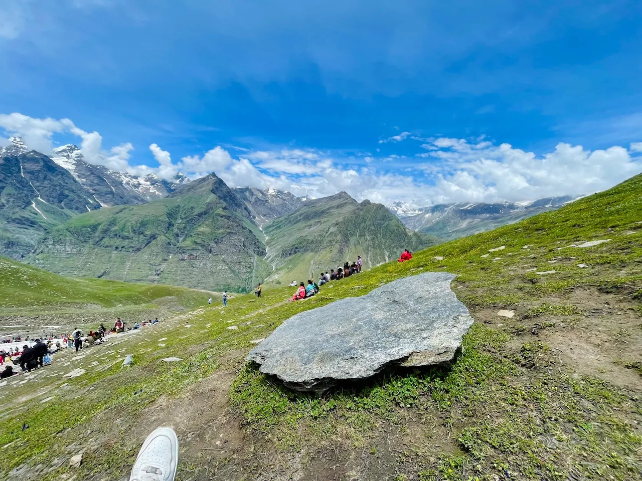
So after taking a hike of more than 40 minutes from the main road I reached at this corner I decided to relax here at the moment and just enjoy the view of the mountain ranges that were covered with a thick blanket of snow it was so beautiful moment that it was just a perfect blend of nature in just a single frame.
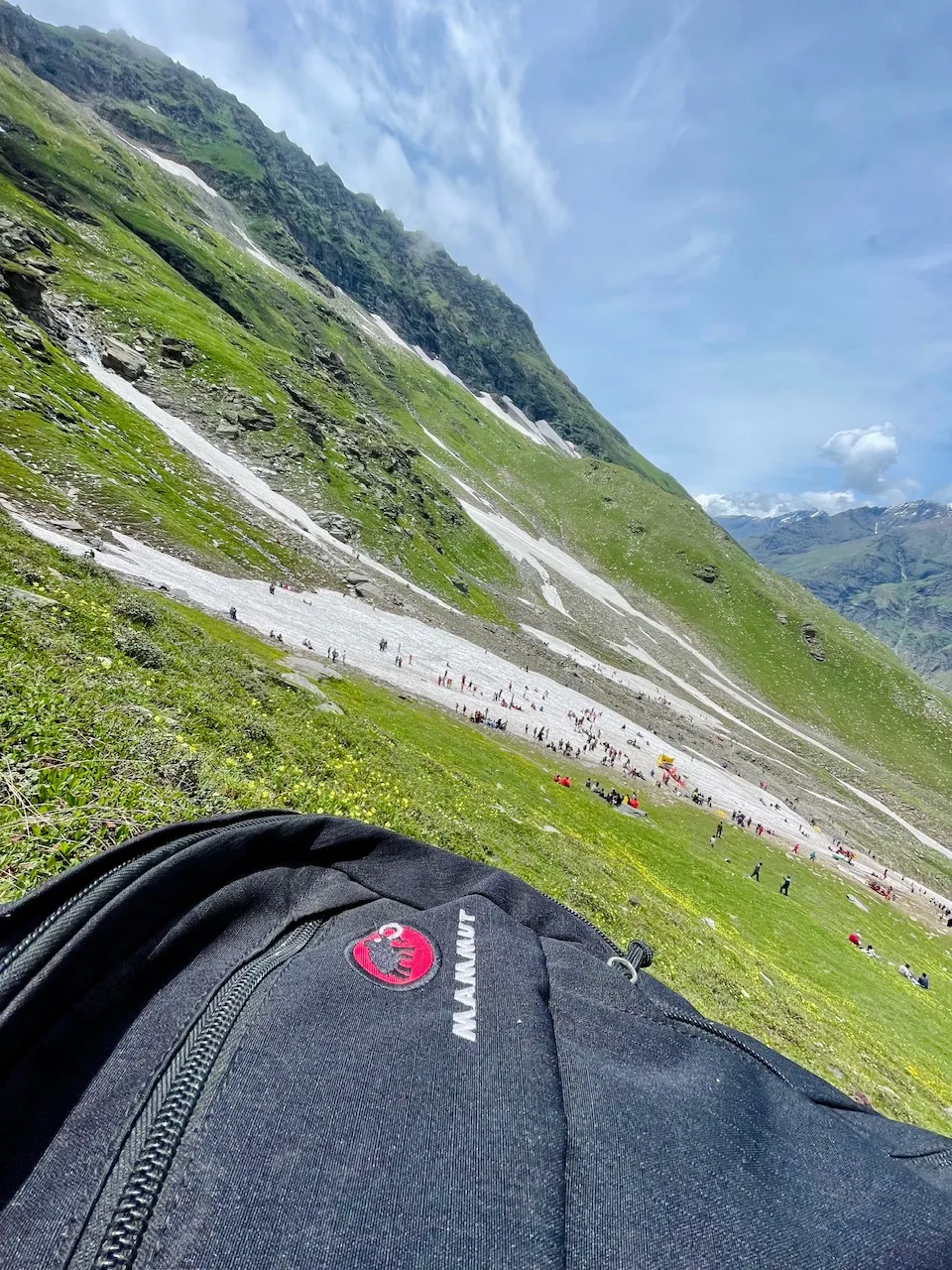
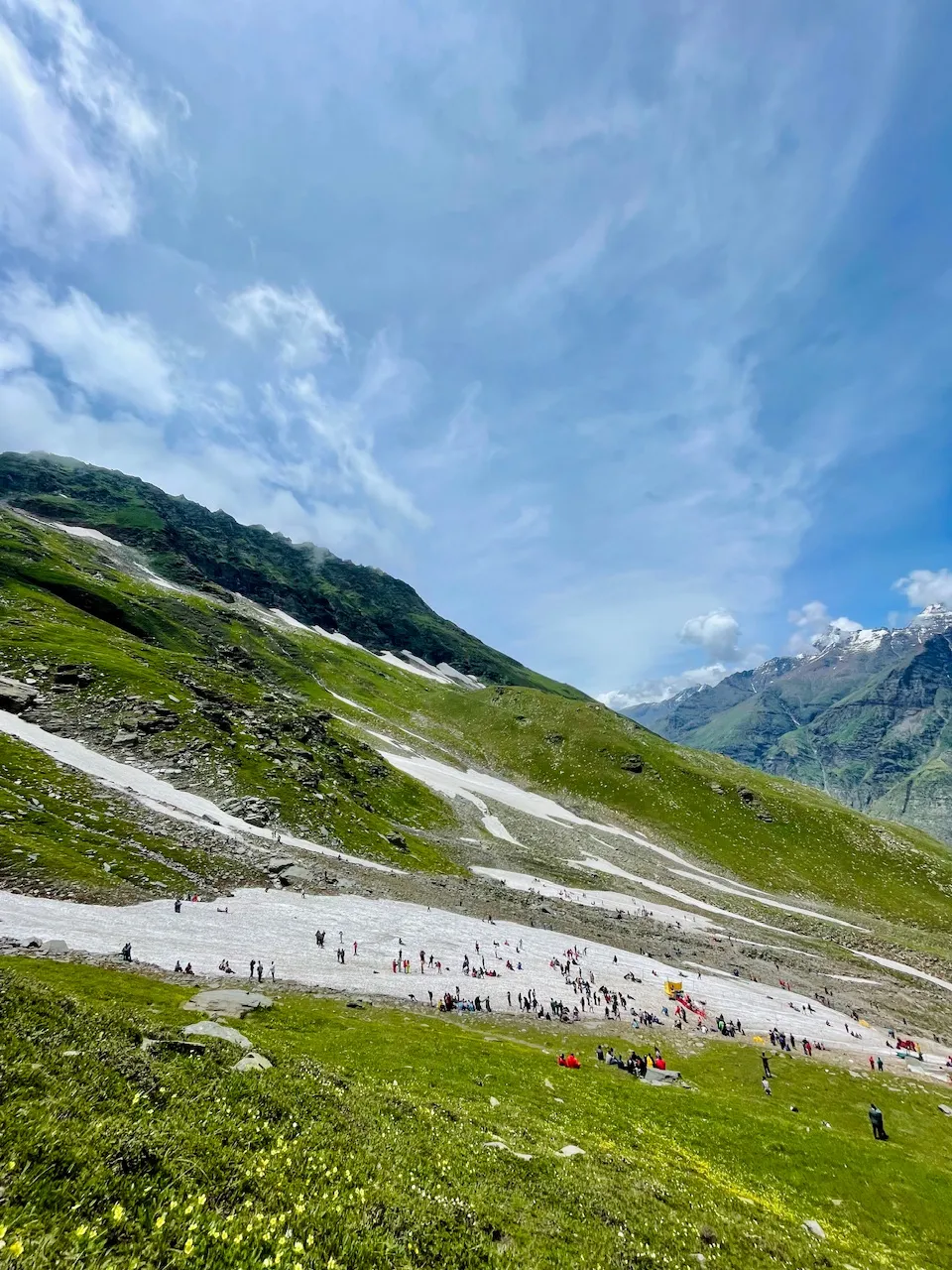
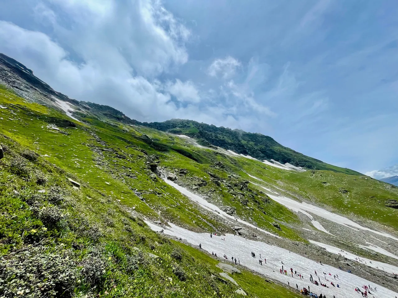
Just right in front of me was that Rahla Glecier where there were these countless number of people enjoying few of them even were doing skiing at the place during this time of the year that it was just a paradise that was still covered and easily accessible by road in order to touch the snow or experience the snow experience.
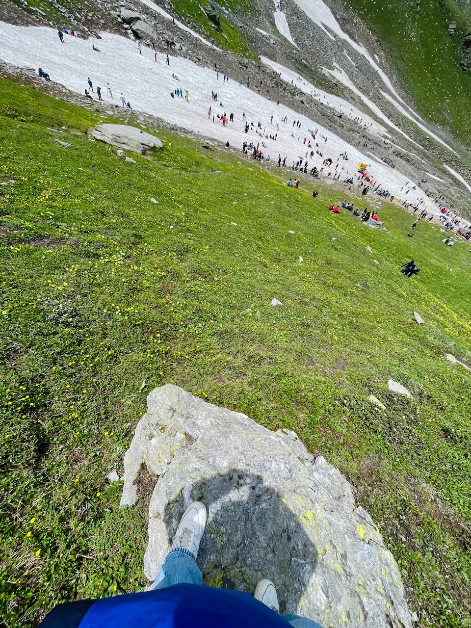
This was the portion that used to be covered with a thick blanket of snow it felt like that I was a bit closer to the glacier but I was quite far away as still now I would start my journey I would reach the other side after more than 40 minutes or something as there were no trees no vegetation as it was the land beyond the non-tropical zone so the places they feel that they Are a bit closer but when we get closer to them it feels like that they are getting more and more far away and that's why few of the people they always get tired in order to reach the mountain summit and most of them the story is about that they were getting closer to the mountain that they were feeling but the mountain was getting more far and far away from them.
You guys can think about the distance from this pictures that I have book I was thinking about visiting the top of the mountain but still I was at an altitude of more than 4000 m above the sea level and I was kind of feeling a bit altitude sickness as I was just all alone and exploring this place even though there were these lot of people but still visiting the top of the mountain bike alone was a risky task rather then I decided to just go bye and explore the higher mountains and enjoy the moment from there and now I was just remembering the place so how I could in my next expedition reach the top of the mountain.
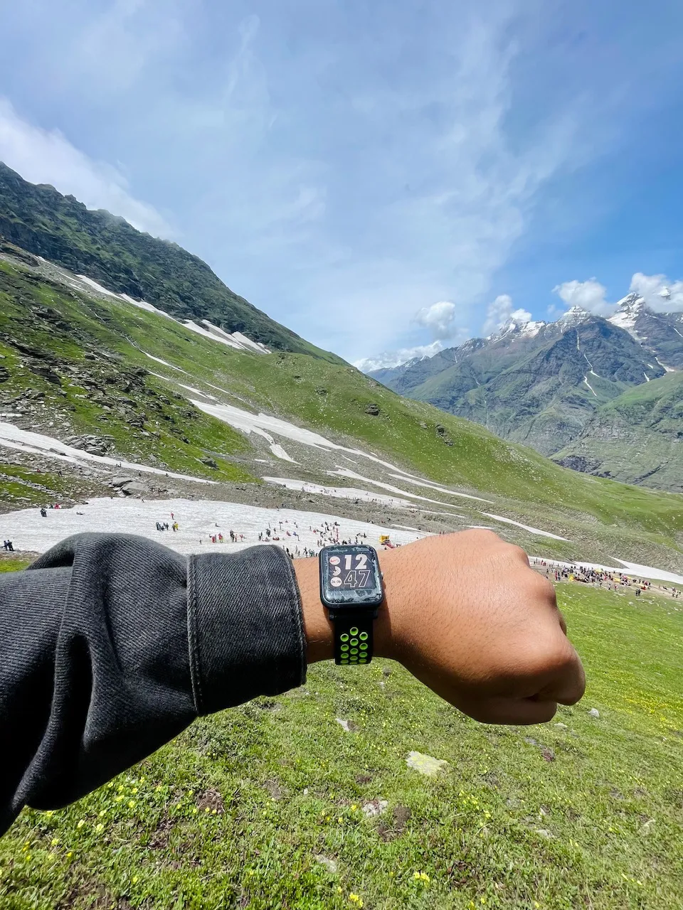
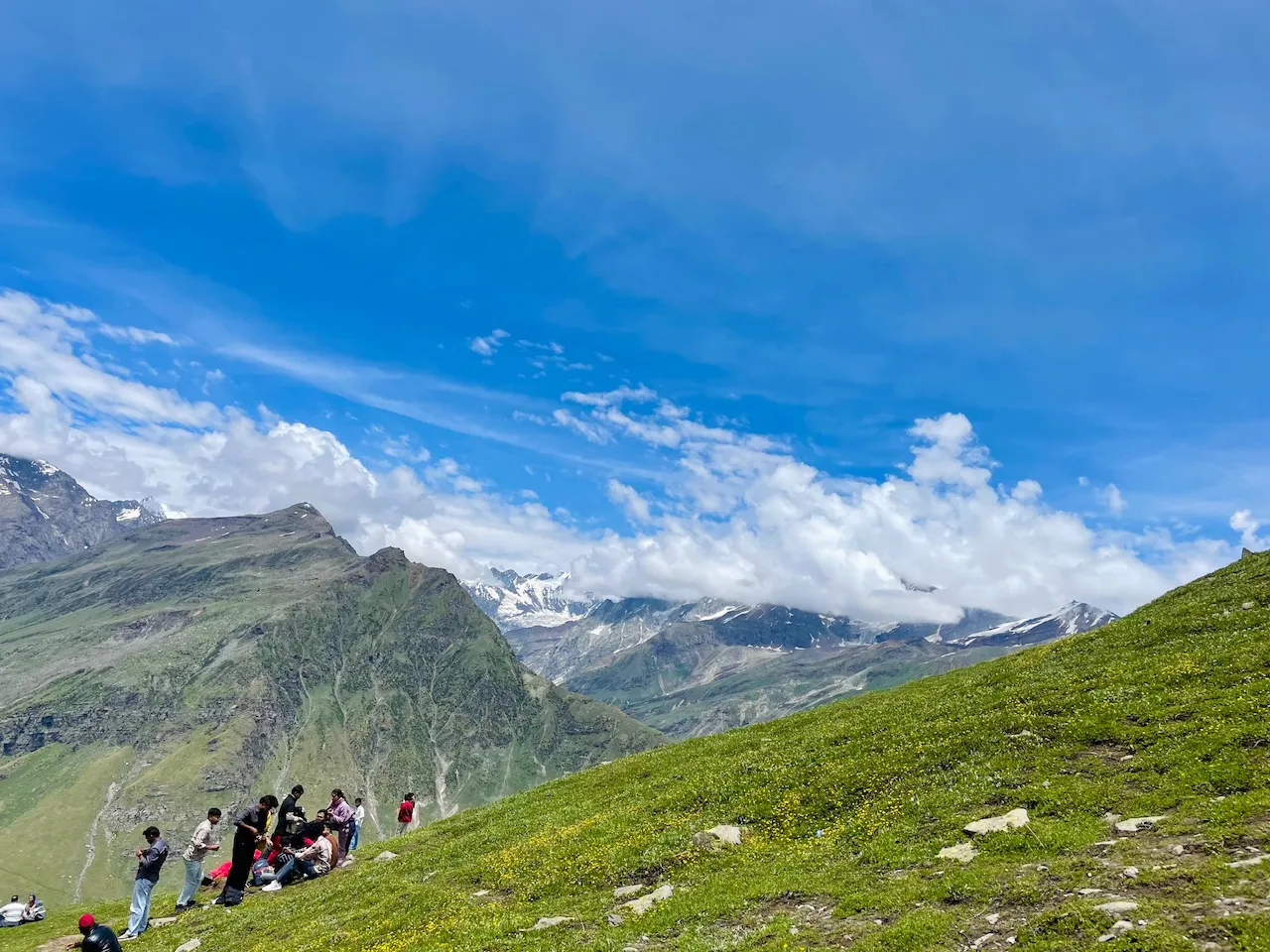
It was around 12:47 PM when I was at this place at this wonderland away from hustle and bustle and in this quite peaceful wonderland I was so amazed to see the clouds forming out that was just slightly formed up from the top of the mountains there were these countless waterfalls closures and happiness all around that I could see.
I relaxed at this rock for quite awhile and I was just looking at the sky the mountains and the place is nearby enjoying the moments and thinking deep about mountains how beautiful the nature is that was something that was just running in my mind from a lot of time and now I thought about why not let's go closer to the glacier and enjoy the moment the happy moments of life.
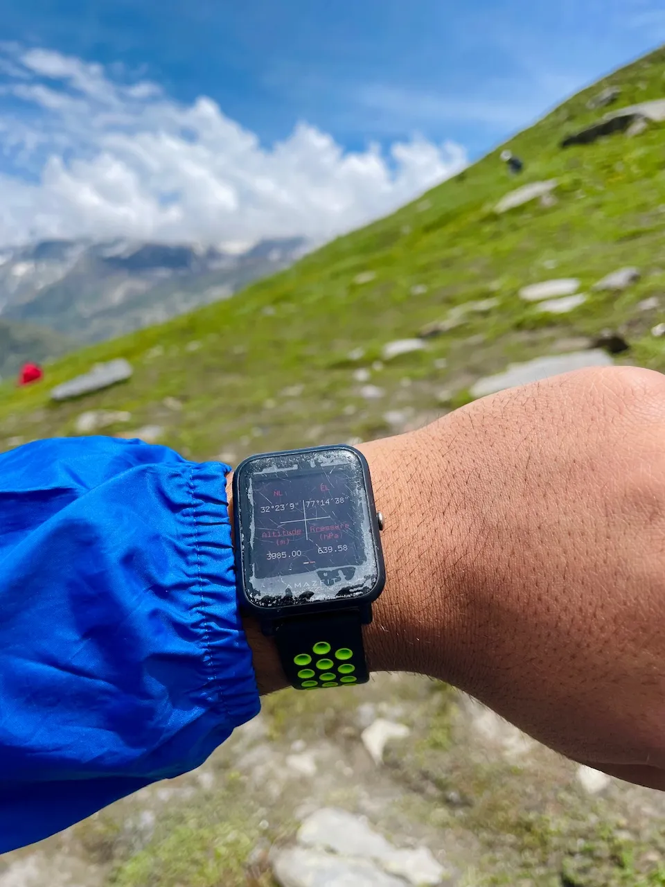
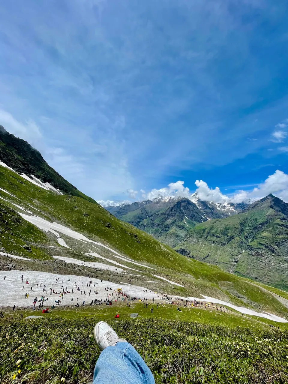
I checked the altitude of the place in my watch and even though the pressure which was 693.58 and we were at an altitude of more than 3985 m above the sea level and it was so beautiful moment my friends as this was the spot that I had been looking for and it was as it seems as green as it is usually as the whole place used to get covered under a thick blanket of snow which lasts for more than eight months in this place.
So I finally reached closer to the spot where there were these people as I was just coming descending from the mountain that I had been on at the top of somewhere in the middle not exactly the top but by the side where I could spot the high mountain peaks of Lahul and Spiti region of Himachal Pradesh. The higher Himalayas.
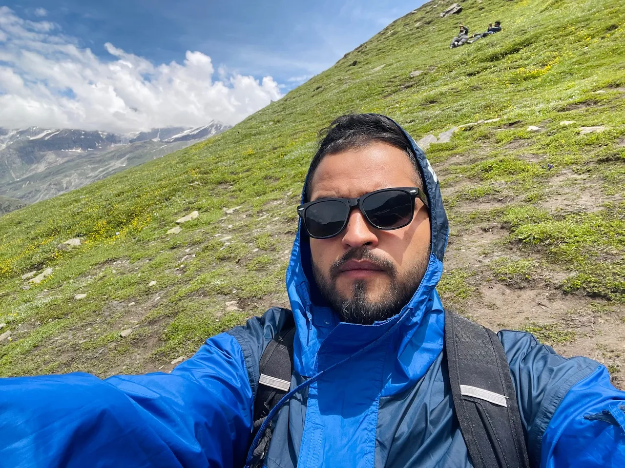
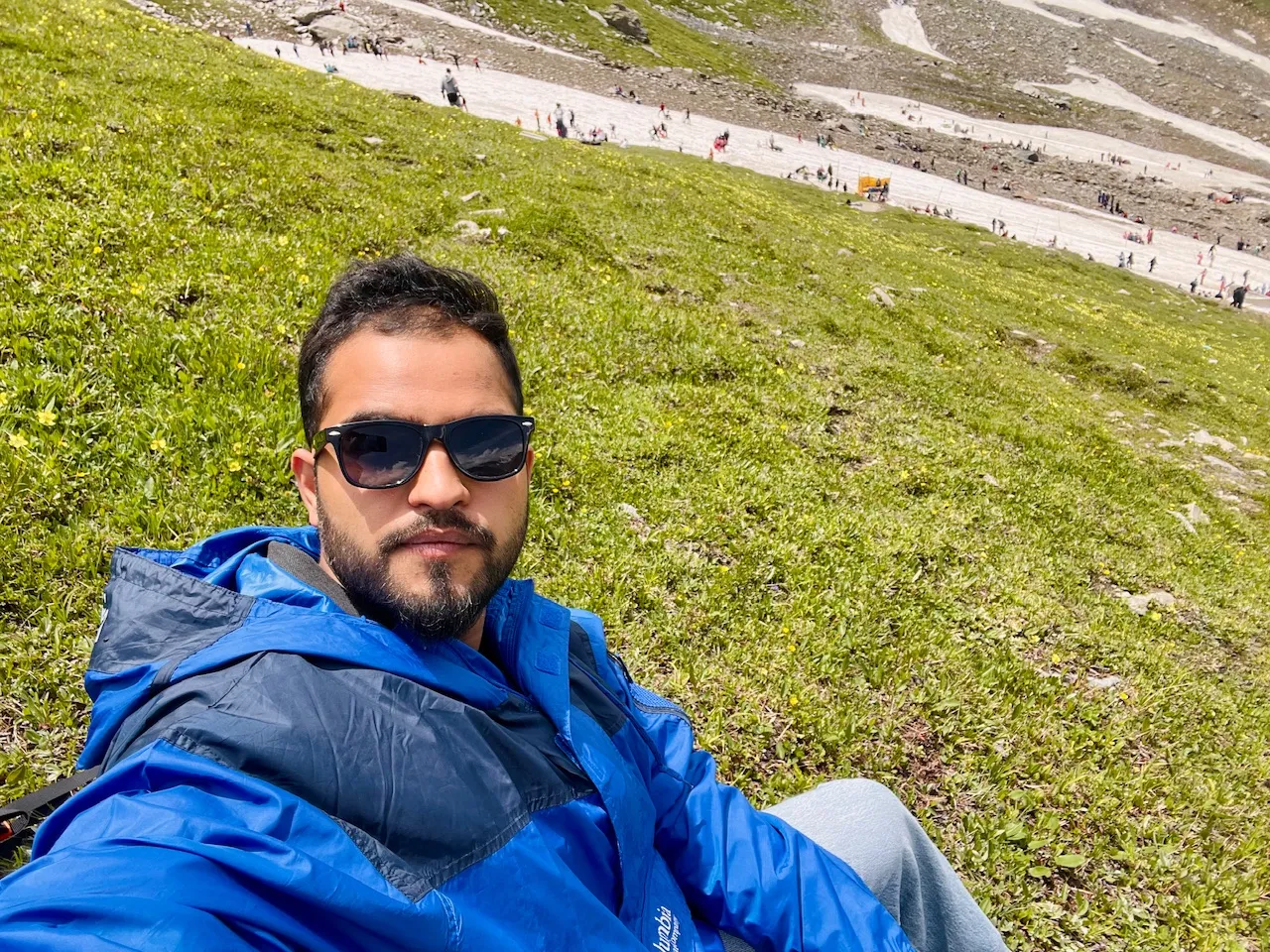
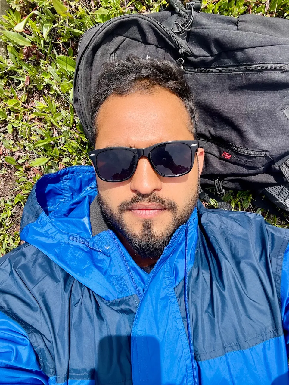
A quick selfie of me descending the mountain.
The Higher Mountain Ranges of Lahul Spiti Belt.
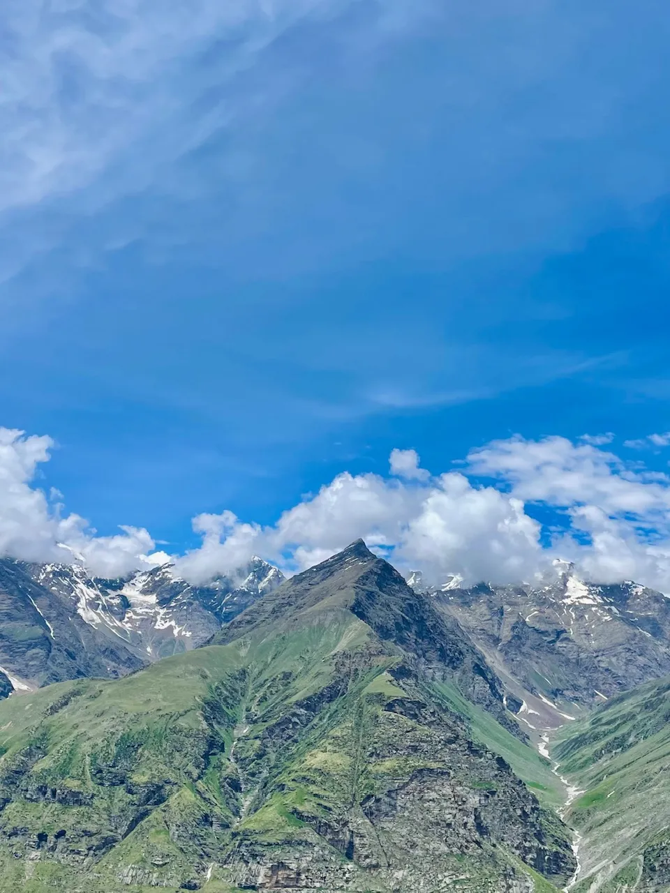
These were the mountain peaks that were all covered with a thick blanket of snow I could see that there were these rivers formed up from the melting of snow from the mountains and most of these mountain peaks were still unnamed and claimed by any human being as they were such an extreme positions as you guys can even see the higher mountain range that was so far away from this place even it was at an altitude of more than 4000 m above the sea level and just imagine how top how high and how difficult would it be to reach at such this glacier and spotted places.
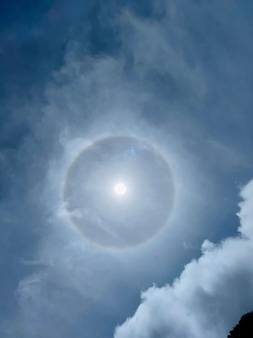
I even saw that there was just this type of ring around the sun and I have heard by the local people they say when the place used to get snow or rain fall this was the sign that they used to see and consider.
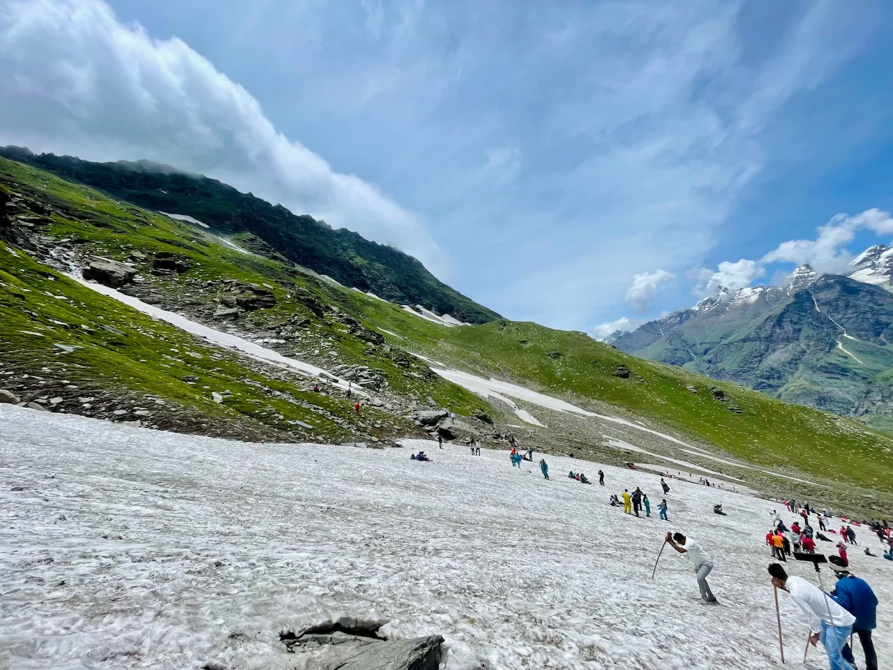
So finally my friends after descending the mountain it took me near about 15 minutes to come down closer to the glacier spot and I saw there were these people doing skiing few of them just enjoying the snow and few of them just full of laughter it was really a cool patch away from the hustle and bustle it was the most quiet corner at this place and even though it was so closer to the road to the highway and that was something that I was so amazed to see that how easy with the construction of roads and infrastructures places like these the hidden gems are still easily accessible usually in in the case that there used to be no roads in order to reach at such an high-altitude place it would take more than 2 to 3 days of continuous hiking but now we could just reach at such places with quick drive of more than 6-7 hours.
And I finally found a corner and that most peaceful one decided to lay here for quite awhile and enjoy the mountains and the view and just relax in the beauty nature for a while.
Thanks for your precious time. ❤️
Love from the Himalayas. 🙏