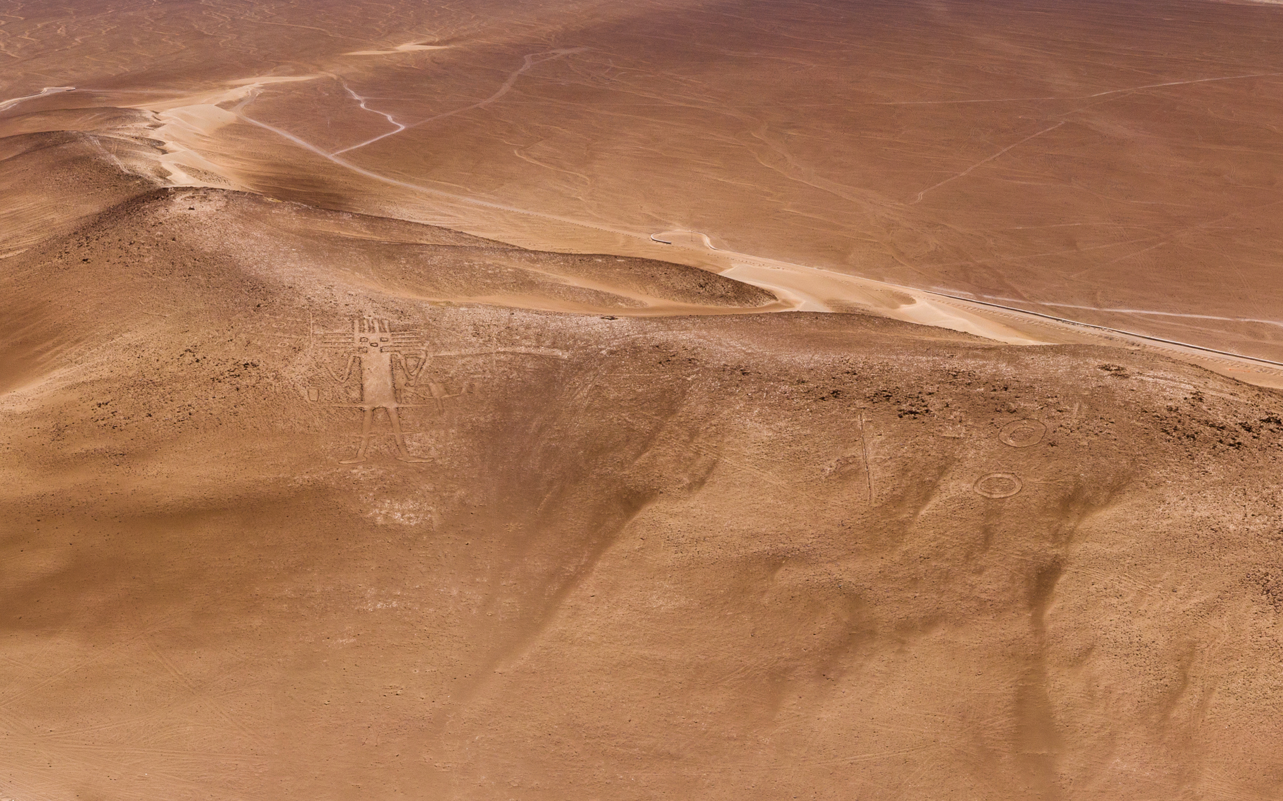
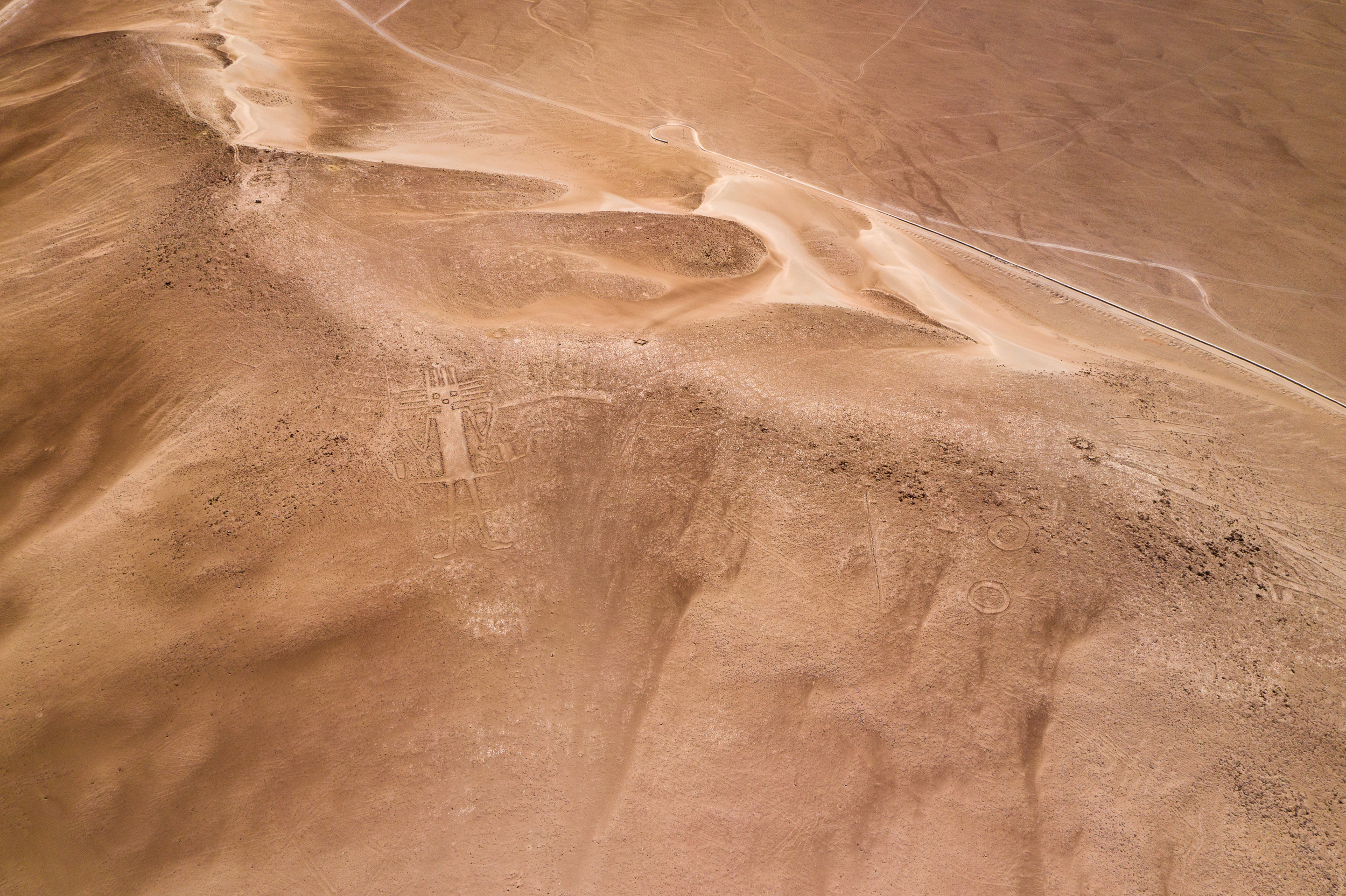
This figure on a mountain in the Atacama Desert, Chile is called the Atacama Giant (and sometimes the Tarapaka Giant). The most remarkable thing about it is that its age is estimated from one to several thousand years! This is a geoglyph — a geometric or figured pattern applied to the ground, usually over 4 meters long. Like many geoglyphs, the Giant is so large that it can only be viewed from the air. Moreover, it is considered the largest anthropomorphic geoglyph in the world — its size is about 119 meters in length.
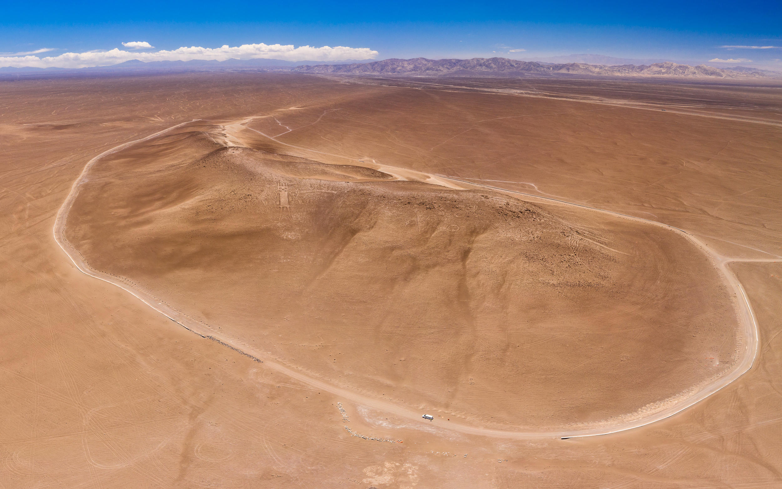
The Giant is located on the slope of Mount Cerro Unita, near the village of Huara in the Tarapaca region. This small mountain is located on a flat desert plain, with a more serious mountain range visible in the distance on one side. Its top is at a height of approx. 1266 meters above sea level, meanwhile the height of the surrounding plain and the road along which we arrived here is about 1200 meters above sea level. So the difference in height is actually not very significant, but due to the flat relief of the surrounding terrain, the mountain is clearly visible. The administrative center of the region, the coastal and port city of Iquique, is just an hour's drive from here.

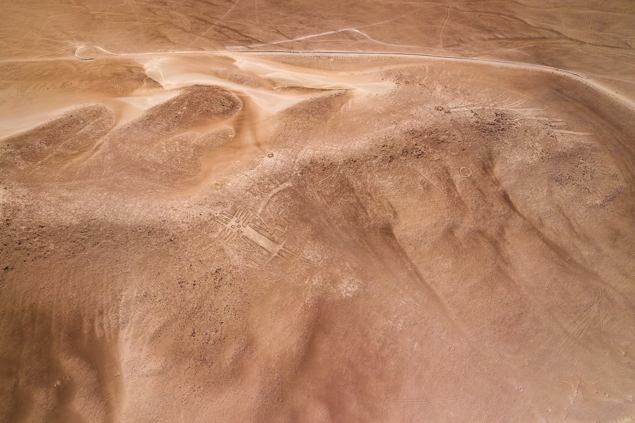
Who exactly and for whom, looking from above, laid out this and other images in the Atacama Desert is a question that has not been fully resolved. In total, almost 5,000 geoglyphs were found in the Atacama, and in fact they are found in other places. On the left, just above the Giant, circles and lines are visible. Also on the right, closer to the top of the mountain, you can see other simpler geoglyphs. It is noteworthy that this place is not guarded by anyone and there was not a single person there except us when we got there.
 |  |
|---|
To estimate the real scale, you can see the car in the photo below. This is a minibus that we took here. How tiny it looks compared to the figure on the side of the mountain! And if you look at the photo on full zoom, you will see me too — an orange dot to the right of the circular landing pad for the drone :) It's good that nowadays it is not necessary to get on a plane to view and photograph geoglyphs. But how did the creators do it? This is a more interesting question.
It's better to watch the photo in high resolution.
Camera: DJI Mavic 2 Pro
Exposure time: 1/30 sec
Aperture: F 11
Sensitivity: ISO 100
Focal length: 10.26 mm
35 mm equivalent: 28 mm
You can also see my photos in my blog LJ and in my profile on NatGeo. You can read a short interview with me here.