En mi reciente visita al Delta Amacuro como les mencioné en mi post anterior tuve la oportunidad de conocer dos comunidades donde tiene presencia la misión médica cubana en este bello país que es Venezuela, el estado es un laberinto de ríos y manglares, un territorio ancestralmente habitado por diversas comunidades indígenas, entre ellas los warao, cuyo significado es "gente de canoa" que no lo sabía hasta que quise indagar un poco mas en Google. Su cultura está profundamente ligada al agua de los ríos que allí coinciden que según me dijeron son varios y los tuve que apuntar, están el Amacuro, el Barima, el Arature, el Cuyubiní, el Imataca, el Ibaruma, y el El Perro.
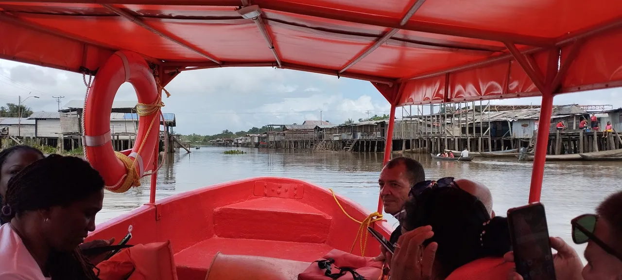
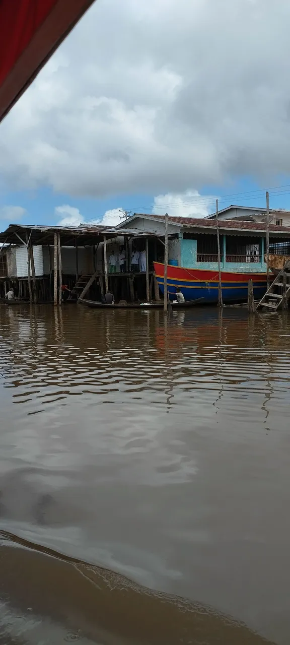
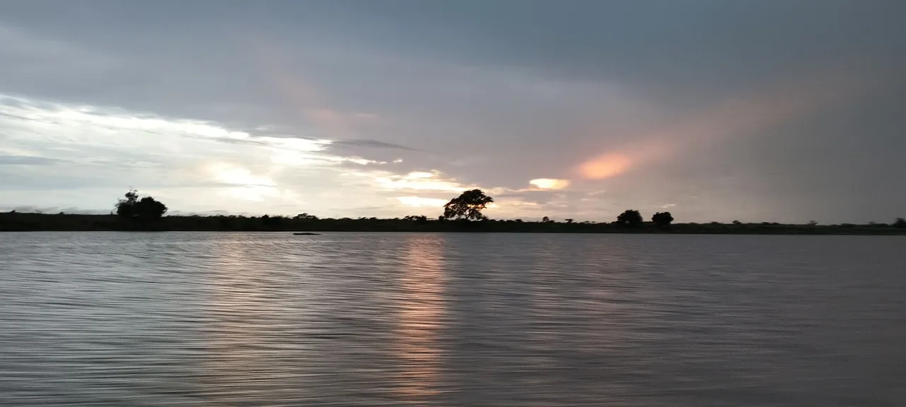
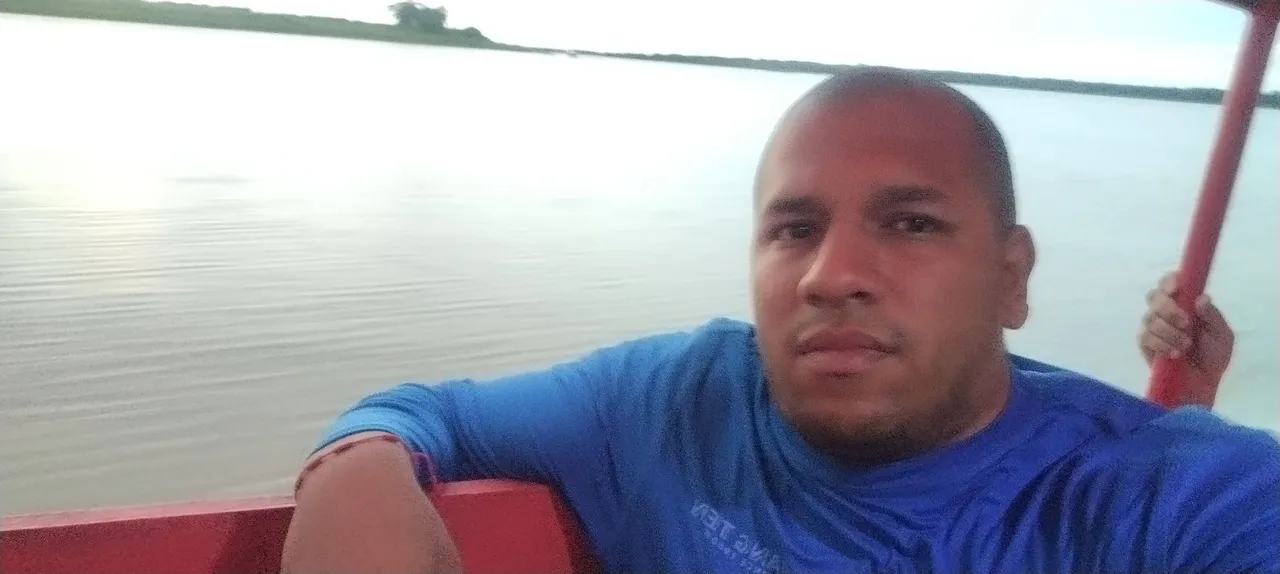
Tiene brazos del río Orinoco que son bastantes amplios en cuestión de anchura y profundidad, según Google tiene varios caños que yo creía que eran municipios Manamo, Macareo, Mariusa, Merejina, Capure, Sacupana, Cocuina, Araguao, Araguaimujo, Pedernales, Curiapo. Los últimos dos son los que pude visitar y hoy les voy a mostrar imágenes de Curiapo, ya que 3speak no me deja subir el video.
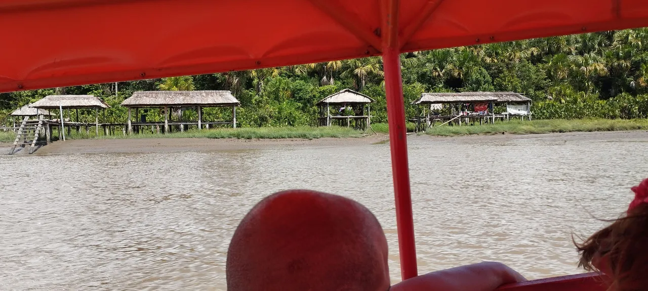
Fue una visita muy rápida de apenas 4 horas, pero intensa ya que el río estaba revuelto y un viaje que debería haber demorado 3 horas en lancha rápida se convirtió en uno de 4 horas y media dando brincos sobre el barquito aquel. Eso nos afectó el tiempo de estancia planificado allá ya que los lancheros no permiten salidas luego de las 4pm por los peligros del río.
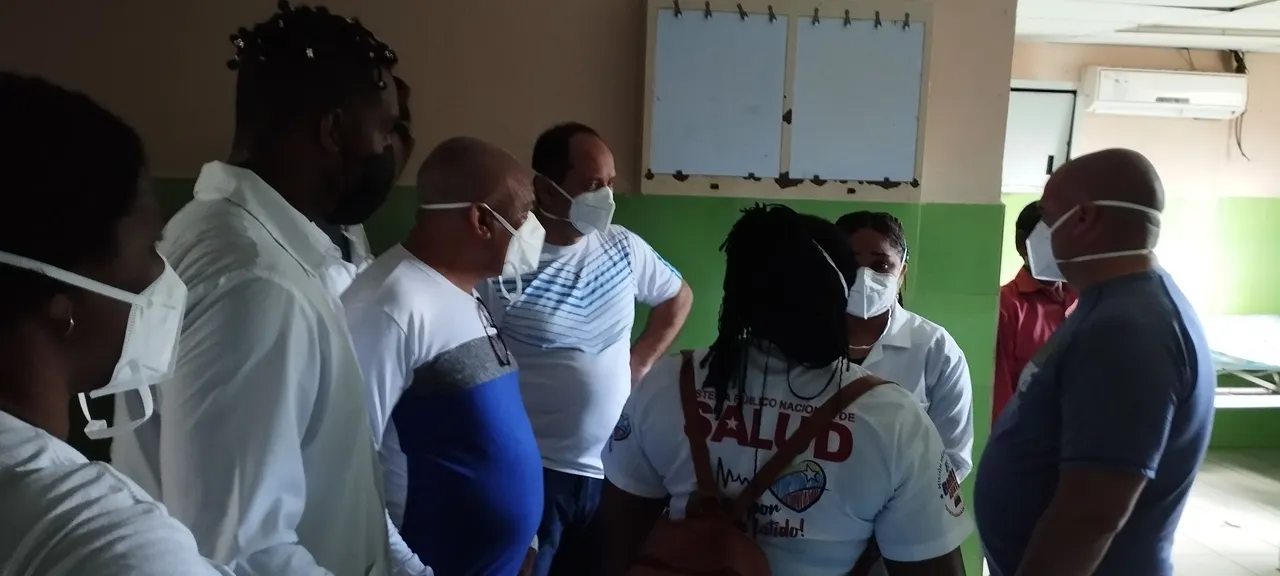
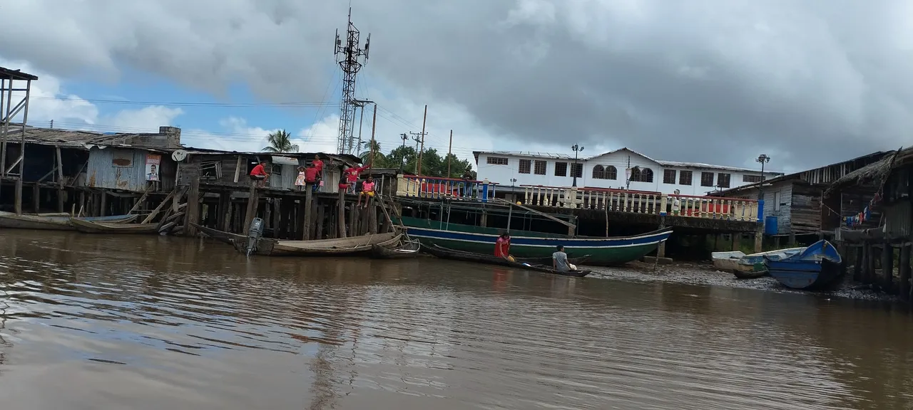
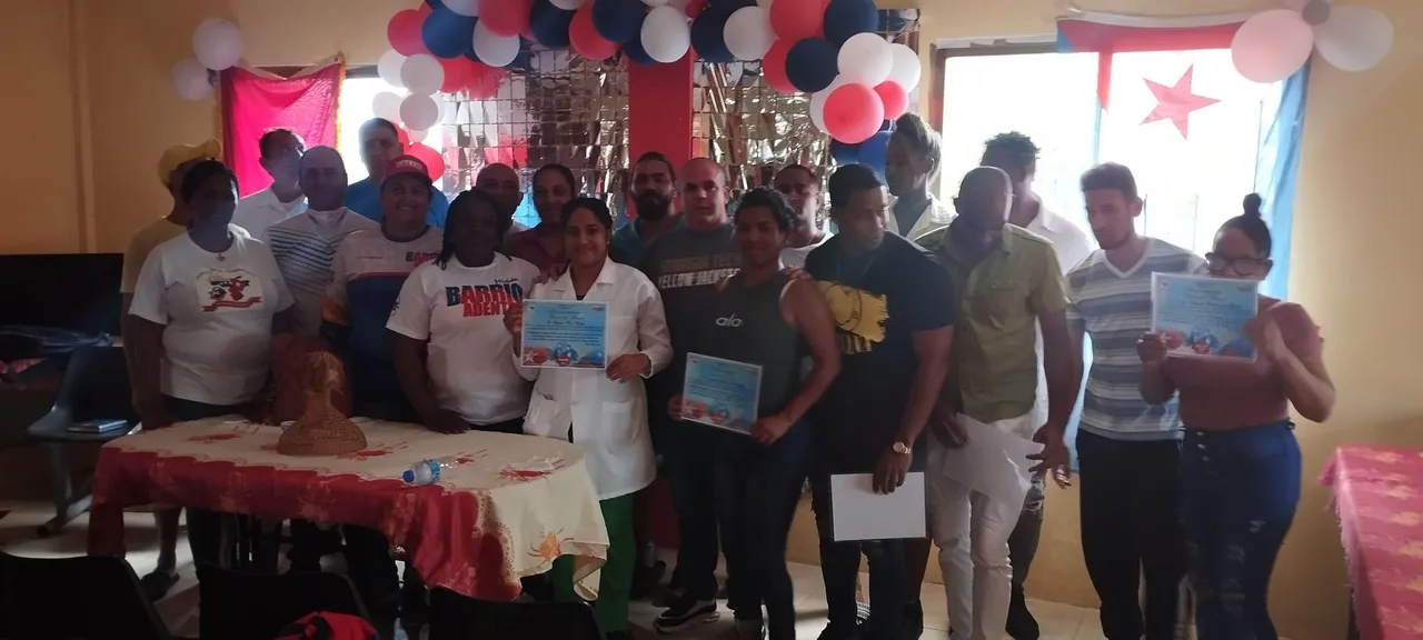
Allí esta el CDI Elina Cotua fue creado para proporcionar atención médica gratuita y de calidad a las comunidades vulnerables del Delta Amacuro. Este centro es fundamental para atender las necesidades sanitarias de las personas de Curiapo y sus alrededores. El personal médico que allí labora es completamente cubano, con el apoyo del personal de servicio y traductores que son de la etnia warao. Se les reconoció su tiempo de servicio en esas zonas de difícil acceso, y se les agradeció por todo el aporte a las comunidades mas vulnerables.
En el CDI se brinda a pesar de todas las dificultades que allí existen principalmente de transporte, atención primaria, pediatría y ginecología. La misión médica también realiza campañas de vacunación y programas de salud preventiva con la comunidad.
Los colaboradores de la brigada médica que allí trabajan permanecen con un excelente animo a pesar de estar en condiciones muy contrarias a las que existen en el resto del país, no existe cobertura de internet ni señal celular, un vecino tiene una antena starlink y colabora con los médicos y en las noches les deja conectarse a la WIFI para que puedan hablar con su familia, ya que la electricidad también es escasa y depende totalmente de cuando tengan combustible.
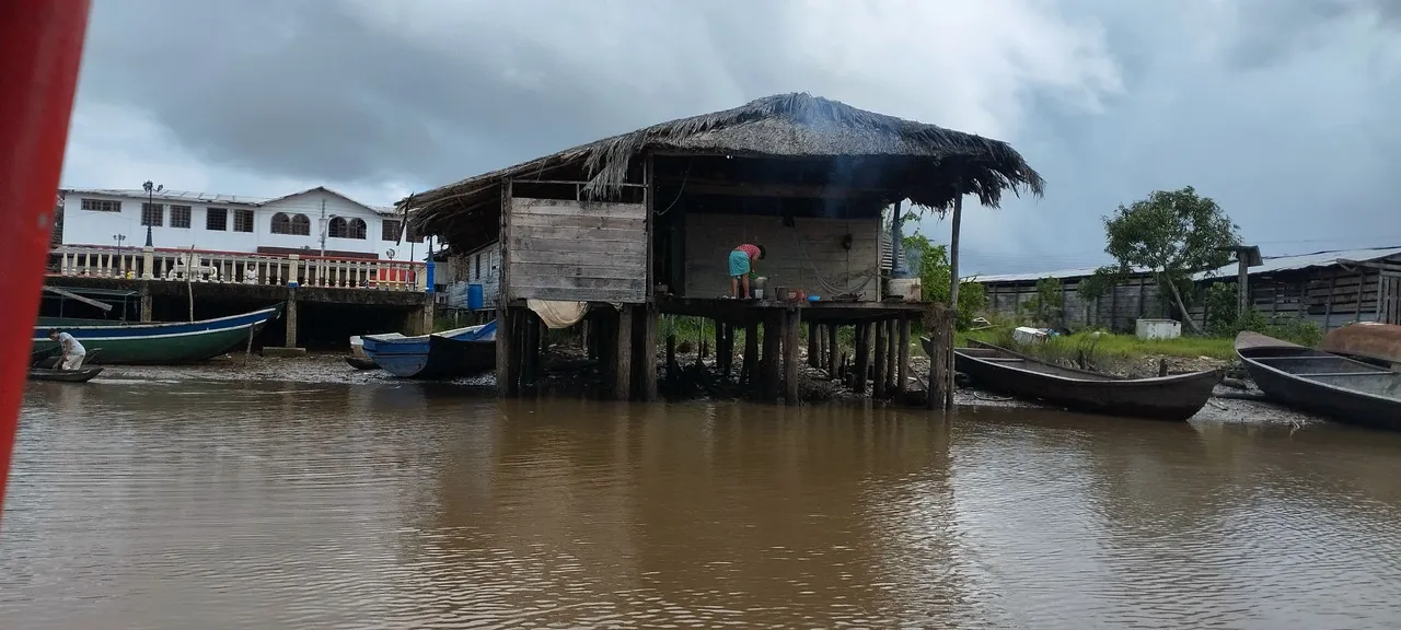
Tuve la oportunidad de visitar una casa warao tradicional que en las fotos se ve, construida sobre pilotes y con techo de palma. Me sorprendí con la sencillez que viven en ese entorno.
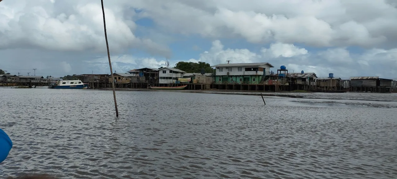
Aquí les dejo datos mas relevantes de Curiapo que dice en Wikipedia: La Parroquia Curiapo mide unos 5463 kilómetros cuadrados, posee numerosas islas algunas en el Océano Atlántico y otras dentro del Delta del Río Orinoco. Algunas de sus islas incluyen: Isla grande de Curiapo, Isla Papagayo, la Isla Curiapo, la Isla Burojo y las Islas Cangrejo y Cangrejito.
Sus rios principales aparte del Orinoco, incluyen al rio grande y el rio arature. La parroquia Curiapo limita al norte con la parroquia Padre Barral, al oeste con la Parroquia Almirante Luis Brión, al este con la Parroquia Aniceto Lugo, al sur con el Estado Bolívar y al noreste con el Océano Atlántico.
Contenido original creado por mí.
Fotos tomadas con Redmi Note 12
Traducido en Google Translate
During my recent visit to the Amacuro Delta, as I mentioned in my previous post, I had the opportunity to visit two communities where the Cuban medical mission is present in this beautiful country of Venezuela. The state is a labyrinth of rivers and mangroves, a territory ancestrally inhabited by various indigenous communities, including the Warao, whose meaning is "canoe people" which I didn't know until I wanted to investigate a little more on Google. Their culture is deeply linked to the water of the rivers that are found there, which, as I was told, are several and I had to write them down: the Amacuro, the Barima, the Arature, the Cuyubiní, the Imataca, the Ibaruma, and the El Perro.
It has branches of the Orinoco River that are quite wide in terms of width and depth, according to Google it has several channels that I thought were municipalities Manamo, Macareo, Mariusa, Merejina, Capure, Sacupana, Cocuina, Araguao, Araguaimujo, Pedernales, Curiapo. The last two are the ones I was able to visit and today I am going to show you images of Curiapo, since 3speak does not let me upload the video.
It was a very quick visit of just 4 hours, but intense since the river was rough and a trip that should have taken 3 hours by speedboat turned into one of 4 and a half hours jumping on that little boat. This affected the time we planned to stay there since the boatmen do not allow departures after 4pm due to the dangers of the river.
The Elina Cotua CDI is located there, which was created to provide free and quality medical care to the vulnerable communities of the Amacuro Delta. This center is essential to meet the health needs of the people of Curiapo and its surroundings. The medical staff that works there is completely Cuban, with the support of the service staff and translators who are from the Warao ethnic group. They were recognized for their time of service in these hard-to-reach areas, and they were thanked for all their contributions to the most vulnerable communities.
In spite of all the difficulties that exist there, the CDI provides primary care, pediatrics and gynecology. The medical mission also carries out vaccination campaigns and preventive health programs with the community.
The medical brigade collaborators who work there remain in excellent spirits despite being in conditions very contrary to those that exist in the rest of the country, there is no internet coverage or cell phone signal, a neighbor has a starlink antenna and collaborates with the doctors and at night lets them connect to the WIFI so they can talk to their family, since electricity is also scarce and depends entirely on when they have fuel.
I had the opportunity to visit a traditional Warao house that you can see in the photos, built on stilts and with a palm roof. I was surprised by the simplicity of the way they live in that environment.
Here are the most relevant facts about Curiapo, as stated in Wikipedia: The Curiapo Parish is about 5,463 square kilometers in area, and has numerous islands, some in the Atlantic Ocean and others within the Orinoco River Delta. Some of its islands include: Isla Grande de Curiapo, Isla Papagayo, Isla Curiapo, Isla Burojo, and the Cangrejo and Cangrejito Islands.
Its main rivers, apart from the Orinoco, include the Rio Grande and the Arature River. The Curiapo Parish is bordered to the north by the Padre Barral Parish, to the west by the Almirante Luis Brión Parish, to the east by the Aniceto Lugo Parish, to the south by the Bolívar State, and to the northeast by the Atlantic Ocean.
Original content created by me.
Photos taken with Redmi Note 12
Translated by Google Translate