Have you ever wanted to really make a difference during humanitarian crises without reallocating even more of your budget? You can! You only require a computer, internet connection and the ability to draw lines and squares with a mouse.
Tasking Manager is an online mapping platform designed for collaborative mapping of regions lacking proper digitization but where humanitarian aid organisations are currently active and require proper maps. It does this by splitting an entire region into smaller tasks that can be easily mapped by individual mappers around the world (possibly you!). All of the software is also community-driven and open source.
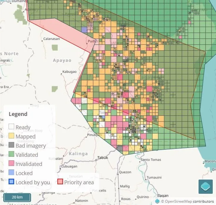
Example of mapping tasks in the Northern Philippines
Want to get started? You can go to https://tasks.hotosm.org/ and start mapping! Just create an account on https://www.openstreetmap.org (mapping software on the basis of the Tasking Manager) and use that to get access to the Tasking Manager.
Some of the most urgently required maps at date of writing (links to event articles):
- Typhoon Mangkhut/Ompong (Northern Philippines)
- Guinea Flood Response
- Joinkrama Flooded Area Mapping (Nigeria)
- DRC/Bundibugyo District Border Mapping (Uganda)
- Sri Lanka Flood response
- ...
There are several projects constantly requiring mapping. Some projects require the mapping of buildings, while others might need roads or waterways to be mapped or a combination of multiple elements. Each projects has a specific description about what is needed currently. For the mapping of the region in the Northern Philippines for example only buildings are required to be mapped since the roads were already sufficiently digitized. A mapping effort in this case would look like this:
![]()
Images from before (left) and after (right) mapping a region.
If you are considering to help projects this way, make sure to check out the Tasking Manager's "learn" page. There you find more information on how exactly to do the mapping and how everything works. It only takes about 10 minutes until you figure it out. Your account will also store statistics, levels, achievements and nice global heat maps of the places you digitized, making the entire activity actually quite satisfying!
If you have used this before, want to, or just got started, please let me know what you think about it!