I am a big fan of crowd-sourced data as it tends to mean that the data is made freely available. Years ago I made some contributions to OpenStreetMap that aims to map the world. That was started as the UK maps made by the government-funded Ordnance Survey had restrictive copyright. It has expanded to cover the world and people can add whatever details they want to it.
There is a guy called Terence Eden who I first met some years ago at a conference and then again last year at Bar Camp London. He is very into such projects. He started Open Benches which logs memorial benches. Actually the benches tend to get mapped by OpenStreetMap, but they do not capture the details written on them.
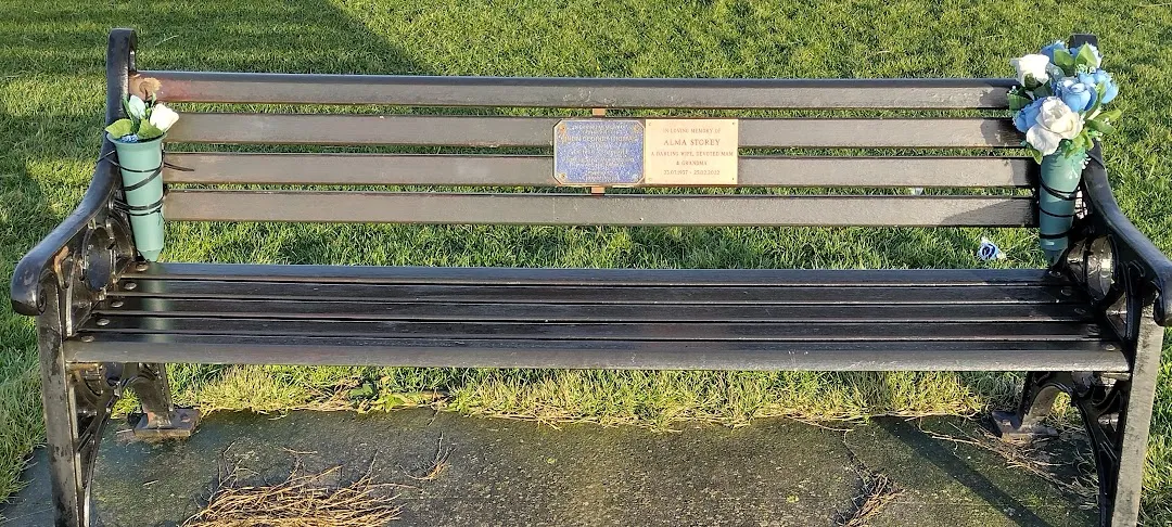
I had been thinking of contributing to this project for a while. I was recently in Newbiggin-by-the-Sea in the north of England where they seem to have a lot of such benches that were not on the site, so I decided to rectify that. The process involves taking some photos. The important part is to capture the actual plaques, but you can have others photos of the whole bench and the view.
I have learnt from this initial experience that you need to be thorough in detailing exactly where each bench is. If you set your camera or phone to record the GPS coordinates in the file then the site will use those, but the accuracy is limited. It may be worth taking a series of photos and use a standard sequence, e.g. long view, close-up, view.
When you upload the close-up the site will try to read the writing. In some cases it does a very good job of this, but it will depend on the lighting, the font and the condition of the plaque.
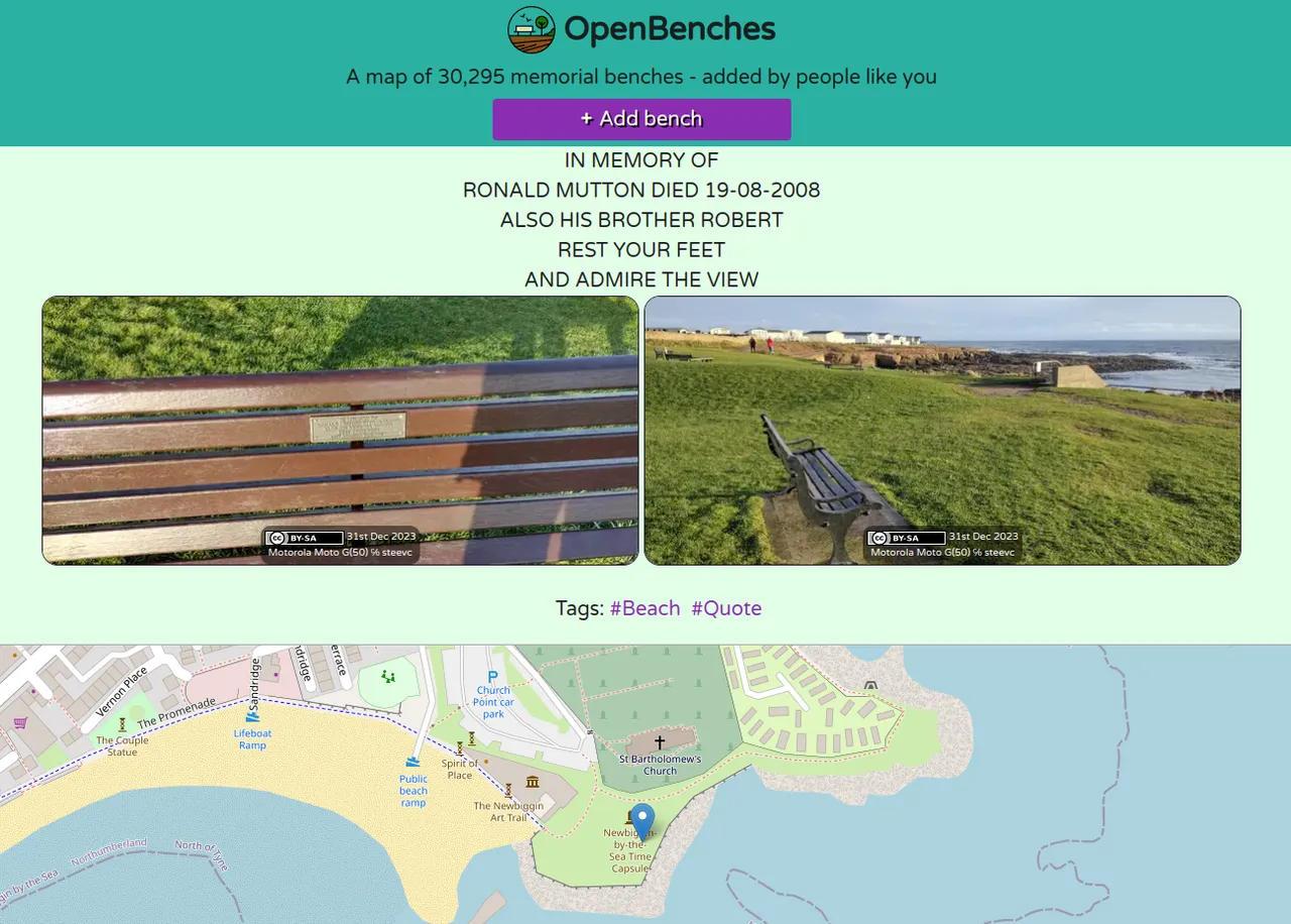
The site design is basic, but functional. It uses OpenStreetMap with some different rendering options.
You can submit anonymously or log in via various services such as Github and Twitter. If you do log in then you can see all your submissions. Here are mine so far. Some people have done thousands, so I have some catching up to do. I would have done more on my trip, but my other half would have got annoyed at me. I will look to do more in my local area and me more meticulous in recording the details. This may be something I can do when out running, but I will check my routes to see if anyone has already covered the area.
Terence is active on Mastodon and the site publishes new submissions there. Mine have already appeared.
I am sure some people are thinking that this is the sort of project that Hive could handle. I do not think Terence is a particular fan of blockchain, so he will probably not be looking to move here, but there may be similar projects that could start here. Maybe someone wants to log all the bus stops in the world with details of where you can go from them. I think you need to build a dedicated front end for such projects to make it usable, but you have to start somewhere. Of course we have Pinmapple that links posts to locations, so the potential is there.