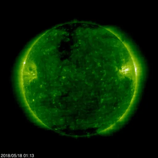
Image courtesy of SOHO. The sun at 195 Angstroms showing the departing active region on the right and two polar coronal holes. The northern hole is expected to produce some geomagnetic storms next week.

GIF courtesy of SOHO. At 2018/05/18 05:00 near the end of the GIF if you don't blink you can see a CME erupt off the southeast limb which is expected to miss the earth though couple with it magnetically with a potential to produce an uptick in earthquakes.
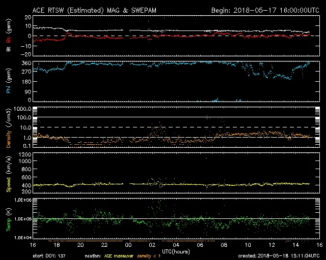
The expected uptick in solar wind telemetries did not appear. Solar wind speed peaked at about 450-75km/sec but have settled down to 370km/sec. Proton density and temperature are moderate, and the Kp index did not rise above three meaning all quiet on earth. The magnetosphere took some buffeting as the solar wind speeds peaked but has calmed down. See for yourself by following the link below.
http://www.sws.bom.gov.au/Satellite/3/2
https://www.swpc.noaa.gov/communities/space-weather-enthusiasts
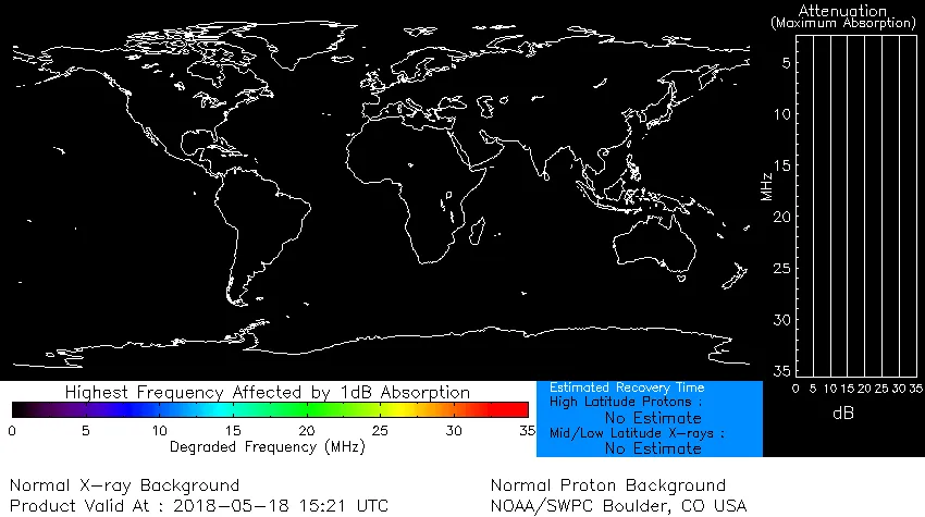
The absorption of x-rays and protons in the upper and lower regions of the Ionosphere is predicted to be nil.
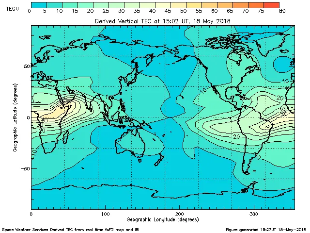
Image courtesy of Australian Gov. Bureau of Meteorology. Total Electron Count is low to moderate.
Auroral activity at both poles is normal as all is quiet in the upper atmosphere .
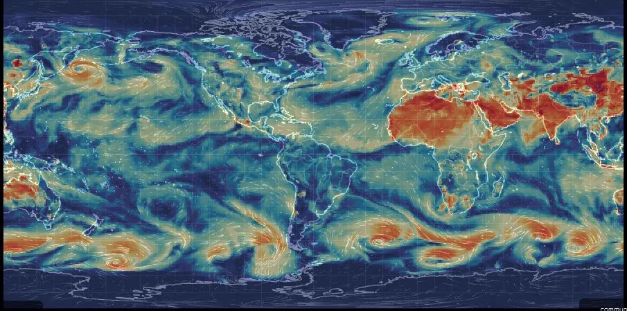
Image courtesy of nullscholl.net. While particulate amounts continue to remain high over north Africa and west over central Asia to Japan, we are also seeing an increase in the far south as well as above Australia. Just east of Russia there appears to be a gyre of particulate building up. I will keep an eye on this to see how it develops. Considering that particulate can act as a base for rain nucleation, I wonder if this could develop into a storm cell.
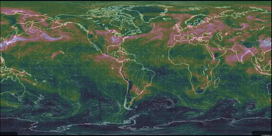
Image courtesy of nullschool.net. Overall it appears as the global SO4 count is down though it also appear to be concentrating in the north and is less spread out than it was yesterday.
ARCTIC TEMPERATURE ~ @ geographic north pole -10.6* C
ANTARCTIC TEMPERATURE ~ @ geographic south pole -42.
Temperature readings acquired via nullschool.net
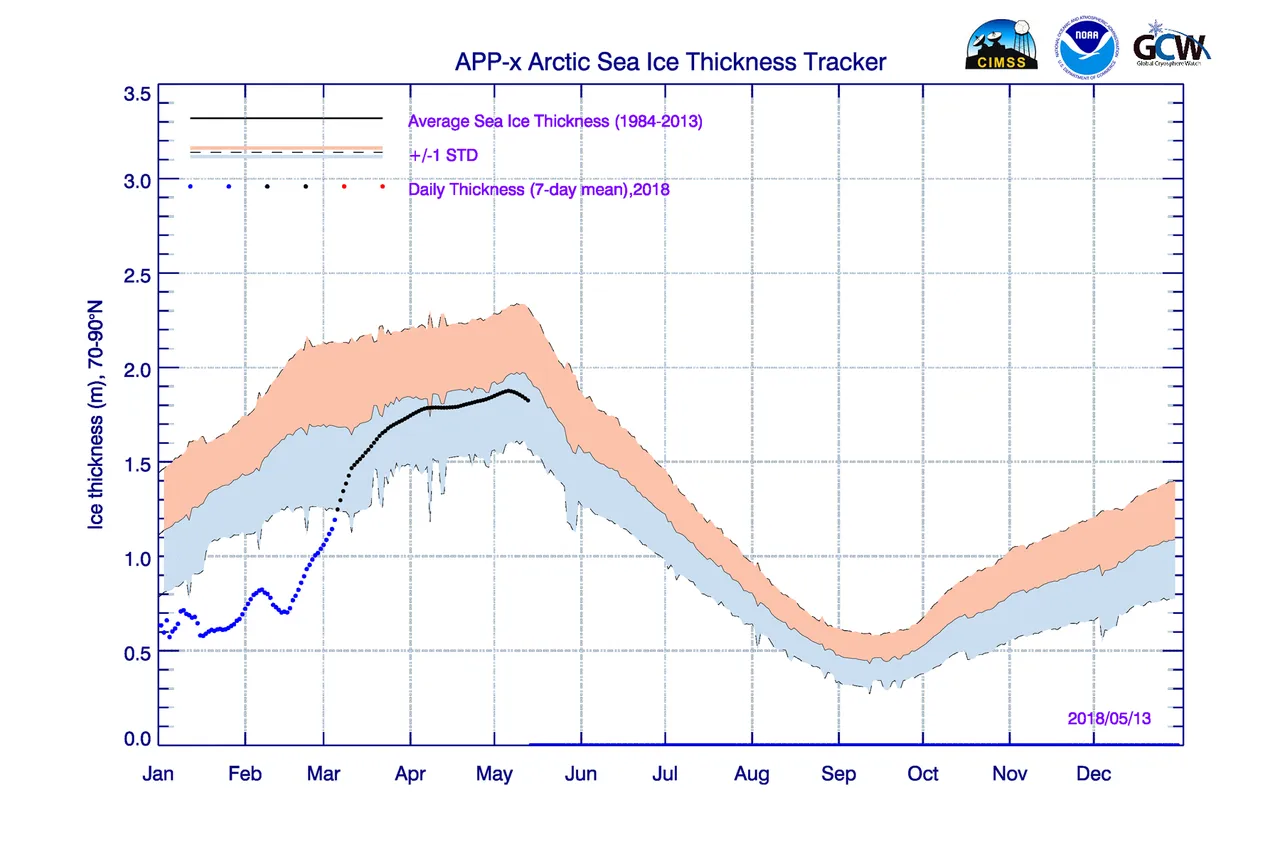
Image courtesy of cryospherewatch.org. Sea ice extent well within the standard deviation
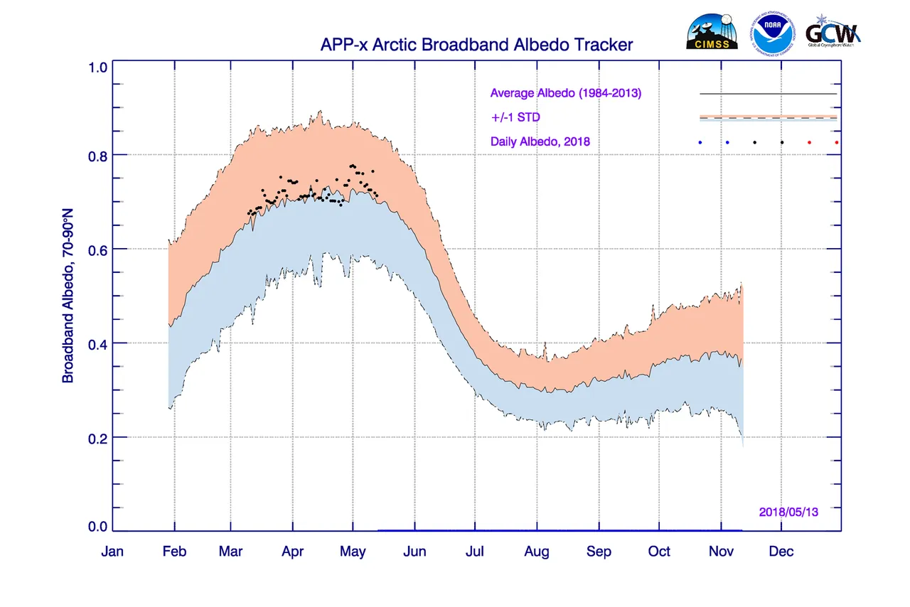
Image courtesy of cryospherewatch.org. Albedo levels are in the high end of the 20 year average which means an increase in the cooling effect
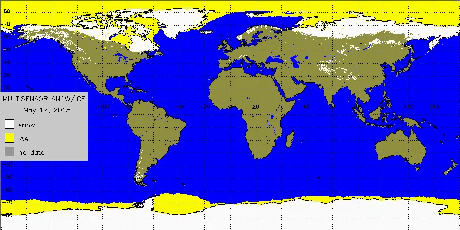
Image courtesy of cryospherewatch.org. Take note of the snowfall in the mid-west US along the Rockies as well as southern France/Italian border. Heading east to the eastern tip of the Black Sea there appears to be snow and further east to northern China there is snow extending up through Russia. Also note the ice coverage throughout the north and south.
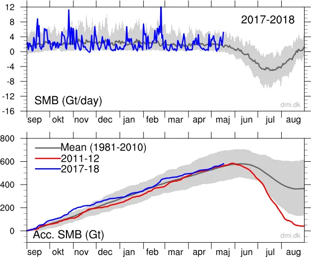
Image courtesy of cryospherewatch.net. Greenland gaining ice mass through May at record levels.
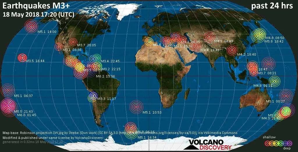
Image courtesy of VolcanoDiscovery. 84 earthquakes in the last 24 hours higher than 3.5 on the Richter scale. Of note were two at 6.2 at al sur de Bucaramanga in South America and a 6.0 South of Kermadec Islands near New Zealand.
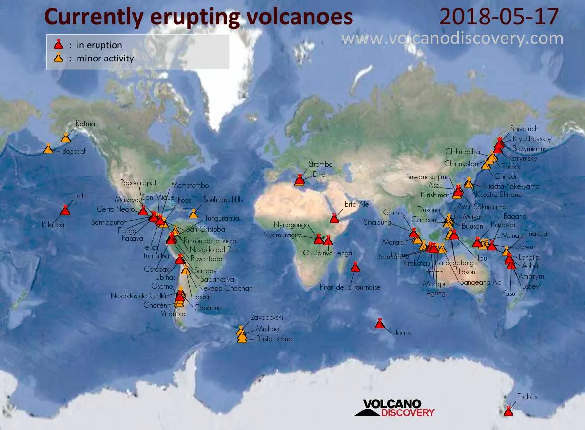
Image courtesy of VolcanoDiscovery. While the majority of focus is on Mt Kilauea which let off a column of steam and ash earlier today, the real culprit adding to the albedo effect is Sakurajima in Japan prompting a Volcanic Ash Alert. Also Volcanic Ash Alert was issued for Sabancaya, Turrialba, and Langila. There is a huge difference between plate volcanoes such as Kilauea and stratovolcano and are known for producing much more ash and particulate than shield volcanoes. Sakurajima has been regularly rumbling away for 70 years.
Thank you for reading. If you would like to see more posts like this then please feel free to follow. Leave an interesting comment or query and I shall follow you.
This report brought to you by Freddie Thornton
PEACE