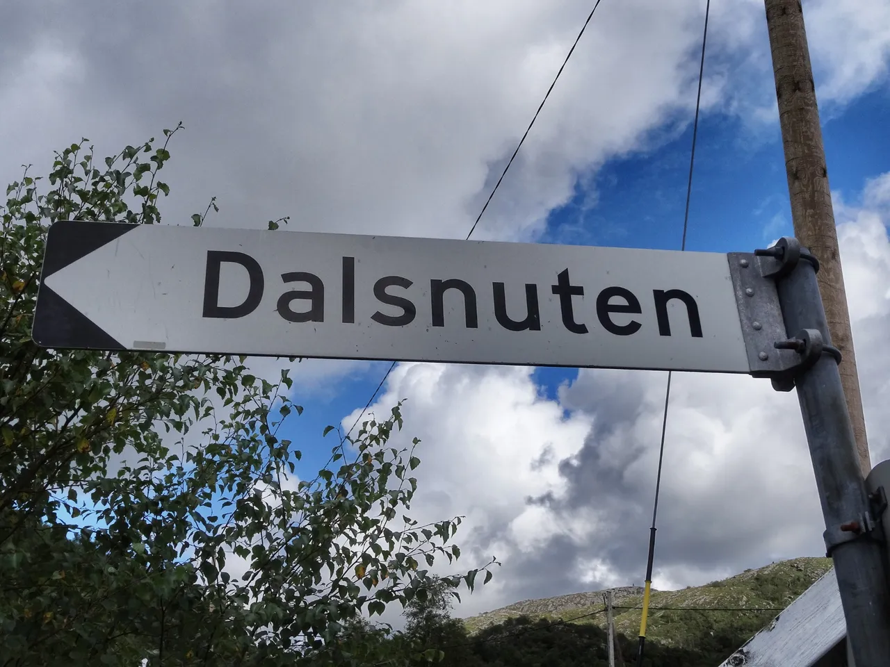
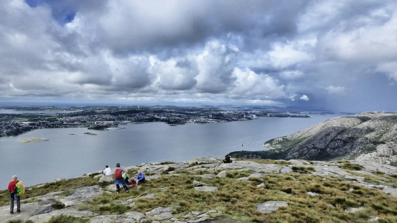
Of course, you're right. It is not a real mountain, it is almost not a true hill. The Dalsnuten mountain near Stavanger, the oil capital of Norway, is just 324 meters high, a small hillock only a few miles away from the shore of the Atlantic Ocean. But the hiking path who starts at the parking lots at Gramstad, Vatne, Holmavika or Dale, offers more you will think: The Dalsnuten – in norwegian the name means „Valley Peak“ - is a very nice hike in easy terrain with a great view of Stavanger, Sandnes, Jæren and Ryfylke.
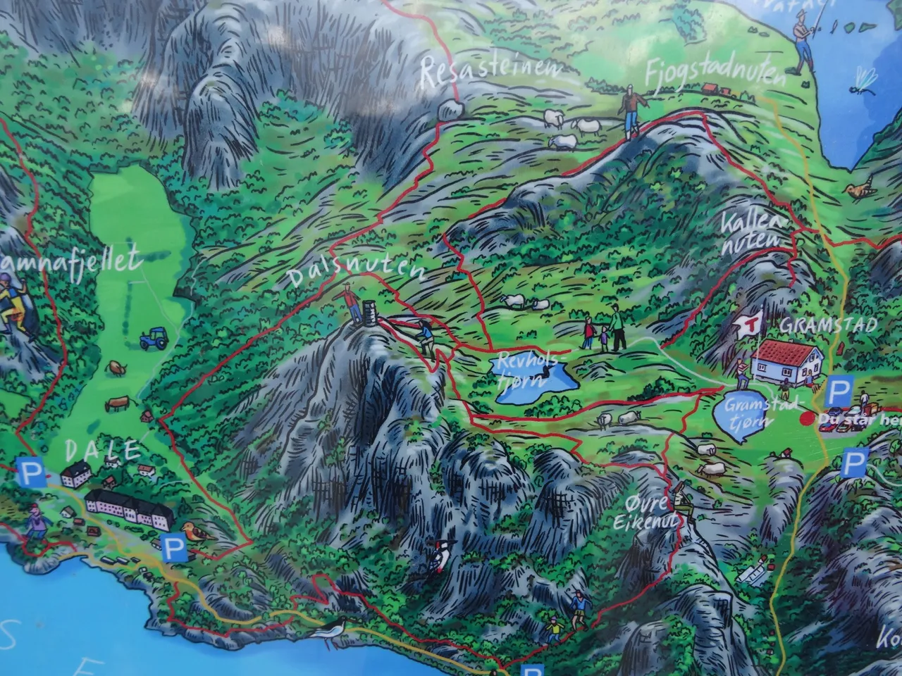
You should not be worry about the lenght of ther trail or the difficulty of the paths. Right from th parking lot at the start or the bus station – we were there by Bus 29 of the perfect norwegian public transport system from Sandness towards Dale, and getting out in Gramstad - you have to go two to four hours for the whole thing. It’s easy at the beginning. Wide is the path, green the grass all around. You walk through a forest an dover some fields. There are a number of marked trails in the area, but you have to go straight ahead to the peak.
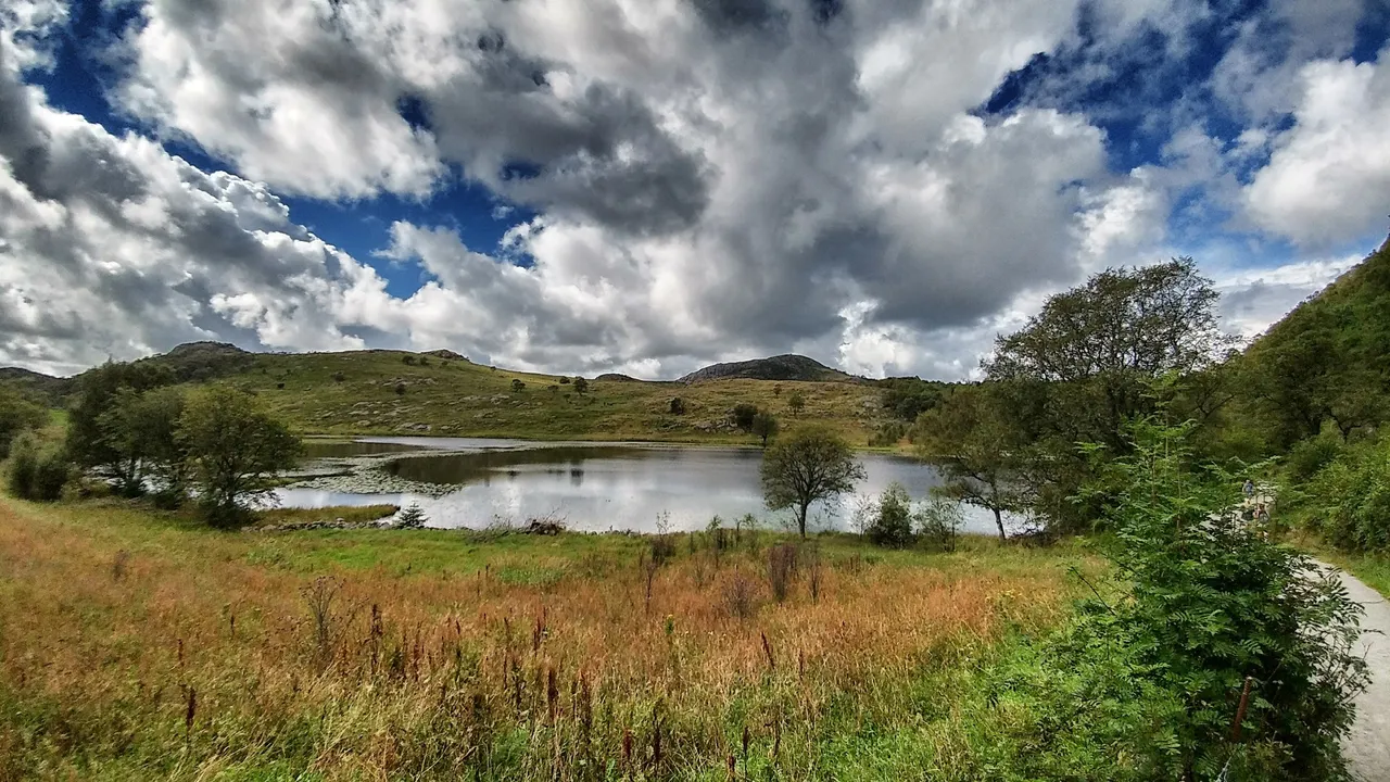
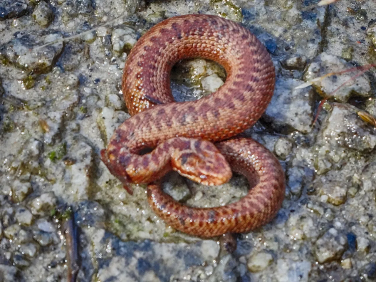
Underway are lakes, rocks and a few of animals, cows, snakes and foxes we have seen for example. After an hour be prepared for a radical change: The grass you walk on isn’t that grass anymore. It’s now a swamp, a morass and it sucks you in when you leave the wooden path on the deepest places. The next level is not so easy, because after the long flat plaine the Dalsnuten rises from his former level and you have to climb the “highness” of Stavangers home hill.
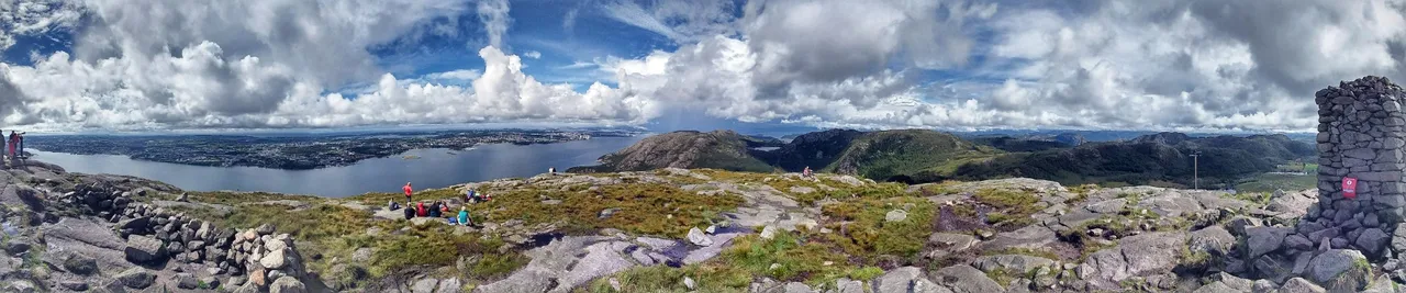
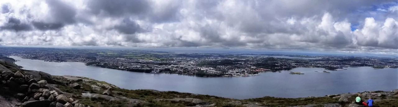
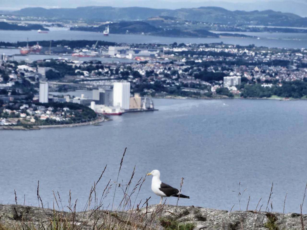
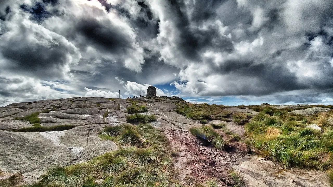
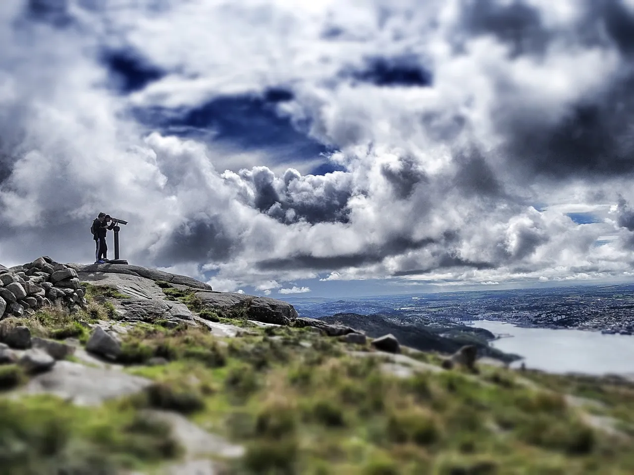
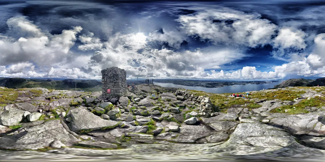
Not for too long, not for too high. Over us a sky how you found only in Scandinavia. Bright blue and sugared with white cotton wool clouds. Over your head – watch for falling rocks! – escalates the peakin many stages. The path leads you a half around the mountain before you see the small tower they builded at the summit. Here is a telescope, but much better than a zoomed view to the other side is the wide glimbse on the complete shoreline from Stagaland to Stavanger.
Backwards you must not take the same way you come. There are different paths return. And when you do the right choince there are good opportunities for bathing at Revholstjørn, a small blue lake, or at Fjogstadvatnet, the bigger brother of Revholstjørn. If you meet Bus 29 after five or six hours ago you will say that was I great day on a small peak I bet.
More from Norway
Walk into the rain
See the hidden streetart of Stavanger
Follow me trekking the Lysefjord
Let me show you the Kjeragbolden
Come with me to Preikestolen
If you like my work, follow me on Hive, Steempeak or Travelfeed
Few more pics for you: