The Flat Earth theory has been gathering momentum substantially over the last year, but if it is such a crackpot notion how is it that hundreds of intelligent people are now advocating this idea?
Three months ago I was introduced to the theory by a friend and have since then been watching a huge number of Youtube films on this subject. I am a very open minded person with a top UK education and when presented with something like this, rather than just write it off as a joke, I do my own research and make my own decisions.
I am struggling now because it was my firm intention to disprove this theory rather than have my whole understanding of the 'Universe' as I know it completely shattered. And yet the more I research I do, the less I believe in our conventional model of a globe earth.
A quick overview of the some of the points I am stuck on
I wholehearted encourage you to respond to these in order that I may move on from this madness!
Where are the unphotoshopped images of our planet and satelites in space? Google 'planet earth from space' or 'satellite in space' and all you will find is clearly photoshopped images. Even NASA admit they photoshop all Earth & satellite pictures before letting us see them. But why can't we just see them as they are?
Where are photographs of the earths curvature from space - WHICH DO NOT USE A WIDE ANGLE/FISH-EYE LENS? Even on my basic Gopro attached to my drone, from 500m altitude I can easily give the appearance of curvature. But in reality, it is lens distortion. The only way to know for sure how the horizon line looks is to have it exactly in the centre of the image, at which point it looks flat. But all the pics on the internet have the horizon at the top of the shot, which will ALWAYS give the appearance of curvature using a wide lens.
http://www.atlanteanconspiracy.com/2015/08/200-proofs-earth-is-not-spinning-ball.html
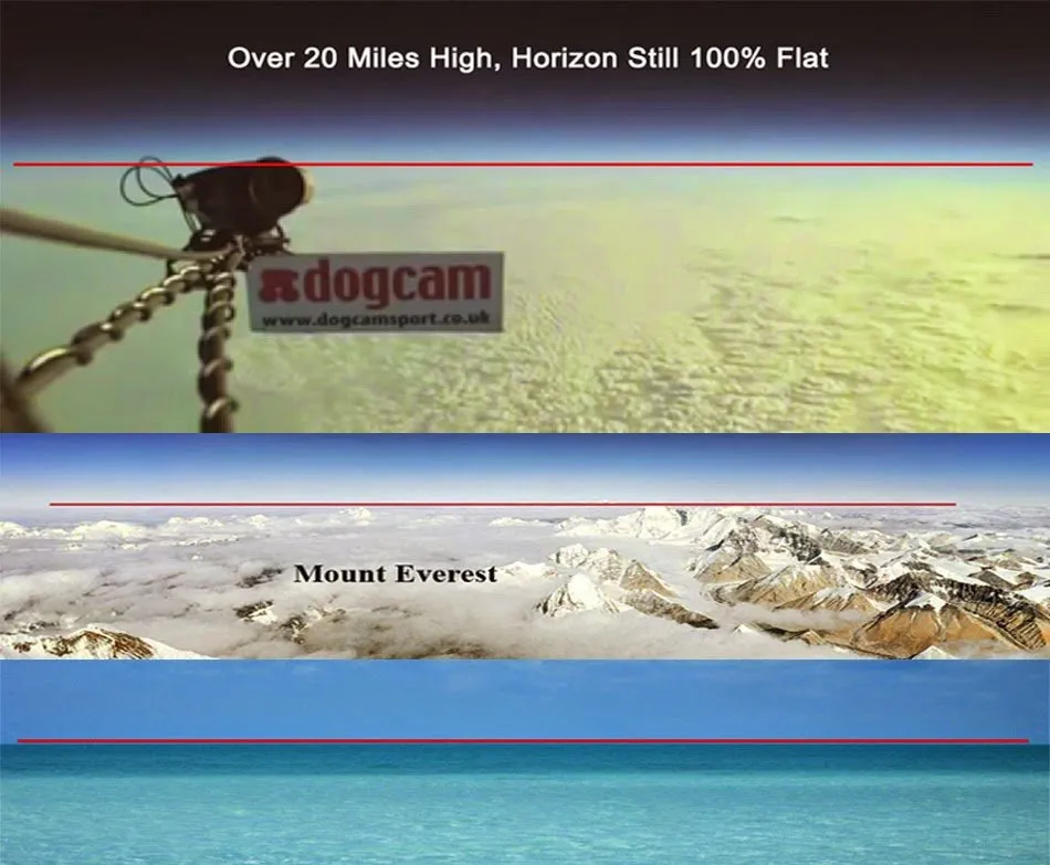
How is it that there are hundreds of people posting films on Youtube showing their results of long distance photography or video looking out over the sea? When the distance of the objects they focus on is measured, the results don't make sense. The objects should be beneath the horizon line, yet time and time again, people are proving that they are still completely visible. That being said, some of them appear to show a small amount of dip in the curvature, but nothing like what it should be based on curvature charts. As a quick example, the Statue of Liberty in New York stands 326 feet above sea level and on a clear day can be seen as far as 60 miles away. If the Earth were a globe, that would put Lady Liberty at 2,074 feet below the horizon.
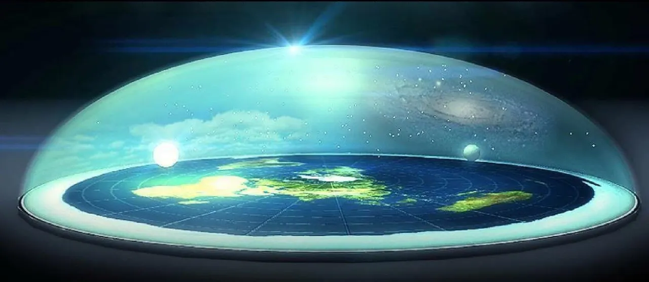
The Antarctic Treaty - This is the longest lasting treaty in history. If you are not aware of this treaty it was signed in 1959 by 12 countries shortly after the last military exploration of the region and has since then been adopted by many more. It states that no country can exploit this region for the vast amount of natural resources there. And no tourists or explorers can enter Antartica unless prior agreement has been made, and only with military guides can they go up to 30 miles inland. Why no further? You can see below what a Flat Earther's answer to this question would be. Coz they will bump into the wall of the dome which encases us all!
- Why do rainbows appear in the shape of a dome?

Robbie George/National Geographic/Getty Images
Surveyors, engineers and architects have (apparently!) never been required to factor the curvature of the Earth into their projects. So canals, railways, bridges and tunnels are always cut and laid horizontally, often over hundreds of miles without any allowance for curvature. How can this be?
If we were living on a ball, airplanes would have to constantly dip their nose in order to avoid flying off into space. But speaking to pilot friends of mine, to put it plainly... they don't dip their noses. So, how can this be?
In the ball-Earth model Antarctica is an ice continent which covers the bottom of the ball from 78 degrees South latitude to 90 and is therefore not more than 12,000 miles in circumference. Yet early explorers including Captian Cook and James Clark Ross, in attempting Antarctic circumnavigation took 3 to 4 years and clocked 50-60,000 miles around. The British ship Challenger also made a complete circumnavigation of Antarctica traversing 69,000 miles. Please explain this?
On a ball-Earth, Johannesburg to Perth should be a straight shot over the Indian Ocean with convenient re-fueling possibilities on Mauritus or Madagascar. In actual practice however, most Johannesburg to Perth flights curiously stop over either in Dubai, Hong Kong or Malaysia all of which make no sense on a globe earth, but are completely understandable when looking at a flat earth.
Polaris, situated directly over the North Pole, should not be visible anywhere in the Southern hemisphere. For Polaris to be seen from the Southern hemisphere of a globe Earth, the observer would be looking through the Earth itself, meaning that miles of land and sea would have to be transparent. Polaris can be seen, however, up to over 20 degrees South latitude.
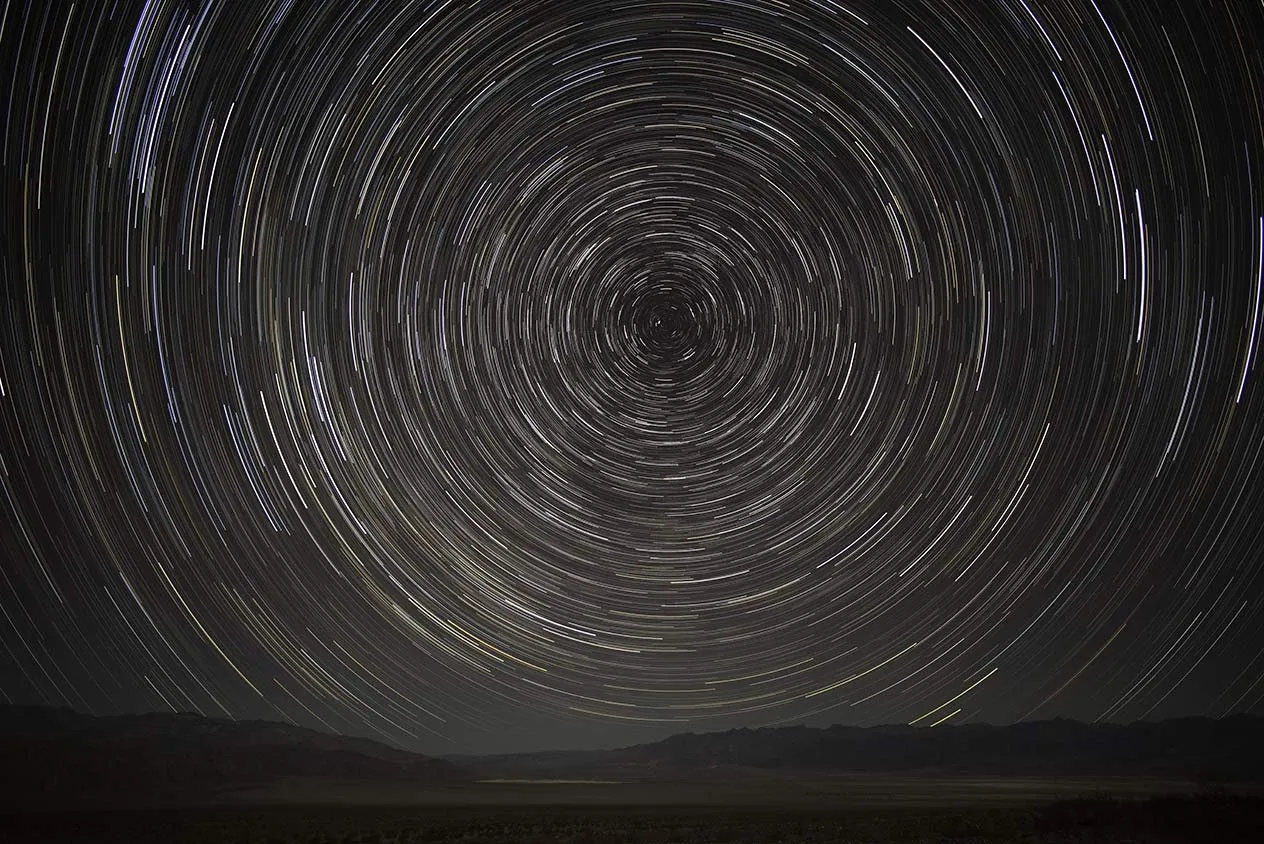
http://www.douglasvincent.com/photography/star-trails/
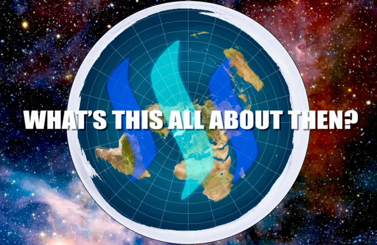
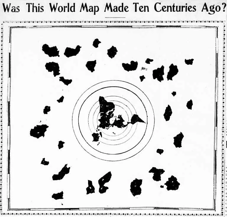
- A 1000 year old map was discovered, after being hidden away in a Japanese Buddhist Temple for many years. This begs the question, how was this map created at a time when to do so would have been impossible? This is a particularly pertinent question because it so clearly depicts the continents we are familiar with... But more importantly what are those other continents beyond the circular ring of Antartica?
https://whotfetw.com/blog/?p=10102
I have a great many more questions I would love to get sensible answers to, but for now will leave it at this.
My feeling is that we may well live on a ball but the dimensions of this ball are much larger than we are being told.
So, I would very much appreciate your comments in assisting me back to my understanding that Planet Earth is a ball floating in space, situated somewhere in the Milky Way!
Many thanks for your time.