More and more satellites carrying a variety of sensors are sent into space by agencies such as NASA, ESA, CNES or CNSA, but their are currently almost 60 governmental space agencies with operating satellites in space. These sensors allow us to look at the earth in ways we had never seen before and on a scale we had never seen before, revolutionizing the techniques used in GIS (Geographical Information Systems).
The longest lasting program for observing the earth's surface is the Landsat mission which was launched in 1972, 46 years ago. This allows us to observe and compare surface images anywhere on the globe for a time span of almost 50 years. No single mission has ever lasted 50 years so the program consists out of multiple satellite missions. The longest earth observing mission to this day lasted 29 years and 3 months, good job Landsat 5!
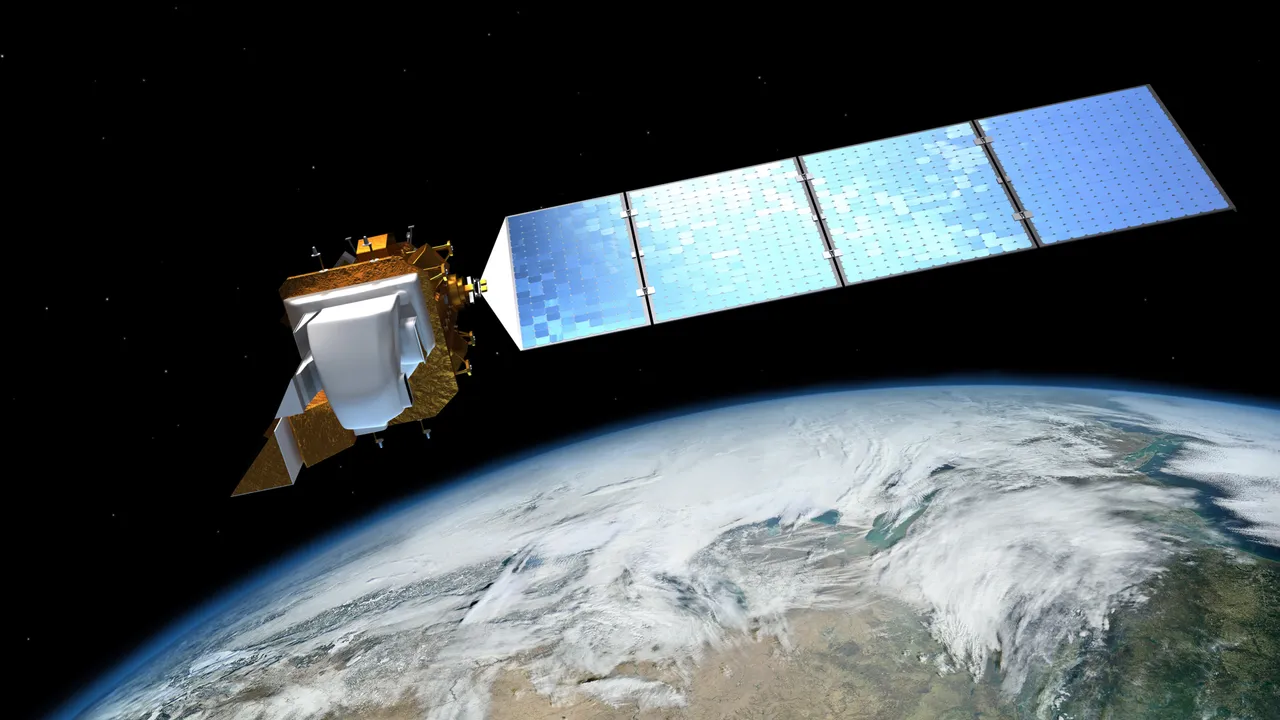
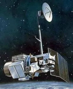
Illustration of Landsat 8 Image source
Short introduction to remote sensing
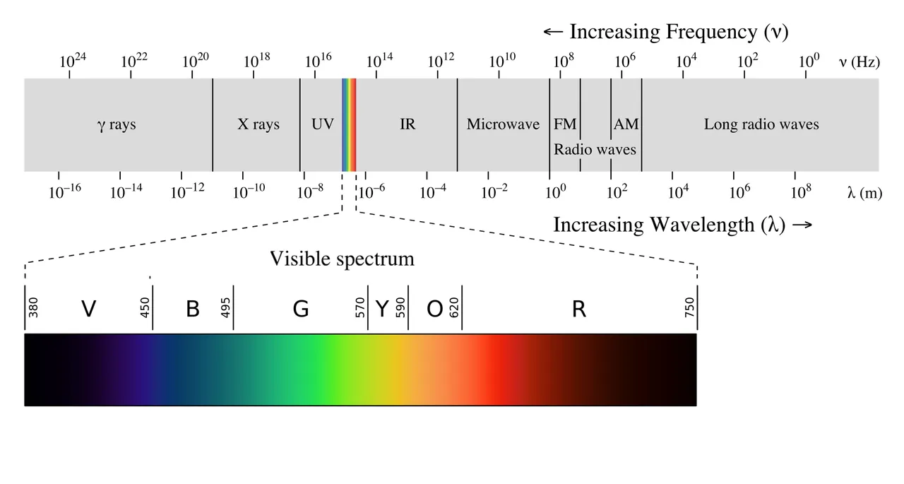
Remote sensing is the analyzing of electromagnetic waves reflecting from the Earth's surface. This reflectance of certain waves can be interpreted an analysed to draw conclusions on the land use and cover of the planet. The source of electromagnetic waves that get reflected are most often from the sun, but also artificial sources can be created do detect custom wavelengths and features. These wavelengths are grouped in bands to create a single measurable unit. A band measuring waves with a wavelength between 450 nm and 500 nm for example, would be an indicator for the color blue. A simple example, if a place on earth reflects a lot of green wavelengths (high measured value for the green band), it can be concluded that the vegetation cover is larger in this area.
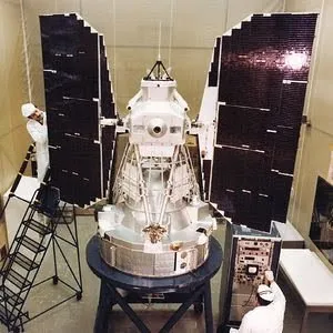
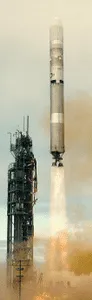
ERTS 1 / Landsat 1
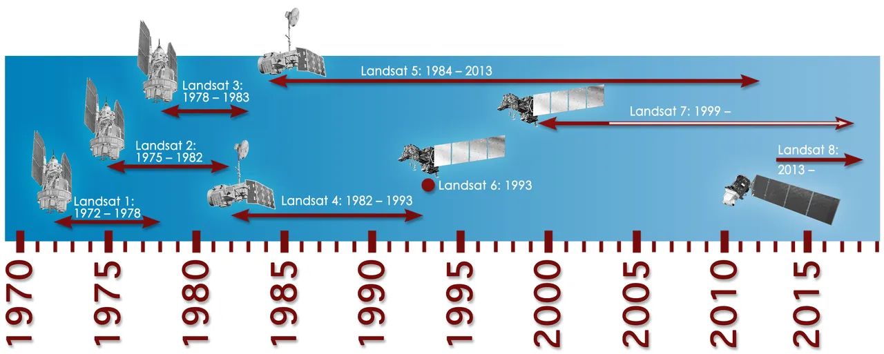
Landsat program timeline Image source
The first mission in the program was originally named "Earth Resources Technology Satellite 1" as the name "Landsat" was only given to the project in 1975. It was launched in 1972 and carried two sensors measuring 7 bands (from 475 nm to 1100 nm) with a resolution of 70 by 70 meters. The primary sensor measured 3 bands to return a colored image of the earth's surface, but the second experimental sensor also successfully returned radiometric images of earth and became the primary sensor, also because the 3-band-sensor stopped working after a few months.
The main goal of the mission was obtaining information on agricultural, forestry, geological and water resources, and to map environmental pollution and meteorological phenomena.
It transmitted over 100.000 images covering 75% of the earth in 5 years and six months, after which the mission was terminated.
ERTS 2 / Landsat 2
Landsat 2 Image source
Landsat 3
The third mission, Originally named Landsat C, was launched in 1978 and had to goal of providing a global archive of satellite imagery. It again carried two sensors at a resolution of 40 meters this time.
Landsat 4
Launched in 1982 it again had the goal of providing a global archive of satellite imagery but this time carrying other sensors. It was the first mission to incorporate the Thematic Mapper allowing 3 more spectral bands to be observed at the much higher resolution of 30 meters.
Shortly after the launch the satellite had lost half of its solar power and the capability of sending data directly to earth. Scientists feared that the mission would fail sooner then expected but they managed to keep the connection working.
in 1993 it lost its ability to transmit data and in 2001 it was decommissioned.
Landsat 5
Landsat 5 Image source
Due to the fear of Landsat 4 failing sooner then expected, the launch of the fifth mission was sped up and executed in 1984. Again the goal was to collect imagery from the surface of the earth and after 29 years and countless instrument failures, it was finally decommissioned in 2013 after transmitting 2.5 million images.
It carried again the Thematic mapper and a Multi-Spectral Scanner. It witnessed many unique events such as the nuclear accident at Chernobyl in 1986 and the devastating tsunami of southeast Asia in 2004.
The mission significantly exceeded its life expectancy lasting almost 30 years instead of the expected 3 year lifetime. It even made it into the Guinness Book of World Records for the longest operating Earth observing satellite.
Landsat 6
Landsat 6 carried an upgraded version of the instruments on Landsat 5 and was designed to continue the work of Landsat 5. It was launched in 1993 but failed to reach orbit. The instruments had increased resolutions up to 15 meters, but could never start observing. The fuel failed to reach the engines and the satellite could not maintain attitude control causing the satellite to tumble.
Landsat 7
The seventh satellite aimed to refresh the global archives of satellite photos and providing cloud-free images. in 2011 it ran out of fuel and the orbit began to degrade. There currently are plans to refuel the satellite by 2020.
It carried only one sensor, the "enhanced thematic mapper plus", but was able to capture a wide range of spectral bands at a resolution up to 15 meters for some bands.
in 2003 an error occurred with the correction of images.
Landsat 8
Landsat 8 is the latest brother in the family of satellites and was a backup for providing continuous data in case Landsat 7 would fail. It carries an Operational Land Imager capturing 9 bands, one more than his predecessor, and a second Thermal Infrared Sensor capturing two more bands in the long wave infrared spectrum.
Future missions
The next mission, Landsat 9 is expected to launch in 2020. It will cost almost 130 million dollars and will carry the same equipment as Landsat 8. It will carry on the legacy of the Landsat program and continue to provide spatially and temporally continuous data allow for a variety of scientific analysis.
Conclusion
The continuity of this program is really what makes it stand out. All these data are free to download and using the Google Earth Engine (Not Google Earth) The data is easily accessible and manipulable making it ideal for large scaled research.
Since recently there is a new website that allows you to live stream Landsat in your browser! You can find the live stream here. Enjoy!
Sources
All images used in this article were allowed to be reused according to their copyrights
https://landsat.usgs.gov/what-landsat-and-when-did-it-begin
http://gisgeography.com/landsat-program-satellite-imagery-bands/
https://landsat.usgs.gov/landsat-1-history
https://en.wikipedia.org/wiki/Landsat_program
https://en.wikipedia.org/wiki/List_of_government_space_agencies