Historically, mankind has cycled through many theories to explain observations of the universe. For example, going from a geocentric model where all things revolve around Earth to a steady-state eternal universe to the Big Bang. Today, we are all but convinced that we have finally found the answer.
The same can be said of many similar areas of scientific research. Geologically, the Earth's history is equally mysterious. In the way that we speak, we claim that our current established models are absolute while admitting them to be theoretical. This is largely due to the dominance of particular theories and of the suppression of others.
For example, the "Big Bang" has became so popular and well-known that this very fact has become one of its strongest defenses. The whole world is working on furthering it, after all, or so it would seem. This theory came about due to a specific observation made in the 1920's and 1930's. No other interpretation was presented, and thus the "Big Bang" became accepted. Then, it was off to the races. It has not made it to the finish line yet, but it has been as if it is the only interpretation in the race.
Without a counter viewpoint, arguments become completely one-sided and unbalanced. Flaws and critical issues do not get addressed as they would in a debate, but rather they are able to just be ignored. As the "Big Bang" interpretation continues to be fed by research worldwide, the certainty of its accuracy seems all but validated without giving heed to the anomalies.
The same is the case for Plate Tectonics. How many people are aware of opposing concepts of how the Earth formed? When a scientist speaks of the concept of "Plate Tectonics", do they speak as if it is a question or a fact? In much the same way, "Plate Tectonics" is presented to society at large as if it is a known fact.
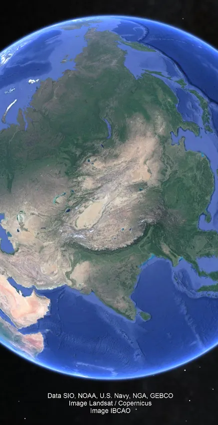
Earth: The Curious Case of the Himalayas and Indonesia
According to Plate Tectonic theory, the Himalayas were created by India crashing into Asia and pushing up the mountain range through subduction of the Indian plate under the Asian plate. Similarly, Indonesia is said to be the result of subduction. Essentially everything we see is waved away simply by throwing "subduction" at it, in plate tectonics.
However, if India crashed into Asia, then why did it create a mountain range in an opposing arc shape?
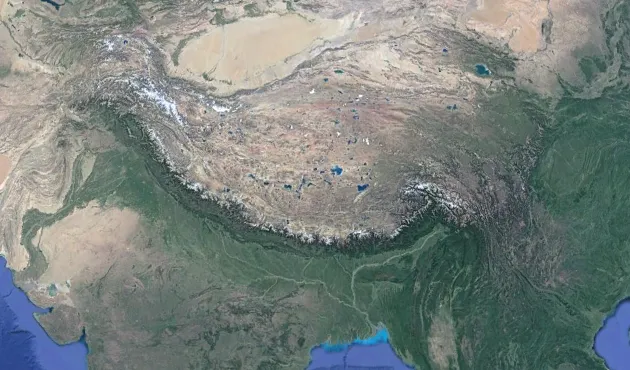
The Himalayas are distinctly in an arc shape. This is a common shape on Earth. In fact, if we look around the Earth, we can find several cases of arcs. Typically, they are formed in the ocean in what is known as an island arc.
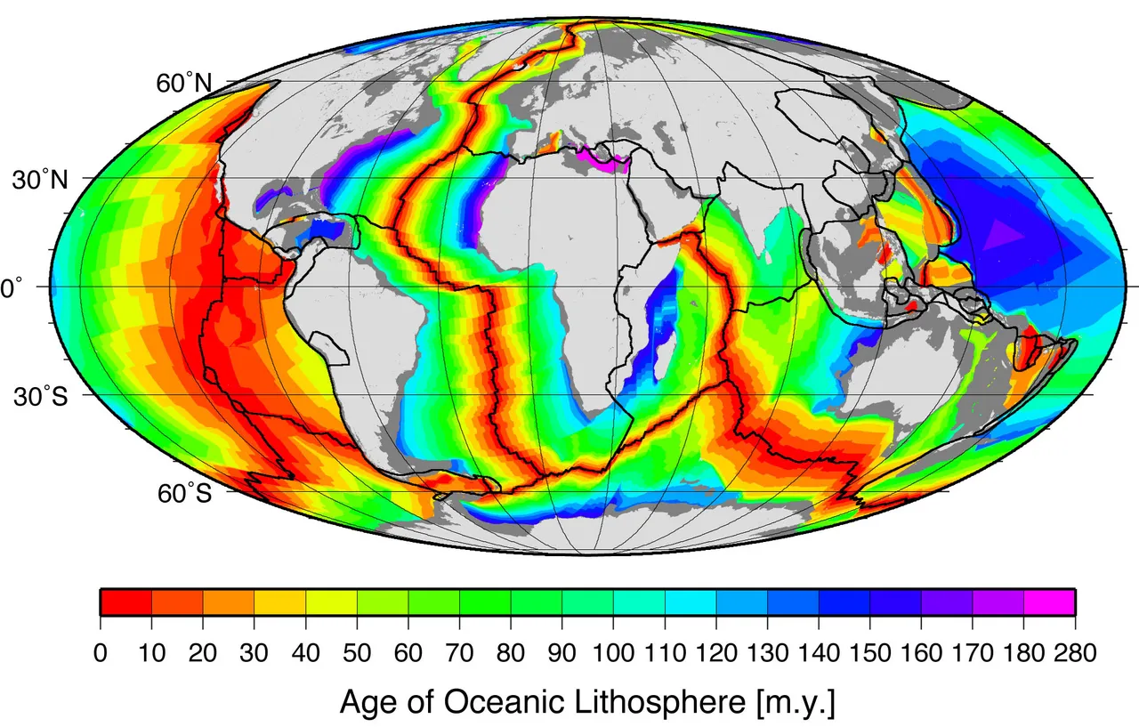
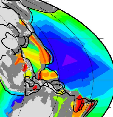
The plate tectonic explanation for this arc is that the Indian plate is arced in this manner. This is depicted in the plate outlines shown in the oceanic crustal age map here:
Source
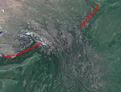
As is shown, the Indian plate itself is conveniently arced so as to produce this arcing mountain range. However, there are several questions that immediately arise from this analysis. Why, then, is there a second plate that just so happens to be east of India creating a second portion of the arcing Himalayas after a gap?
This is extremely unlikely to happen by chance. However, the plate tectonic explanation cannot describe why the Himalayas mountain chain is broken apart and thus claims that there is no plate subduction between these two areas.
Looking around the Earth, there are many arc-shaped formations:
From Google Earth
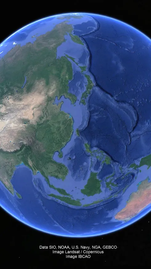
The Indonesian archipelago is also formed in an arc:
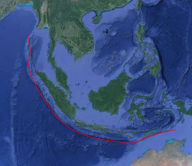
From Google Earth
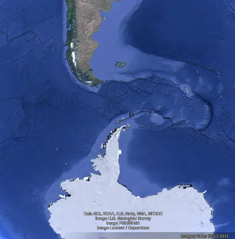
Arcs are distinctly the results of waves, as they are in the shape of waves from a focal point. In fact, if we look at the Figure between Antarctica and South America, we can see evidence that this arc was created by a shockwave caused when the two continents separated. Both continents point in the direction of the arc and the energy released left trails on the northern and southern side as it literally created the arc islands to the east. These were thus formed in the presence of water, a necessary component in the formation of volcanoes. Without sufficient water present, steam cannot be created and thereby a formation is only a mountain and not a volcano. With water present in its formation, a structure becomes highly likely to be volcanic. Moreover, they were formed suddenly and rapidly due to the shockwave created from separation.
The entire Malay Archipelago of which Indonesia is part is largely volcanic, as are most arc formations:
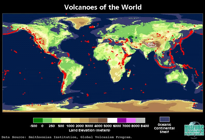
Source
So in short, what is happening?
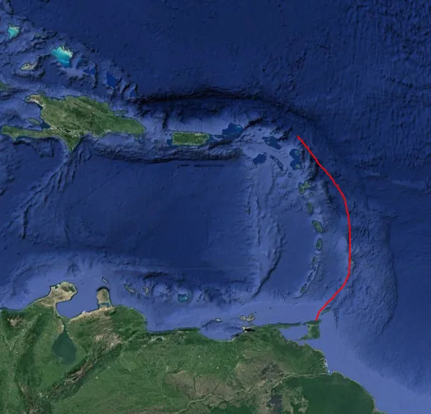
Distinctly, the Himalayas are not formed by a plate subducting because their focal point is in the opposite direction of India. Instead, if we follow the Himalayas towards a focal point we can see it may be related to the oceanic rift which ended north of Russia:
From Google Earth
This is why there is a gap in the Himalayas arc: because the sudden creation of them had a weak point where they literally spilled down onto the southern land, shown again here:
From Google Earth
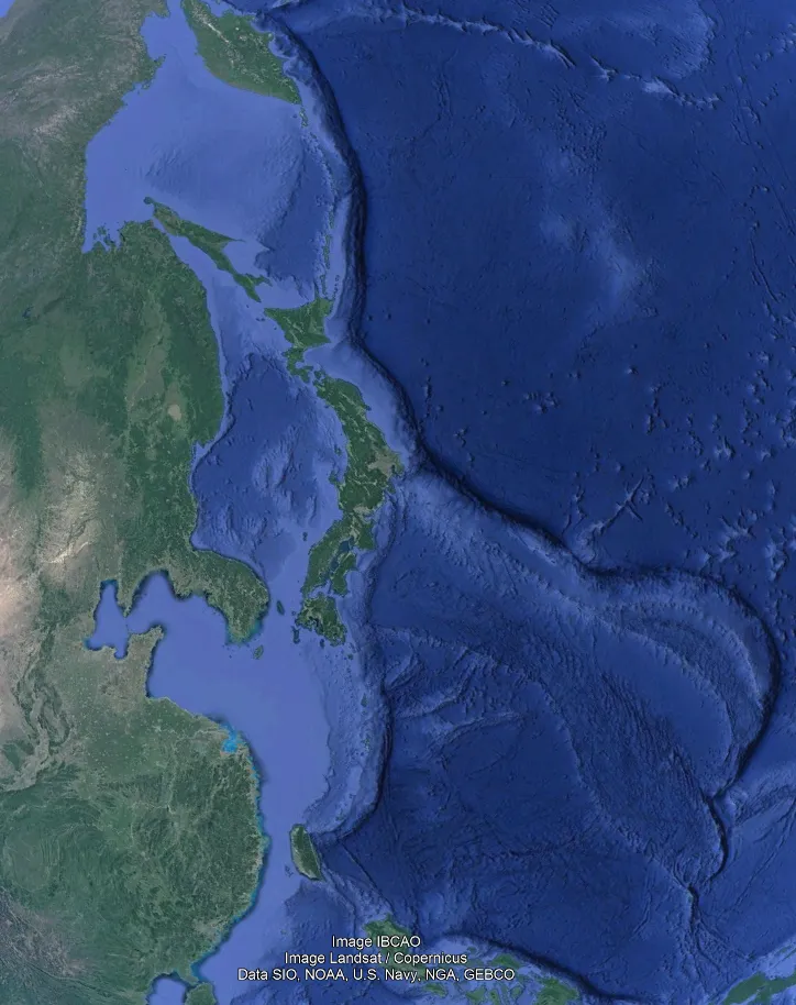
For the Indonesian Archipelago, its focal point appears to be where Asia and North America seem to have ripped apart:
From Google Earth
This is because the Earth expanded. It once had a physically smaller outer surface, but it built up energy. This likely occurred due to a change in its state from non-rotating alike to Venus to rotation as Earth does, which produced an electromagnetic field. As a result of this, energy built up until the planet reached an activation energy for change. And then the change proceeded quickly, spontaneously, and catastrophically. The crust broke along the so-called continental crust margins releasing shockwaves of energy and then the pressure built up was able to be released as the Earth rapidly grew to a new steady-state. As a result, what we see today is much more stable and unchanging. This process is not continuous, slow, and steady but rather is rapid and sudden like any other reaction once sufficient activation energy has been input, literally creating the oceans in the process.
Moreover, this is why the Pacific Ocean is much more volcanically active, home of the "Ring of Fire": because this is where the Earth shattered, as is evidenced by the apparent oceanic crust age:
Source
The Expanding Earth model may be scoffed at as pseudoscience, but this is just a way to belittle an idea without addressing its merits. When a model in science gains the upper-hand, and becomes widely accepted, it quickly loses any need to actually rebut arguments of other models. And yet the arguments remain. The Earth could not just arbitrarily fit together into a smaller globe without oceans if it were not actually this way. The jig-saw puzzle of the Earth fitting together on a smaller globe is very difficult to refute. The argument of "how?" is insufficient to disprove the model. Just because a mechanism is not understood to explain how something happened does not mean that it did not happen.
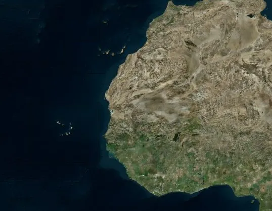
The Curious Case of the Canary Islands and Cape Verde
The Canary Islands and Cape Verde off the west coast of Africa are volcanic, meaning they formed in the presence of water. If we look closely at Africa itself, we can see exactly how they were formed. Starting from a large view of western Africa:
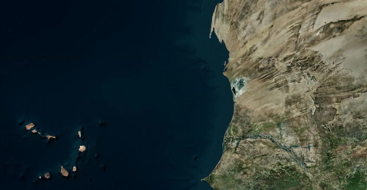
When we zoom in, we see evident flow channels of massive flooding that occurred in the area where the water ran off into the ocean at the two island chains, leaving behind sediment which literally created the islands:
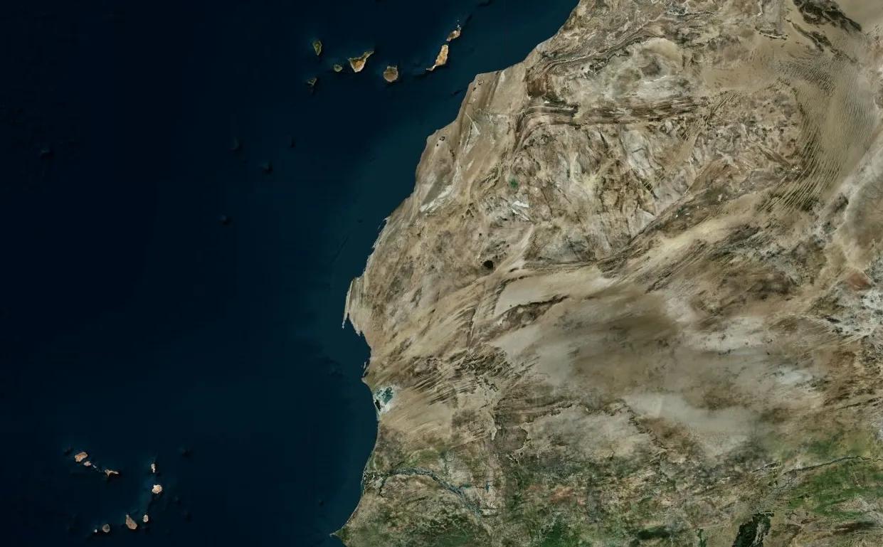
From Bing Maps

These are all signs of sudden and rapid change and not results of millions of years of "plate tectonics." It is important to note that we assume constant rates of radioactive decay when using radiometric dating. However, if the Earth went through such a drastic change, we cannot reliably use this form of dating as an absolute metric.
Of course, there is much more to this. However, plate tectonics requires a slow and steady process and Earth clearly did not change in a slow and steady process. Moreover, no other planet or moon exhibits plate tectonic characteristics. There is no reason that the Earth would be "special" functioning under its own unique mechanics. Rather, the surface of Earth was much more like Mercury and Venus--a single land-mass--until the crust shattered from internal pressure, releasing water and creating continents, mountains, and most features of Earth we see today.
For More Information
If you'd like to read more, check out my other Steemit posts. Also, this is largely built on physics, philosophy, and an extensive study of many aspects of reality that I write about in my book, The Instruction Manual: As It Is Written In the Cosmos which I read in this YouTube playlist.
Thanks for reading!
-Steve Scully