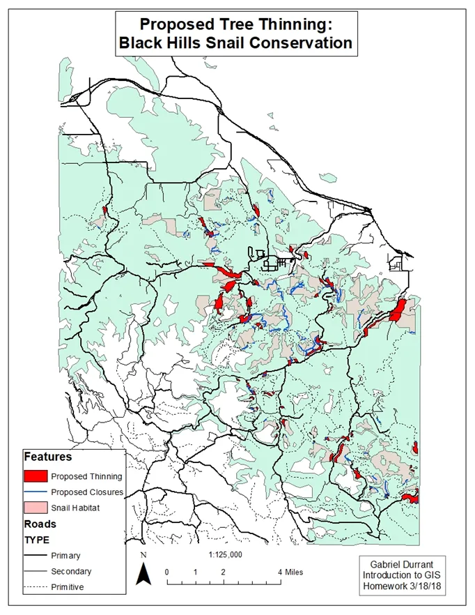
As I have shown in my previous posts, GIS mapping is detailed and can be used in many different areas. This time I have created a map that shows proposed road closures and tree cuttings to help preserve the Black Hills Snail (Oreohelix cooperi) in the Sturgis, SD region.
Their numbers are decreasing due to roads cutting through their natural habitat, ending up with a lot of smushed snails. To find the target areas, we had to use a few tricks in the ArcGIS program.
First, to find which primitive roads impacted the snails, we did a query that contained both primitive roads AND snail habitat locations. These have been highlighted in blue as roads that can be closed during the snails' mating season, which is when they are most active and likely to be run over.
Next, we found major roads in their habitat, and decided that cutting the tree line back in these areas would help prevent the snails from reaching the major roads. These areas are shown in red. ArcGIS has a buffer tool that can create a buffer a set distance away from any feature you want. So we did a query of major roads, inside the snail habitat, then added a buffer around those areas.
This is just a small example of how mapping programs can help solve environmental and ecological problems.