This week I had the opportunity to visit the London GeoBusiness show and it was an absolute drone-fest. There are just too many pictures to put in the blog, so I've selected the best, most interesting technology there.
The event was aimed at the Geo Spatial industry, so mostly Geographical Information Systems (GIS), Earth Observation (EO), survey and data management specialists. Pretty nerdy, but was great fun at 4pm when the free beer and prosecco came out! :)
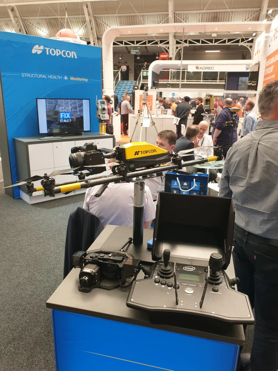
This is the Topcon Falcon 8. It isn't something from Star Wars, it's from Intel, the microchip manufacturer. It's one of the best out there (look at that Sony DSLR on it) and is super stable and so is often used in tight spaces, such as urban environments. It's a great colour too.
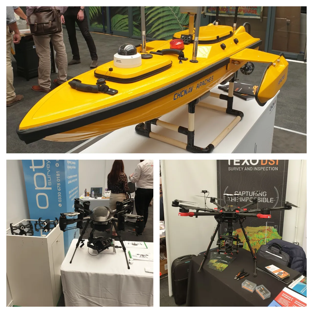
It's not just flying drones that are cool, this CHC Navigation Apache 6 is cool. It's used for bathymetric survey, underwater object positioning, offshore construction, underwater archaeology and wrecked rescue. It's tough.
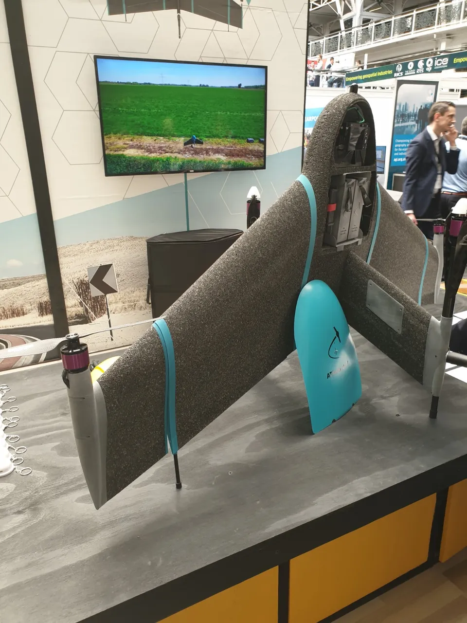
This is called 'Marylyn' and is awesome. It is lightweight, can fly for a long time and is a vertical take off and landing (VTOL) machine. This means you do not have to put this thing on a catapult and fling it into the air. It takes off like a normal quadcopter drone and can then fly like a bird. Excellent.
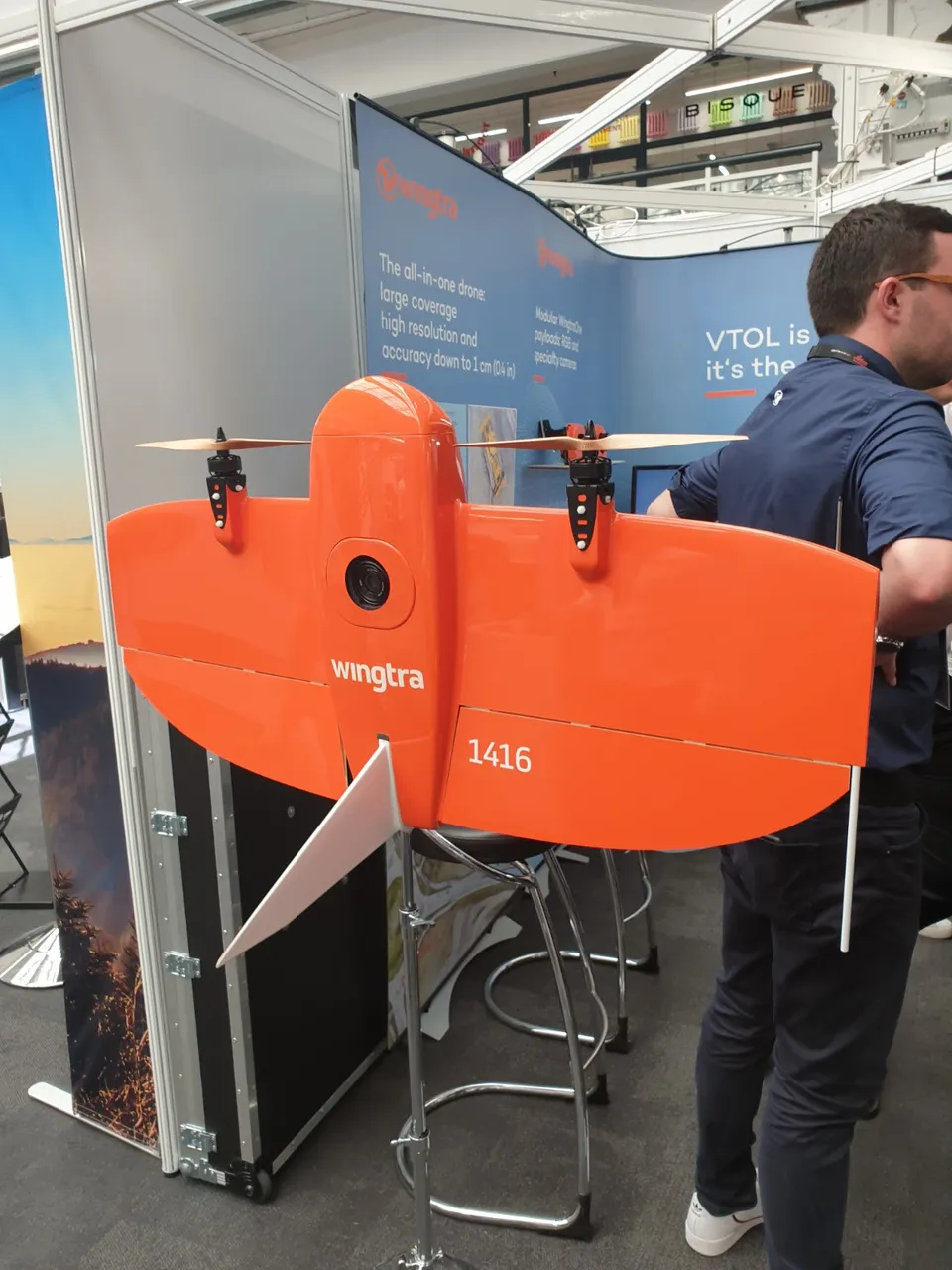
Ahh, this is the Wingtra. This is a solid project and is another VTOL drone. I dream of flying this orange wing and it is an industry beast, with lovely wooden props. I really, really want one to be a serious UAV surveyor.
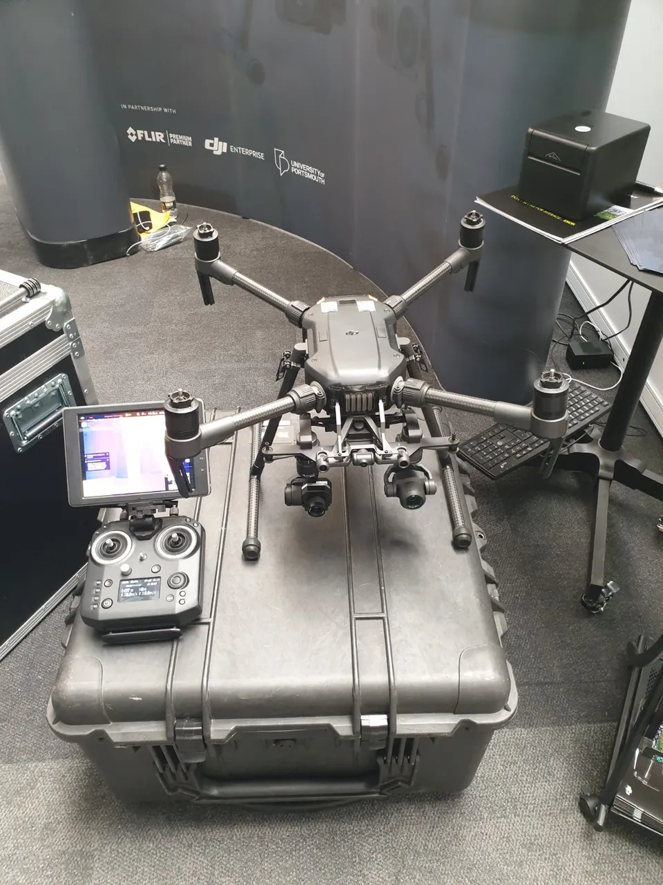
This is some kind of DJI drone, I didn't get the model type, but it looks like an attack vehicle to me... Something that would follow The Predator. This has two cameras, which is amazing for surveying in two different spectra of light. I.e. the visible spectra (what we see) and the near infra red spectrum (heat signals). This kind of set up is used a lot in the asset management and survey industry for understanding heat loss, temperature differences etc. They have been used to rescue missions too.
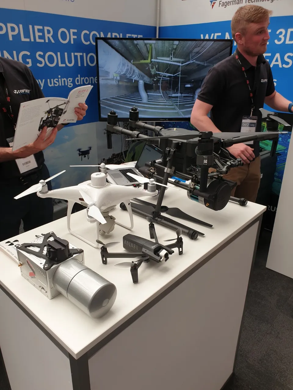
Here we have a DJI 4 Phantom RTK (real time kinetics), which means it is super accurate in terms of geopositional location. To the right is some kind of big brother and in front is a Parrot Anafi. This is a compact little drone that shoots in 4K and can look up AND down. Sweet huh!
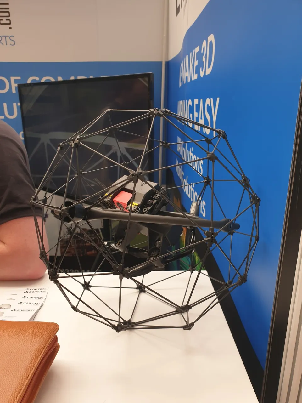
What we have here is a drone that is held in a cage. These are for flying in really tight spaces, such as mines! They are notoriously difficult to control due to the presence of the cage, but due to this they can bounce off walls without damaging the drone itself. These are often used to create high resolution 3D models of tunnels, mines and the inside of structures.
What a great day being surrounded by all this tech! Love it!
Are you into this tech too? Get in touch! If you have any questions, just shout :)
💲💵 MAKE MONEY with your photography and video 💵💲
🌎🏠 Live RENT FREE / FREE HOLIDAYS by house-sitting 🌎🏠
⛏ Mine JSE Coin in your web browser & website ⛏

Dronegraphica Website
Facebook
Instagram
All images are my own and If you like them please upvote, follow, comment, ask questions or get some discussion going, It’d be great to hear from you!
Posted from my blog with SteemPress