
About LISCADSEE :
Liscad See is software used to process survey data into countur and get volume to project surveyor.
in processing survey data to be countour the use of liscadsee application is very easy when processing data, liscad see can make the job faster completed and with maximum results
Requirements
in the implementation have several procedures as follows:
Have a Survey area
before conducting the survey first has a work area, the discussion of this tutorial area is Urea Bulk Storage which is located in one of the fertilizer companies located in Indonesia

Conducting Survey using TCR703 tool
The tool used is TCR 703, the survey tool is a total station manufactured by one of the germany company that is Leica Geosystem, currently the total station makes it easy to conduct surveys without having to record the data manually, TCR703 already has a data download service using software LGO (leica geosystem)

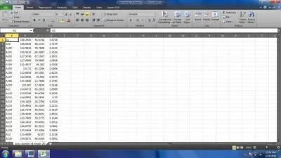
Survey Data In CSV Format
The result of survey data is converted into CSV format by doing save as on microsoft excel and choose CSV format
Import to LISCAD S.E.E Application
Liscad SEE application version 9.0

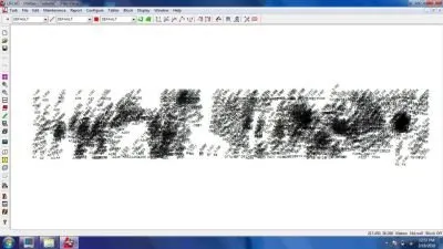
LIscad See View Data
the data displayed on the LISCAD SEE software is a coordinate point containing elevation data and symbols
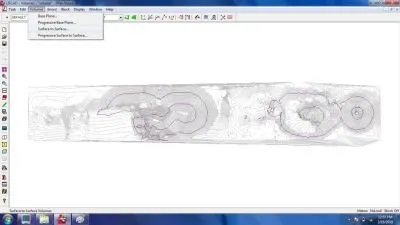
Display Features
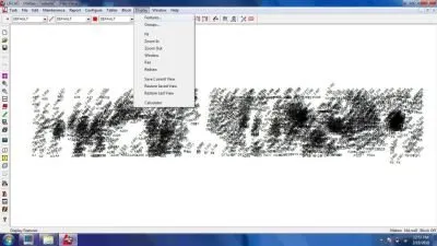
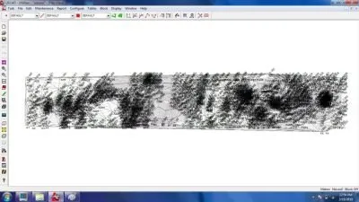
Chose Triangles and Contours
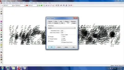
Result of CSV Data Into Contours and Triangles
The coordinate data is linked by making contour so that it becomes a closed polygon
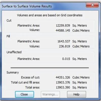
The Last One Counts The Volume
Result Of Survey Data Volume
the calculation results are shown in the form of cubic meter units with the sum of fill and cut volumes so that the total volume of the required survey value
Finish Tutorial Using LISCAD S.E.E Software
Thank You By @azyref
Posted on Utopian.io - Rewarding Open Source Contributors