Components
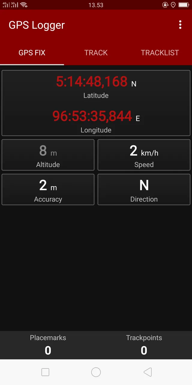
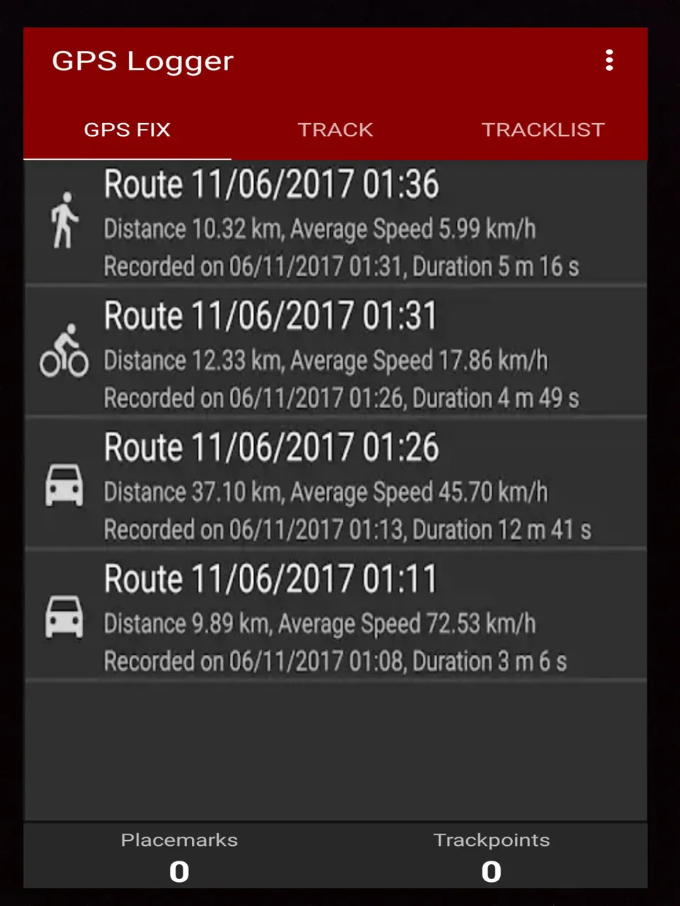
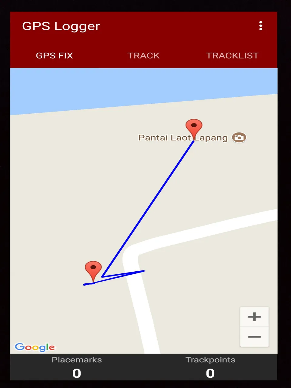
The gps logger application is a simple application for recording user positions and user paths. Accurate basic gps tracker with power saving eyes. Users can record all user trips and view them in the built-in google earth from the app tracklist and share them in KML, GPX, and TXT formats in various ways.
Proposal
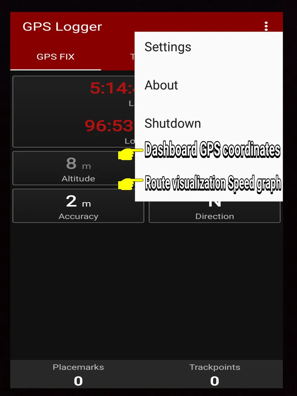
After installing the gps logger app users can record all user trips and view them in the built-in google earth from the app tracklist and share them in KML, GPX, and TXT formats in various ways. As a user I propose to developers to add "Dashboard GPS coordinates" feature and "Route visualization Speed graph" feature in the toolbar section of the gps logger application
Mockups / Examples
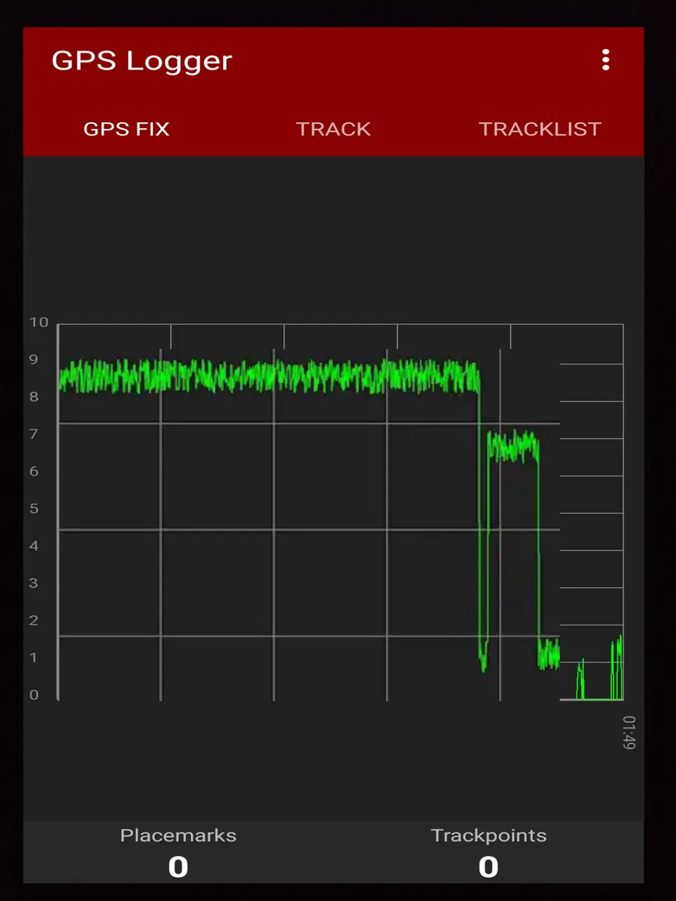
This is a sample image after the developer adds the "Dashboard GPS coordinates" feature and the "Route visualization Speed graph" feature in the toolbar section of the gps logger application
Benefits
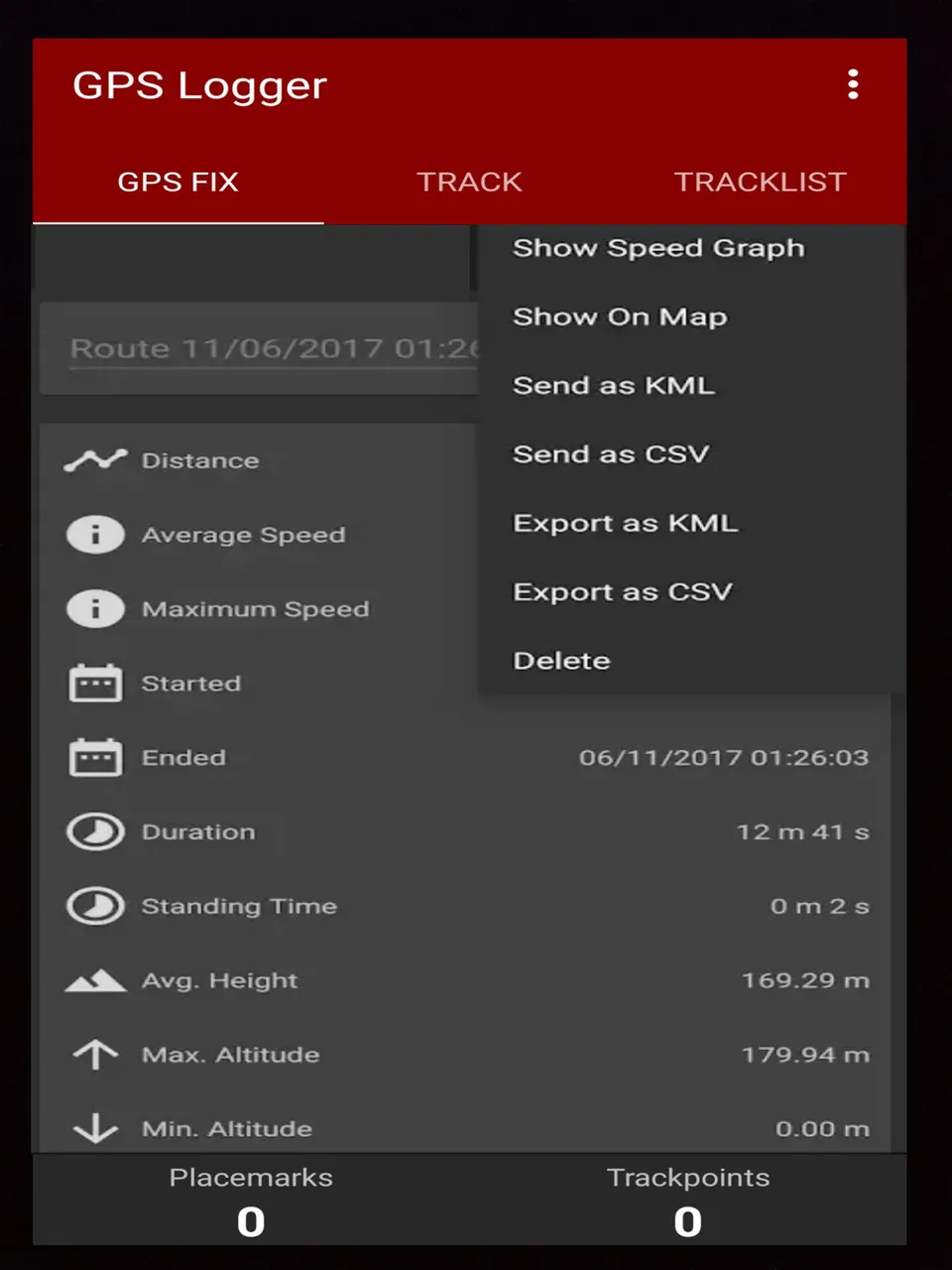
With the "Dashboard GPS coordinates" feature and the "Route visualization Speed graph" feature in the toolbar section of the user's gps logger application can record, visualize and export user trips. And help users better understand user routes and identify negative and positive peaks as well as when users are standing by using different colors according to the speed of the user to uncover the slow and fast sections of the user route. And users can manage user routes, users also see detailed information about user routes, export routes in KML and CSV formats then send routes to other apps such as Google Earth in KML and CSV formats and customizable preferences, exports and import databases when migrating between devices. This is a wonderful thing.
Posted on Utopian.io - Rewarding Open Source Contributors